 |
|
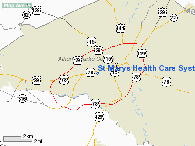
St Marys Health Care Systems Heliport |
Location
& QuickFacts
|
FAA Information Effective: |
2007-07-05 |
|
Airport
Identifier: |
7GA0 |
|
Airport
Status: |
Operational |
|
Longitude/Latitude: |
083-24-29.0000W/33-56-52.4140N
-83.408056/33.947893 (Estimated) |
|
Elevation: |
736 ft / 224.33 m (Surveyed) |
|
Land: |
0
acres |
|
From
nearest city: |
2 nautical miles SW of Athens, GA |
|
Location: |
Clarke County, GA |
|
Magnetic Variation: |
03W (1985) |
Owner
& Manager
|
Ownership: |
Privately owned |
|
Owner: |
St. Mary's Hospital |
|
Address: |
1230 Baxter St.
Athens, GA 30606-3791 |
|
Phone
number: |
404-548-7581 |
|
Manager: |
E. J. Fechtel, Jr., Admin. |
|
Address: |
1230 Baxter St.
Athens, GA 30606-3791 |
|
Phone number: |
404-354-3033 |
Airport
Operations and Facilities
|
Airport Use: |
Private
MEDICAL. |
|
Wind
indicator: |
Yes |
|
Segmented
Circle: |
Yes |
|
Control
Tower: |
No |
|
Lighting
Schedule: |
1800-0600 |
|
Landing
fee charge: |
No |
|
Sectional
chart: |
Atlanta |
|
Region: |
ASO - Southern |
|
Boundary
ARTCC: |
ZTL - Atlanta |
|
Tie-in
FSS: |
MCN - Macon |
|
FSS
on Airport: |
No |
|
FSS
Toll Free: |
1-800-WX-BRIEF |
|
Runway Information
Helipad H1
|
Dimension: |
40 x 40 ft / 12.2 x 12.2 m |
|
Surface: |
ASPH, |
|
|
Runway H1 |
Runway |
|
Traffic
Pattern: |
Left |
Left |
|
Radio Navigation
Aids
|
ID |
Type |
Name |
Ch |
Freq |
Var |
Dist |
|
DDA |
NDB |
Commerce |
|
244.00 |
03W |
8.9 nm |
|
BMW |
NDB |
Barrow County |
|
404.00 |
03W |
9.1 nm |
|
BJT |
NDB |
Bulldog |
|
221.00 |
03W |
9.4 nm |
|
JNM |
NDB |
Monroe |
|
392.00 |
03W |
20.3 nm |
|
VV |
NDB |
Junne |
|
353.00 |
05W |
26.5 nm |
|
VOF |
NDB |
Alcovy |
|
370.00 |
03W |
26.7 nm |
|
FKV |
NDB |
Flowery Branch |
|
365.00 |
03W |
29.2 nm |
|
IIY |
NDB |
Washington/wilkes County |
|
435.00 |
03W |
31.5 nm |
|
AJR |
NDB |
Habersham |
|
347.00 |
03W |
34.0 nm |
|
AA |
NDB |
Cedar |
|
341.00 |
04W |
46.8 nm |
|
AND |
NDB |
Anderson County |
|
230.00 |
04W |
48.0 nm |
|
BR |
NDB |
Redan |
|
266.00 |
02W |
48.6 nm |
|
UMB |
NDB |
Culvr |
|
380.00 |
04W |
49.4 nm |
|
PDK |
VOR/DME |
Peachtree |
113X |
116.60 |
02W |
44.6 nm |
|
AHN |
VORTAC |
Athens |
33 |
109.60 |
00E |
4.2 nm |
|
ELW |
VORTAC |
Electric City |
023X |
108.60 |
00E |
42.0 nm |
|
ODF |
VORTAC |
Foothills |
081X |
113.40 |
00E |
45.3 nm |
Remarks
- PPR--HELIPORT
USED FOR PARKING OF CARS, MUST BE CLEARED BEFORE USE.
- E111:
VFR & PVT USE OF HELI WITH ATLANTA GADO; MAINTAIN OPNL AGRMT WITH
ATHENS ATCT.
St Marys Health Care Systems Heliport
Address:
Clarke County, GA
Tel:
404-548-7581,
404-354-3033
Images
and information placed above are from
http://www.airport-data.com/airport/7GA0/
We
thank them for the data!
| General
Info |
| Country |
United
States |
| State |
GEORGIA
|
| FAA ID |
7GA0
|
| Latitude |
33-56-52.414N
|
| Longitude |
083-24-29.000W
|
| Elevation |
736 feet
|
| Near City |
ATHENS
|
We don't guarantee the information is fresh and accurate. The data may
be wrong or outdated.
For more up-to-date information please refer to other sources.
|
|


