|
 |
|
||||
|
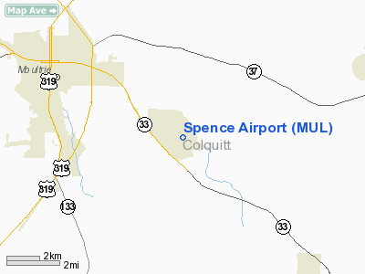
Spence Airport (IATA: MUL, ICAO: KMUL, FAA LID: MUL) is a city-owned public-use airport located four nautical miles (7 km) southeast of the central business district of Moultrie, a city in Colquitt County, Georgia, United States. The airport serves the general aviation community, with no scheduled commercial airline service. HistoryThe City of Moultrie gained its first official municipal airport, Clark Field, in the 1930s. In 1940, local leaders, aware of the Federal government's airport building program, formed a committee to represent the community. The committee then contacted the Civil Aeronautics Administration (CAA) about the possibility of acquiring a modern CAA built airport at Moultrie. The CAA, receptive to the idea, informed the committee that once the local government provided the land the Federal government would fund the building of an airfield. Due to the impossibility of expanding Clark Field for a modern airport, Moultrie and Colquitt County then took an option on a tract of land northeast of the city. When the committee members learned the Army planned on establishing additional training bases in the Southeast, they traveled to Maxwell AAF, Alabama to secure an Air Corps airfield on the site. Air Corps engineers came to Moultrie in March 1941. After inspecting the first site, they selected a more desirable site five miles southeast of the city. In June, after the War Department approved the second site, Moultrie and Colquitt County purchased the 1600 acres involved. Military useThe airport was used for many years by the military, finally being closed as Spence Air Base. Civil useHowever, the USAF was still a presence at the civilian airport after its formal inactivation. Moody AFB in Valdosta made an agreement with the Cityi of Moultrie to use the airfield for an Air Force auxiliary field. The Air Force extended the north¬west/southeast runway to 8,000 ft for use by Moody's T-33 Shooting Stars, followed by its T-37 Tweets and T-38 Talons. The military use of Spence Airport continues into the current-day. Between 2000 and 2005, Spence served as an auxiliary field for the pilot training program at Moody, being used for take off and landing operations by their Raytheon T-6 Texan II turbo-prop trainers. As of 2008, Spence Airport still averages over 20 military flight operations per day. Part of the cantonment area eventually became the Moultrie Regional Industrial Park and a county correctional institution. In 1968, Maule Aircraft built a manufacturing plant at Spence where it remains to this day. In 1978, Spence first hosted the Sunbelt Agricultural Exposition. In 2004, the Sunbelt Expo has grown into the world's largest farm show with over 1,000 exhibitors. Since many of the visitors fly to the show, Spence's old tower is manned during the event to control air traffic. Sunbelt Expo maintains a year round administration center at Spence. Today, three of Spence's wartime hangars are still in existence. Other buildings built by during the war also remain. Facilities and aircraftSpence Airport covers an area of 100 acres (40 ha) at an elevation of 292 feet (89 m) above mean sea level. It has one runway designated 14/32 with a concrete surface measuring 4,500 by 75 feet (1,372 x 23 m). For the 12-month period ending September 11, 2008, the airport had 18,100 aircraft operations, an average of 49 per day: 56% general aviation and 44% military. At that time there were 3 aircraft based at this airport: 33.3% single-engine and 66.7% multi-engine. The above content comes from Wikipedia and is published under free licenses – click here to read more.
Runway InformationRunway 14/32
Radio Navigation Aids
Remarks
Based Aircraft
Operational StatisticsTime Period: 2005-04-06 - 2006-04-05
Spence Airport Address: Colquitt County, GA Tel: 229-9850-1974 Images
and information placed above are from We thank them for the data!
We don't guarantee the information is fresh and accurate. The data may
be wrong or outdated.
|
||||||||||||||||||||||||||||||||||||||||||||||||||||||||||||||||||||||||||||||||||||||||||||||||||||||||||||||||||||||||||||||||||||||||||||||||||||||||||||||||||||||||||||||||||||||||||||||||||||||||||||||||||||||||||||||||||||||||||||||||||||||||||||||||||||||||||||||||||||||||||||||||||||||||||||||||||||||||||||||||||||||||||||

 |
|
|