|
|
Southwest Georgia Regional Airport |
| Southwest Georgia Regional Airport |
 |
| IATA: ABY â ICAO: KABY â FAA LID: ABY |
| Summary |
| Airport type |
Public |
| Owner |
City of Albany |
| Serves |
Albany, Georgia |
| Location |
31°32â²08â³N 084°11â²40â³W / 31.53556°N 84.19444°W / 31.53556; -84.19444Coordinates: 31°32â²08â³N 084°11â²40â³W / 31.53556°N 84.19444°W / 31.53556; -84.19444 |
| Elevation AMSL |
197 ft / 60 m |
| Website |
www.albany.ga.us/... |
| Runways |
| Direction |
Length |
Surface |
| ft |
m |
| 4/22 |
6,601 |
2,012 |
Asphalt |
| 16/34 |
5,219 |
1,591 |
Asphalt |
| Statistics (2007) |
| Aircraft operations |
105,448 |
| Source: Federal Aviation Administration |
Oblique aerial photo of Albany Army Airfield, 1944, looking southeast 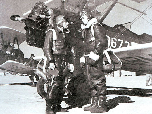 | |
Flight Training |
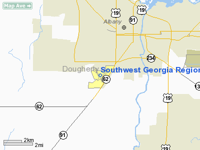
Southwest Georgia Regional Airport (IATA: ABY, ICAO: KABY, FAA LID: ABY) is a public airport located three miles (5 km) southwest of the central business district of Albany, a city in Dougherty County, Georgia, United States. The airport is owned by the City of Albany and is served by commercial passenger airlines. Facilities and aircraft
Southwest Georgia Regional Airport covers an area of 980 acres (397 ha) which contains two asphalt paved runways: 4/22 measuring 6,601 x 150 ft (2,012 x 46 m) and 16/34 measuring 5,219 x 150 ft (1,591 x 46 m). For the 12-month period ending April 27, 2007, the airport had 105,448 aircraft operations, an average of 288 per day: 40% air taxi, 33% general aviation, 25% scheduled commercial and 2% military.
Airlines and destinations
Scheduled passenger service
| Airlines |
Destinations |
| Delta Connection operated by Atlantic Southeast Airlines |
Atlanta |
Cargo
History
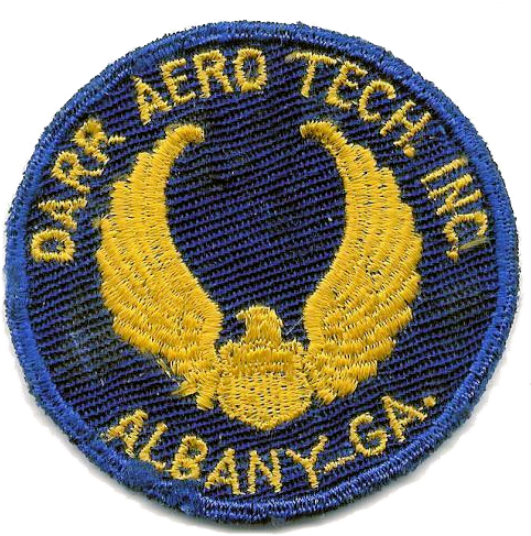 | |
Patch of the 52nd Army Air Force Fight Training Detachment |
Albany Airport opened in 1935, about 4 miles southwest of the city. In October 1938, Eastern Air Lines began mail service to the field. Eastern's Eddie Rickenbacker announced that as soon as the City improved the airport, his airline would start passenger service. The City was doing just that during 1939 and 1940 in the form of a WPA project to enlarge the landing area and build a passenger terminal.
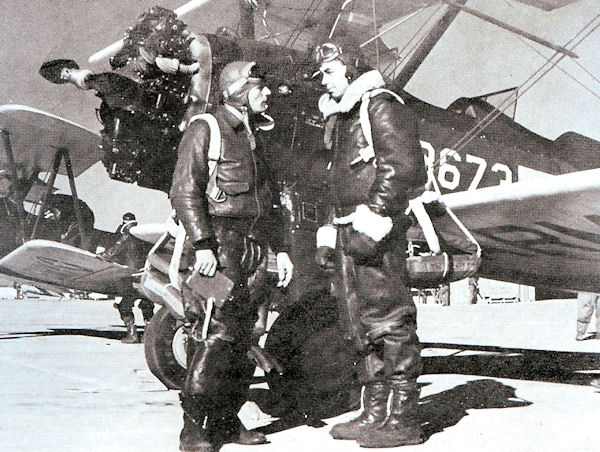
In 1940 the United States Army Air Corps was establishing civilian pilot training schools at airports in the southeast, with its moderate weather. Previously Albany Airport was rejected as an advanced training base, (Turner Army Airfield was built north of Albany instead), but approved Albany Airport for a primary contract school in June. The City agreed to provide $500,000 for further improvements to the landing field, the completion of the passenger terminal, the cost of constructing two hangars and half the cost of a third hangar. An additional investment of over $400,000 was made by Hal S. Darr, owner of the contract flying school for the construction of the cantonment area and one half the cost of one hangar. Ground was broken in July 1940. The Army Air Corps named the school the 52nd Army Air Force Fight Training Detachment. Thus Darr Aero Tech became the first Army Air Corps activity constructed in Georgia during the buildup to World War II.
On 15 August 1940, the first class of 45 cadets began training. The cadets were initially housed in the Georgia Hotel until the barracks reached completion on 20 August. Flight training commenced with 15 PT-13 Stearmans and 11 flight instructors. Seven classes of American cadets were trained until July 1941. On June 8, 1941, the school received the first British RAF cadets. For the next 14 months, Darr's classes were exclusively British. A conflict existed between Turner and Darr over airspace. Generally, Turner's airspace was located north of Albany and Darr's south of Albany. Where the areas overlapped, Turner's aircraft flew above 5,000 ft. and Darr's below 5,000. Darr's three auxiliary fields were located south of Albany.
During the first year of operation, Darr Aero Tech graduated 559 American and 86 British cadets. The last British class graduated on 10 October 1942. The seven British cadets killed at Darr and Turner Field, were interred at Albany's Crown Hill Cemetery. A granite monument and flagpole mark the graves today.
On 11 December 1941, the Defense Plant Corporation bought the school from Mr. Darr for $408,000 and the airfield was called Albany Army Airfield. Anticipating an increase in training, an additional $100,000 was spent on improvements in 1942 that included a dispensary, cold storage building, additional barracks and a Link Trainer building. After the end of 1943 training began to decrease, eventually ending with the closing of the school on 28 December 1944.
In September 1945, control of the airfield was turned over to the City of Albany, and Eastern resumed service after the war. The airport eventually received paved runways. In 2004, the only structures of Darr Aero Tech remaining are the three hangars. No trace of the cantonment area exists. In 1959, a new terminal building was completed and named in honor of the then Mayor William McAfee.
Albany Army Airfield and Darr Aero Tech is remembered by a display inside the terminal building plus a memorial and flagpole outside.
The above content comes from Wikipedia and is published under free licenses – click here to read more.
Location
& QuickFacts
|
FAA Information Effective: |
2007-07-05 |
|
Airport
Identifier: |
ABY |
|
Airport
Status: |
Operational |
|
Longitude/Latitude: |
084-11-40.1040W/31-32-07.8540N
-84.194473/31.535515 (Estimated) |
|
Elevation: |
197 ft / 60.05 m (Surveyed) |
|
Land: |
980 acres |
|
From
nearest city: |
3 nautical miles SW of Albany, GA |
|
Location: |
Dougherty County, GA |
|
Magnetic Variation: |
02W (1985) |
Owner
& Manager
|
Ownership: |
Publicly owned |
|
Owner: |
City Of Albany
ARPT OPERATED BY ALBANY-DOUGHERTY CO AVIATION COMMISSION. |
|
Address: |
3905 Newton Road, Suite 100
Albany, GA 31701-7356 |
|
Phone
number: |
229-430-5175 |
|
Manager: |
Yvette Aehle |
|
Address: |
3905 Newton Road, Suite 100
Albany, GA 31707 |
|
Phone number: |
229-430-5175 |
Airport
Operations and Facilities
|
Airport Use: |
Open to public |
|
Wind
indicator: |
Yes |
|
Segmented
Circle: |
Yes |
|
Control
Tower: |
Yes |
|
Lighting
Schedule: |
DUSK-DAWN
WHEN ATCT CLSD, ACTVT HIRL RY 04/22, MIRL RY 16/34 &
MALSR RY 04 - CTAF. |
|
Beacon
Color: |
Clear-Green (lighted land airport) |
|
Landing
fee charge: |
No |
|
Sectional
chart: |
Jacksonville |
|
Region: |
ASO - Southern |
|
Traffic
Pattern Alt: |
800 ft |
|
Boundary
ARTCC: |
ZJX - Jacksonville |
|
Tie-in
FSS: |
MCN - Macon |
|
FSS
on Airport: |
No |
|
FSS
Toll Free: |
1-800-WX-BRIEF |
|
NOTAMs
Facility: |
ABY (NOTAM-d service avaliable) |
|
Certification
type/date: |
I A S 05/1973
CLSD TO UNSKED ACR OPNS WITH MORE THAN 30 PSGR SEATS EXCP
PPR CALL AMGR 229-430-5175. |
|
Federal Agreements: |
NGY3 |
Airport
Communications
|
CTAF: |
120.250 |
|
Unicom: |
122.950 |
Airport
Services
|
Fuel available: |
100LLA
FUEL AVBL AFTER HOURS CALL 229-434-8787. |
|
Airframe Repair: |
MAJOR |
|
Power Plant Repair: |
MAJOR |
|
Bottled
Oxygen: |
NONE |
|
Bulk
Oxygen: |
HIGH |
|
Runway Information
Runway 04/22
|
Dimension: |
6601 x 150 ft / 2012.0 x 45.7 m |
|
Surface: |
ASPH, Good Condition |
|
Surface
Treatment: |
Saw-cut or plastic Grooved |
|
Weight
Limit: |
Single wheel: 80000 lbs.
Dual wheel: 135000 lbs.
Dual
tandem wheel: 230000 lbs. |
|
Edge
Lights: |
High |
|
|
Runway 04 |
Runway 22 |
|
Longitude: |
084-11-58.9600W |
084-11-07.8320W |
|
Latitude: |
31-31-46.5100N |
31-32-34.9820N |
|
Elevation: |
196.00
ft |
189.00
ft |
|
Alignment: |
42 |
127 |
|
ILS
Type: |
ILS |
|
|
Traffic
Pattern: |
Right |
Left |
|
Markings: |
Precision instrument, Good Condition |
Precision instrument, Good Condition |
|
Crossing
Height: |
55.00
ft |
52.00
ft |
|
VASI: |
4-light PAPI on left side |
4-box on left side |
|
Visual
Glide Angle: |
0.00° |
3.00° |
|
RVR
Equipment: |
touchdown |
|
|
Approach
lights: |
MALSR |
|
|
Runway
End Identifier: |
|
Yes |
|
Obstruction: |
79 ft trees, 3175.0 ft from runway, 550 ft
right of centerline, 37:1 slope to clear |
67 ft ant, 2800.0 ft from runway, 800 ft left
of centerline, 38:1 slope to clear |
|
Runway 16/34
|
Dimension: |
5200 x 150 ft / 1585.0 x 45.7 m |
|
Surface: |
ASPH, Good Condition |
|
Surface
Treatment: |
Saw-cut or plastic Grooved |
|
Weight
Limit: |
Single wheel: 30000 lbs. |
|
Edge
Lights: |
Medium |
|
|
Runway 16 |
Runway 34 |
|
Longitude: |
084-11-57.9920W |
084-11-39.2450W |
|
Latitude: |
31-32-28.6260N |
31-31-39.7360N |
|
Elevation: |
195.00
ft |
196.00
ft |
|
Alignment: |
127 |
127 |
|
Traffic
Pattern: |
Right |
Left |
|
Markings: |
Non-precision instrument, Good Condition |
Non-precision instrument, Good Condition |
|
Crossing
Height: |
49.00
ft |
44.00
ft |
|
VASI: |
4-box on left side |
4-box on left side |
|
Visual
Glide Angle: |
3.00° |
3.00° |
|
Runway
End Identifier: |
Yes |
|
|
Obstruction: |
42 ft tree, 1200.0 ft from runway, 400 ft left
of centerline, 25:1 slope to clear |
54 ft trees, 1700.0 ft from runway, 482 ft
left of centerline, 33:1 slope to clear |
|
Radio Navigation
Aids
|
ID |
Type |
Name |
Ch |
Freq |
Var |
Dist |
|
AB |
NDB |
Putny |
|
227.00 |
02W |
6.3 nm |
|
CXU |
NDB |
Camilla |
|
369.00 |
02W |
19.4 nm |
|
IWJ |
NDB |
Blaak |
|
344.00 |
03W |
32.4 nm |
|
OHY |
NDB |
Coney |
|
400.00 |
02W |
32.6 nm |
|
LYZ |
NDB |
Willis |
|
359.00 |
01W |
37.9 nm |
|
LKG |
NDB |
Lindbergh |
|
242.00 |
03W |
38.7 nm |
|
CYR |
NDB |
Caidy |
|
338.00 |
01W |
38.9 nm |
|
GTP |
NDB |
Patten |
|
245.00 |
02W |
39.5 nm |
|
TM |
NDB |
Tifto |
|
409.00 |
03W |
39.9 nm |
|
SUR |
NDB |
Fitzgerald |
|
362.00 |
03W |
46.5 nm |
|
IFM |
VOR |
Tift Myers |
|
112.50 |
01W |
36.7 nm |
|
MGR |
VOR/DME |
Moultrie |
025X |
108.80 |
02W |
33.8 nm |
|
PZD |
VORTAC |
Pecan |
108X |
116.10 |
02W |
8.8 nm |
Remarks
- LOW
FLYNG ACFT 3 MILES SOUTHEAST.
- ACFT
BYD 3 NM AND BLO 2000 FT ON APCH TO RY 16 BRG 325-040 FROM ARPT NOT
VISIBLE FM ATCT DUE TO TREES.
- NUMEROUS
BIRDS ON & WITHIN 5 NM OF ARPT SEP-FEB.
- TWY
H SOUTH OF CARGO RAMP OTS INDEFLY.
Based
Aircraft
|
Aircraft
based on field: |
46 |
|
Single
Engine Airplanes: |
32 |
|
Multi
Engine Airplanes: |
11 |
|
Helicopters: |
3 |
Major Carriers
Serving This Airport
| Atlantic Southeast Airlines |
100.0% |
Most Popular Destinations
|
Hartsfield
- Jackson Atlanta Intl (ATL) |
100.0% |
Most Popular Aircraft
|
N889AS |
6.2% |
|
N884AS |
5.6% |
|
N922EV |
5.3% |
|
N886AS |
5.3% |
|
N873AS |
5.0% |
|
N882AS |
4.7% |
|
N885AS |
4.7% |
|
N876AS |
4.2% |
|
N921EV |
3.6% |
|
N878AS |
3.6% |
Operational Statistics
Time Period: 2005-05-01
- 2006-04-30
|
Aircraft
Operations: |
182/Day |
|
Commerical: |
0.3% |
|
Air Taxi: |
8.9% |
|
General
Aviation Local: |
50.3% |
|
General
Aviation Itinerant: |
22.7% |
|
Military: |
17.8% |
Southwest Georgia Regional Airport
Address:
Dougherty County, GA
Tel:
229-430-5175
Images
and information placed above are from
http://www.airport-data.com/airport/ABY/
We
thank them for the data!
| General
Info |
| Country |
United
States |
| State |
GEORGIA
|
| FAA ID |
ABY
|
| Latitude |
31-32-07.854N
|
| Longitude |
084-11-40.104W
|
| Elevation |
197 feet
|
| Near City |
ALBANY
|
We don't guarantee the information is fresh and accurate. The data may
be wrong or outdated.
For more up-to-date information please refer to other sources.
|
|