 |
|
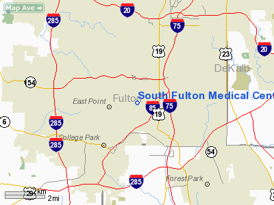
South Fulton Medical Center Heliport |
|
|
Location
& QuickFacts
|
FAA Information Effective: |
2007-07-05 |
|
Airport
Identifier: |
GA71 |
|
Airport
Status: |
Operational |
|
Longitude/Latitude: |
084-25-37.7390W/33-40-46.3900N
-84.427150/33.679553 (Estimated) |
|
Elevation: |
952 ft / 290.17 m (Estimated) |
|
Land: |
1
acres |
|
From
nearest city: |
0 nautical miles N of East Point, GA |
|
Location: |
Fulton County, GA |
|
Magnetic Variation: |
02W (1985) |
Owner
& Manager
|
Ownership: |
Privately owned |
|
Owner: |
South Fulton Medical Center |
|
Address: |
1170 Cleveland Ave.
East Point, GA 30344 |
|
Phone
number: |
404-305-3500 |
|
Manager: |
South Fulton Medical Center |
|
Address: |
1170 Cleveland Ave.
East Point, GA 30344 |
|
Phone number: |
404-305-3500 |
Airport
Operations and Facilities
|
Airport Use: |
Private
MEDICAL. |
|
Wind
indicator: |
Yes |
|
Segmented
Circle: |
No |
|
Control
Tower: |
No |
|
Lighting
Schedule: |
PHONE REQ
FOR PERIMETER LGTS CALL 404-305-3500. |
|
Sectional
chart: |
Atlanta |
|
Region: |
ASO - Southern |
|
Boundary
ARTCC: |
ZTL - Atlanta |
|
Tie-in
FSS: |
MCN - Macon |
|
FSS
on Airport: |
No |
|
FSS
Toll Free: |
1-800-WX-BRIEF |
|
Runway Information
Helipad H1
|
Dimension: |
74 x 74 ft / 22.6 x 22.6 m |
|
Surface: |
ASPH, |
|
|
Runway H1 |
Runway |
|
Traffic
Pattern: |
Left |
Left |
|
Radio Navigation
Aids
|
ID |
Type |
Name |
Ch |
Freq |
Var |
Dist |
|
BR |
NDB |
Redan |
|
266.00 |
02W |
6.2 nm |
|
FT |
NDB |
Flanc |
|
344.00 |
02W |
11.7 nm |
|
FF |
NDB |
Pecat |
|
316.00 |
02W |
23.0 nm |
|
EQQ |
NDB |
Coweta County |
|
234.00 |
03W |
29.2 nm |
|
JHH |
NDB |
Griffin |
|
412.00 |
04W |
31.4 nm |
|
VOF |
NDB |
Alcovy |
|
370.00 |
03W |
32.4 nm |
|
DJD |
NDB |
Canton |
|
415.00 |
04W |
34.6 nm |
|
JNM |
NDB |
Monroe |
|
392.00 |
03W |
35.2 nm |
|
GPQ |
NDB |
Carrollton |
|
278.00 |
02W |
35.9 nm |
|
EVZ |
NDB |
Cartersville |
|
308.00 |
04W |
37.5 nm |
|
FKV |
NDB |
Flowery Branch |
|
365.00 |
03W |
40.8 nm |
|
BMW |
NDB |
Barrow County |
|
404.00 |
03W |
44.6 nm |
|
JZP |
NDB |
Pickens County |
|
285.00 |
04W |
46.7 nm |
|
OP |
NDB |
Yates |
|
339.00 |
03W |
47.3 nm |
|
DOB |
TACAN |
Dobbins |
077X |
|
01W |
14.7 nm |
|
PDK |
VOR/DME |
Peachtree |
113X |
116.60 |
02W |
13.4 nm |
|
ATL |
VORTAC |
Atlanta |
116X |
116.90 |
00W |
3.1 nm |
|
RMG |
VORTAC |
Rome |
101X |
115.40 |
01E |
45.1 nm |
|
ATL |
VOT |
Atlanta Muni |
|
111.00 |
|
1.3 nm |
Remarks
- PRVDD
VFR/PVT USE; APCH/DEP ROUTES ARE FROM 075 DEGS TO 125 DEGS AND FROM
300 DEGS TO 330 DEGS; TKOF/LNDG AREA MARKED; AND WIND INDICATOR MAINTAINED.
South Fulton Medical Center Heliport
Address:
Fulton County, GA
Tel:
404-305-3500
Images
and information placed above are from
http://www.airport-data.com/airport/GA71/
We
thank them for the data!
| General
Info |
| Country |
United
States |
| State |
GEORGIA
|
| FAA ID |
GA71
|
| Latitude |
33-40-46.390N
|
| Longitude |
084-25-37.739W
|
| Elevation |
952 feet
|
| Near City |
EAST POINT
|
We don't guarantee the information is fresh and accurate. The data may
be wrong or outdated.
For more up-to-date information please refer to other sources.
|
|


