 |
|
Location
& QuickFacts
|
FAA Information Effective: |
2007-07-05 |
|
Airport
Identifier: |
GA73 |
|
Airport
Status: |
Operational |
|
Longitude/Latitude: |
084-27-11.7270W/33-09-42.4400N
-84.453258/33.161789 (Estimated) |
|
Elevation: |
850 ft / 259.08 m (Estimated) |
|
Land: |
0 acres |
|
From
nearest city: |
4 nautical miles N of Concord, GA |
|
Location: |
Pike County, GA |
|
Magnetic Variation: |
02W (1985) |
Owner
& Manager
|
Ownership: |
Privately owned |
|
Owner: |
James R. Friedline |
|
Address: |
1325 Hwy 362 West
Williamson, GA 30292 |
|
Phone number: |
770-228-5748 |
|
Manager: |
James R. Friedline |
|
Address: |
1325 Hwy 362 West
Williamson, GA 30292 |
|
Phone number: |
770-228-5748 |
Airport
Operations and Facilities
|
Airport Use: |
Private |
|
Wind indicator: |
No |
|
Segmented Circle: |
No |
|
Control Tower: |
No |
|
Landing fee charge: |
No |
|
Sectional chart: |
Atlanta |
|
Region: |
ASO - Southern |
|
Boundary ARTCC: |
ZTL - Atlanta |
|
Tie-in FSS: |
MCN - Macon |
|
FSS on Airport: |
No |
|
FSS Toll Free: |
1-800-WX-BRIEF |
Airport
Services
|
Airframe Repair: |
NONE |
|
Power Plant Repair: |
NONE |
|
Runway Information
Runway 08/26
|
Dimension: |
2400 x 50 ft / 731.5 x 15.2 m |
|
Surface: |
TURF, |
|
|
Runway 08 |
Runway 26 |
|
Traffic
Pattern: |
Left |
Left |
|
Radio Navigation
Aids
|
ID |
Type |
Name |
Ch |
Freq |
Var |
Dist |
|
FF |
NDB |
Pecat |
|
316.00 |
02W |
8.5 nm |
|
JHH |
NDB |
Griffin |
|
412.00 |
04W |
11.4 nm |
|
EQQ |
NDB |
Coweta County |
|
234.00 |
03W |
14.2 nm |
|
OP |
NDB |
Yates |
|
339.00 |
03W |
19.8 nm |
|
PIM |
NDB |
Pine Mountain |
|
272.00 |
03W |
28.5 nm |
|
BR |
NDB |
Redan |
|
266.00 |
02W |
29.9 nm |
|
FT |
NDB |
Flanc |
|
344.00 |
02W |
37.3 nm |
|
GPQ |
NDB |
Carrollton |
|
278.00 |
02W |
41.8 nm |
|
VOF |
NDB |
Alcovy |
|
370.00 |
03W |
43.9 nm |
|
DOB |
TACAN |
Dobbins |
077X |
|
01W |
45.3 nm |
|
PDK |
VOR/DME |
Peachtree |
113X |
116.60 |
02W |
43.6 nm |
|
ATL |
VORTAC |
Atlanta |
116X |
116.90 |
00W |
28.1 nm |
|
LGC |
VORTAC |
Lagrange |
103X |
115.60 |
01E |
38.5 nm |
|
CSG |
VORTAC |
Columbus |
118X |
117.10 |
01E |
43.5 nm |
|
MCN |
VORTAC |
Macon |
089X |
114.20 |
01E |
49.5 nm |
|
ATL |
VOT |
Atlanta Muni |
|
111.00 |
|
29.9 nm |
Remarks
Based
Aircraft
|
Aircraft
based on field: |
5 |
|
Single
Engine Airplanes: |
5 |
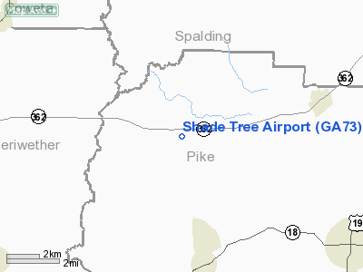
Shade Tree Airport
Address:
Pike County, GA
Tel:
770-228-5748
Images
and information placed above are from
http://www.airport-data.com/airport/GA73/
We
thank them for the data!
| General
Info |
| Country |
United
States |
| State |
GEORGIA
|
| FAA ID |
GA73
|
| Latitude |
33-09-42.440N
|
| Longitude |
084-27-11.727W
|
| Elevation |
850 feet
|
| Near City |
CONCORD
|
We don't guarantee the information is fresh and accurate. The data may
be wrong or outdated.
For more up-to-date information please refer to other sources.
|
|


