|
|
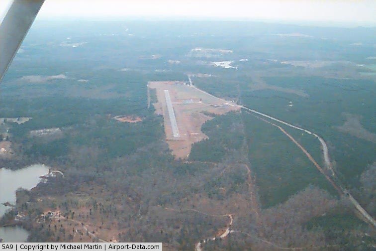
Roosevelt Memorial Airport |
|
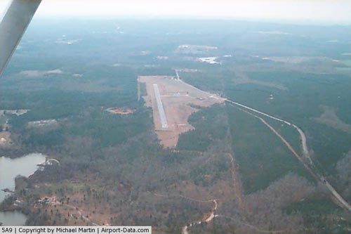 |
(Click on the photo to enlarge) |
Location
& QuickFacts
|
FAA Information Effective: |
2007-07-05 |
|
Airport
Identifier: |
5A9 |
|
Airport
Status: |
Operational |
|
Longitude/Latitude: |
084-41-19.7390W/32-56-00.4640N
-84.688816/32.933462 (Estimated) |
|
Elevation: |
880 ft / 268.22 m (Estimated) |
|
Land: |
165 acres |
|
From
nearest city: |
3 nautical miles N of Warm Springs, GA |
|
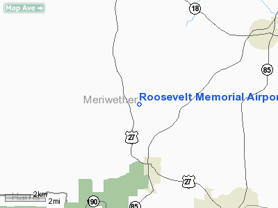
Location: |
Meriwether County, GA |
|
Magnetic Variation: |
02W (1985) |
Owner
& Manager
|
Ownership: |
Publicly owned |
|
Owner: |
Meriwether County Arpt Authority |
|
Address: |
Box 906
Warm Springs, GA 31830 |
|
Phone number: |
800-205-1762 |
|
Manager: |
Oscar Parker, Chairman |
|
Address: |
1101 Nebulla Road
Manchester, GA 31816 |
|
Phone number: |
706-846-8002 |
Airport
Operations and Facilities
|
Airport Use: |
Open to public |
|
Wind
indicator: |
Yes |
|
Segmented
Circle: |
Yes |
|
Control
Tower: |
No |
|
Lighting
Schedule: |
DUSK-DAWN
MIRL RY 17/35 OPER LOW INTST DUSK-2200; AFT 2200 ACTVT -
CTAF. |
|
Beacon
Color: |
Clear-Green (lighted land airport) |
|
Landing
fee charge: |
No |
|
Sectional
chart: |
Atlanta |
|
Region: |
ASO - Southern |
|
Boundary
ARTCC: |
ZTL - Atlanta |
|
Tie-in
FSS: |
MCN - Macon |
|
FSS
on Airport: |
No |
|
FSS
Toll Free: |
1-800-WX-BRIEF |
|
NOTAMs
Facility: |
MCN (NOTAM-d service avaliable) |
|
Federal Agreements: |
NGY |
Airport
Communications
Airport
Services
|
Fuel available: |
100LL |
|
Airframe Repair: |
MINOR |
|
Power Plant Repair: |
MINOR |
|
Bottled
Oxygen: |
NONE |
|
Bulk
Oxygen: |
NONE |
|
Runway Information
Runway 17/35
|
Dimension: |
3000 x 75 ft / 914.4 x 22.9 m |
|
Surface: |
ASPH, Good Condition |
|
Weight
Limit: |
Single wheel: 28000 lbs. |
|
Edge
Lights: |
Medium |
|
|
Runway 17 |
Runway 35 |
|
Traffic
Pattern: |
Left |
Left |
|
Markings: |
Basic, Good Condition |
Basic, Good Condition |
|
Obstruction: |
20 ft trees, 460.0 ft from runway, 150 ft right
of centerline, 13:1 slope to clear
TREES 125' LEFT OF CNTRLN EXTDD.
+20 FT TREES AND BRUSH 140 FT FROM RWY END, 55 FT TO 120 FT
LEFT OF RY CNTRLN. |
49 ft trees, 1180.0 ft from runway, 20:1 slope
to clear
TREES 125' LEFT OF CNTRLN EXTDD. |
|
Radio Navigation
Aids
|
ID |
Type |
Name |
Ch |
Freq |
Var |
Dist |
|
PIM |
NDB |
Pine Mountain |
|
272.00 |
03W |
10.7 nm |
|
EQQ |
NDB |
Coweta County |
|
234.00 |
03W |
19.5 nm |
|
FF |
NDB |
Pecat |
|
316.00 |
02W |
24.3 nm |
|
OP |
NDB |
Yates |
|
339.00 |
03W |
25.3 nm |
|
JHH |
NDB |
Griffin |
|
412.00 |
04W |
27.7 nm |
|
AWS |
NDB |
Lawson |
|
335.00 |
02W |
42.0 nm |
|
GPQ |
NDB |
Carrollton |
|
278.00 |
02W |
44.0 nm |
|
BR |
NDB |
Redan |
|
266.00 |
02W |
46.8 nm |
|
IZS |
NDB |
Montezuma |
|
426.00 |
04W |
48.4 nm |
|
FT |
NDB |
Flanc |
|
344.00 |
02W |
49.9 nm |
|
LSF |
VOR/DME |
Lawson |
051X |
111.40 |
02W |
39.3 nm |
|
CSG |
VORTAC |
Columbus |
118X |
117.10 |
01E |
25.3 nm |
|
LGC |
VORTAC |
Lagrange |
103X |
115.60 |
01E |
27.0 nm |
|
ATL |
VORTAC |
Atlanta |
116X |
116.90 |
00W |
43.7 nm |
|
ATL |
VOT |
Atlanta Muni |
|
111.00 |
|
45.5 nm |
Remarks
Based Aircraft
|
Aircraft
based on field: |
1 |
|
Single
Engine Airplanes: |
1 |
Operational Statistics
Time Period: 2005-06-23
- 2006-06-22
|
Aircraft
Operations: |
97/Week |
|
General
Aviation Local: |
50.0% |
|
General
Aviation Itinerant: |
50.0% |
Roosevelt Memorial Airport
Address:
Meriwether County, GA
Tel:
800-205-1762, 706-846-8002
Images
and information placed above are from
http://www.airport-data.com/airport/5A9/
We
thank them for the data!
| General
Info |
| Country |
United
States |
| State |
GEORGIA
|
| FAA ID |
5A9
|
| Latitude |
32-56-00.464N
|
| Longitude |
084-41-19.739W
|
| Elevation |
880 feet
|
| Near City |
WARM SPRINGS
|
We don't guarantee the information is fresh and accurate. The data may
be wrong or outdated.
For more up-to-date information please refer to other sources.
|
|