 |
|
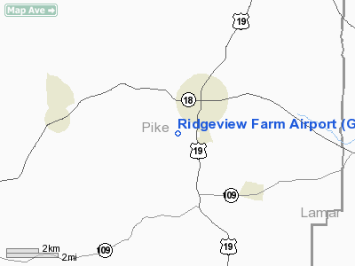
Location
& QuickFacts
|
FAA Information Effective: |
2007-07-05 |
|
Airport
Identifier: |
GA10 |
|
Airport
Status: |
Operational |
|
Longitude/Latitude: |
084-21-29.7180W/33-05-00.4470N
-84.358255/33.083458 (Estimated) |
|
Elevation: |
854 ft / 260.30 m (Surveyed) |
|
Land: |
30
acres |
|
From
nearest city: |
2 nautical miles SW of Zebulon, GA |
|
Location: |
Pike County, GA |
|
Magnetic Variation: |
02W (1985) |
Owner
& Manager
|
Ownership: |
Privately owned |
|
Owner: |
Douglas T. Rounds |
|
Address: |
Po Box 100
Zebulon, GA 30295 |
|
Phone number: |
404-567-3396 |
|
Manager: |
Douglas T. Rounds |
|
Address: |
Po Box 100
Zebulon, GA 30295 |
|
Phone number: |
404-567-3396 |
Airport
Operations and Facilities
|
Airport Use: |
Private |
|
Wind indicator: |
Yes |
|
Segmented Circle: |
No |
|
Control Tower: |
No |
|
Landing fee charge: |
No |
|
Sectional chart: |
Atlanta |
|
Region: |
ASO - Southern |
|
Boundary ARTCC: |
ZTL - Atlanta |
|
Tie-in FSS: |
MCN - Macon |
|
FSS on Airport: |
No |
|
FSS Toll Free: |
1-800-WX-BRIEF |
Airport
Services
|
Bottled
Oxygen: |
NONE |
|
Bulk
Oxygen: |
NONE |
|
Runway Information
Runway 12/30
|
Dimension: |
2100 x 60 ft / 640.1 x 18.3 m |
|
Surface: |
TURF, Good Condition |
|
|
Runway 12 |
Runway 30 |
|
Traffic
Pattern: |
Left |
Left |
|
Displaced
threshold: |
630.00
ft |
0.00 ft |
|
Obstruction: |
56 ft trees, 500.0 ft from runway, 8:1 slope
to clear
APPROACH RATIO 20-1 FROM DSPLCD THR. |
60 ft trees, 1500.0 ft from runway, 25:1 slope
to clear |
|
Radio Navigation
Aids
|
ID |
Type |
Name |
Ch |
Freq |
Var |
Dist |
|
JHH |
NDB |
Griffin |
|
412.00 |
04W |
8.9 nm |
|
OP |
NDB |
Yates |
|
339.00 |
03W |
13.1 nm |
|
FF |
NDB |
Pecat |
|
316.00 |
02W |
14.6 nm |
|
EQQ |
NDB |
Coweta County |
|
234.00 |
03W |
20.7 nm |
|
PIM |
NDB |
Pine Mountain |
|
272.00 |
03W |
29.7 nm |
|
BR |
NDB |
Redan |
|
266.00 |
02W |
33.9 nm |
|
FT |
NDB |
Flanc |
|
344.00 |
02W |
43.2 nm |
|
VOF |
NDB |
Alcovy |
|
370.00 |
03W |
43.8 nm |
|
IZS |
NDB |
Montezuma |
|
426.00 |
04W |
46.6 nm |
|
BEP |
NDB |
Bay Creek |
|
350.00 |
03W |
48.1 nm |
|
GPQ |
NDB |
Carrollton |
|
278.00 |
02W |
48.4 nm |
|
PDK |
VOR/DME |
Peachtree |
113X |
116.60 |
02W |
47.7 nm |
|
ATL |
VORTAC |
Atlanta |
116X |
116.90 |
00W |
33.0 nm |
|
LGC |
VORTAC |
Lagrange |
103X |
115.60 |
01E |
42.8 nm |
|
MCN |
VORTAC |
Macon |
089X |
114.20 |
01E |
42.9 nm |
|
CSG |
VORTAC |
Columbus |
118X |
117.10 |
01E |
43.6 nm |
|
ATL |
VOT |
Atlanta Muni |
|
111.00 |
|
34.7 nm |
Remarks
- DEER
FREQUENTLY ON AND INVOF ARPT.
- VFR
OPNS ONLY.
Based
Aircraft
|
Aircraft
based on field: |
3 |
|
Single
Engine Airplanes: |
3 |
Operational Statistics
Time Period: 1990-04-18
- 1991-04-17
|
Aircraft
Operations: |
49/Week |
|
General
Aviation Local: |
40.0% |
|
General
Aviation Itinerant: |
60.0% |
Ridgeview Farm Airport
Address:
Pike County, GA
Tel:
404-567-3396
Images
and information placed above are from
http://www.airport-data.com/airport/GA10/
We
thank them for the data!
| General
Info |
| Country |
United
States |
| State |
GEORGIA
|
| FAA ID |
GA10
|
| Latitude |
33-05-00.447N
|
| Longitude |
084-21-29.718W
|
| Elevation |
854 feet
|
| Near City |
ZEBULON
|
We don't guarantee the information is fresh and accurate. The data may
be wrong or outdated.
For more up-to-date information please refer to other sources.
|
|


