 |
|
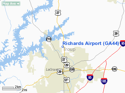
Location
& QuickFacts
|
FAA Information Effective: |
2007-07-05 |
|
Airport
Identifier: |
GA44 |
|
Airport
Status: |
Operational |
|
Longitude/Latitude: |
085-01-53.7780W/33-04-45.4440N
-85.031605/33.079290 (Estimated) |
|
Elevation: |
650 ft / 198.12 m (Estimated) |
|
Land: |
4 acres |
|
From
nearest city: |
6 nautical miles NE of Lagrange, GA |
|
Location: |
Troup County, GA |
|
Magnetic Variation: |
01W (1985) |
Owner
& Manager
|
Ownership: |
Privately owned |
|
Owner: |
Jack Richards |
|
Address: |
351 Waugh Rd
La Grange, GA 30240 |
|
Phone
number: |
404-884-6419 |
|
Manager: |
Jack Richards |
|
Address: |
351 Waugh Rd
La Grange, GA 30240 |
|
Phone number: |
404-884-6419 |
Airport
Operations and Facilities
|
Airport Use: |
Private |
|
Wind
indicator: |
Yes |
|
Segmented
Circle: |
No |
|
Control
Tower: |
No |
|
Sectional
chart: |
Atlanta |
|
Region: |
ASO - Southern |
|
Boundary
ARTCC: |
ZTL - Atlanta |
|
Tie-in
FSS: |
MCN - Macon |
|
FSS
Toll Free: |
1-800-WX-BRIEF |
|
Runway Information
Runway 18/36
|
Dimension: |
1700 x 50 ft / 518.2 x 15.2 m |
|
Surface: |
TURF-DIRT, |
|
|
Runway 18 |
Runway 36 |
|
Traffic
Pattern: |
Left |
Left |
|
Radio Navigation
Aids
|
ID |
Type |
Name |
Ch |
Freq |
Var |
Dist |
|
PIM |
NDB |
Pine Mountain |
|
272.00 |
03W |
16.3 nm |
|
EQQ |
NDB |
Coweta County |
|
234.00 |
03W |
19.3 nm |
|
GPQ |
NDB |
Carrollton |
|
278.00 |
02W |
29.7 nm |
|
FF |
NDB |
Pecat |
|
316.00 |
02W |
30.5 nm |
|
JHH |
NDB |
Griffin |
|
412.00 |
04W |
41.0 nm |
|
OP |
NDB |
Yates |
|
339.00 |
03W |
43.6 nm |
|
FT |
NDB |
Flanc |
|
344.00 |
02W |
45.5 nm |
|
AWS |
NDB |
Lawson |
|
335.00 |
02W |
47.3 nm |
|
DER |
NDB |
Alexander City |
|
382.00 |
01W |
48.4 nm |
|
BR |
NDB |
Redan |
|
266.00 |
02W |
49.7 nm |
|
LSF |
VOR/DME |
Lawson |
051X |
111.40 |
02W |
44.9 nm |
|
TGE |
VOR/DME |
Tuskegee |
120X |
117.30 |
02E |
48.1 nm |
|
LGC |
VORTAC |
Lagrange |
103X |
115.60 |
01E |
9.0 nm |
|
CSG |
VORTAC |
Columbus |
118X |
117.10 |
01E |
27.9 nm |
|
ATL |
VORTAC |
Atlanta |
116X |
116.90 |
00W |
44.6 nm |
|
ATL |
VOT |
Atlanta Muni |
|
111.00 |
|
46.2 nm |
Remarks
Based Aircraft
|
Aircraft
based on field: |
1 |
|
Single
Engine Airplanes: |
1 |
Richards Airport
Address:
Troup County, GA
Tel:
404-884-6419
Images
and information placed above are from
http://www.airport-data.com/airport/GA44/
We
thank them for the data!
| General
Info |
| Country |
United
States |
| State |
GEORGIA
|
| FAA ID |
GA44
|
| Latitude |
33-04-45.444N
|
| Longitude |
085-01-53.778W
|
| Elevation |
650 feet
|
| Near City |
LAGRANGE
|
We don't guarantee the information is fresh and accurate. The data may
be wrong or outdated.
For more up-to-date information please refer to other sources.
|
|


