 |
|
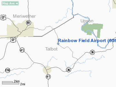
Location
& QuickFacts
|
FAA Information Effective: |
2007-07-05 |
|
Airport
Identifier: |
6GE2 |
|
Airport
Status: |
Operational |
|
Longitude/Latitude: |
084-32-16.0000W/32-49-58.0000N
-84.537778/32.832778 (Estimated) |
|
Elevation: |
780 ft / 237.74 m (Estimated) |
|
Land: |
0 acres |
|
From
nearest city: |
3 nautical miles NE of Woodland, GA |
|
Location: |
Talbot County, GA |
|
Magnetic Variation: |
() |
Owner
& Manager
|
Ownership: |
Privately owned |
|
Owner: |
Jim Hannah |
|
Address: |
Rt 1 Box 162a
Woodland, GA 31836 |
|
Phone
number: |
706-674-2808 |
|
Manager: |
Jim Hannah |
|
Address: |
Rt 1 Box 162a
Woodland, GA 31836 |
|
Phone number: |
706-674-2808 |
Airport
Operations and Facilities
|
Airport Use: |
Private |
|
Segmented
Circle: |
No |
|
Control
Tower: |
No |
|
Sectional
chart: |
Atlanta |
|
Region: |
ASO - Southern |
|
Boundary
ARTCC: |
ZTL - Atlanta |
|
Responsible
ARTCC: |
ZTL - Atlanta |
|
Tie-in
FSS: |
MCN - Macon |
|
FSS
Toll Free: |
1-800-WX-BRIEF |
|
Runway Information
Runway 18/36
|
Dimension: |
1800 x 60 ft / 548.6 x 18.3 m |
|
Surface: |
TURF, |
|
|
Runway 18 |
Runway 36 |
|
Traffic
Pattern: |
Left |
Left |
|
Displaced
threshold: |
50.00 ft |
50.00 ft |
|
Obstruction: |
80 ft pline |
50 ft trees |
|
Radio Navigation
Aids
|
ID |
Type |
Name |
Ch |
Freq |
Var |
Dist |
|
PIM |
NDB |
Pine Mountain |
|
272.00 |
03W |
16.9 nm |
|
OP |
NDB |
Yates |
|
339.00 |
03W |
18.4 nm |
|
JHH |
NDB |
Griffin |
|
412.00 |
04W |
26.3 nm |
|
EQQ |
NDB |
Coweta County |
|
234.00 |
03W |
27.0 nm |
|
FF |
NDB |
Pecat |
|
316.00 |
02W |
28.2 nm |
|
IZS |
NDB |
Montezuma |
|
426.00 |
04W |
38.8 nm |
|
AWS |
NDB |
Lawson |
|
335.00 |
02W |
40.7 nm |
|
BEP |
NDB |
Bay Creek |
|
350.00 |
03W |
45.1 nm |
|
LKG |
NDB |
Lindbergh |
|
242.00 |
03W |
45.2 nm |
|
LSF |
VOR/DME |
Lawson |
051X |
111.40 |
02W |
37.9 nm |
|
CSG |
VORTAC |
Columbus |
118X |
117.10 |
01E |
27.6 nm |
|
LGC |
VORTAC |
Lagrange |
103X |
115.60 |
01E |
36.1 nm |
|
MCN |
VORTAC |
Macon |
089X |
114.20 |
01E |
45.8 nm |
|
ATL |
VORTAC |
Atlanta |
116X |
116.90 |
00W |
48.1 nm |
|
ATL |
VOT |
Atlanta Muni |
|
111.00 |
|
49.9 nm |
Remarks
- 1600
FT AGL RADIO ANTENNA 9600 FT S OF APT.
- C+W
AIRPORT IS 2600 FT NW OF RAINBOW FIELD.
- PRVDD
VFR PVT USE.
Rainbow Field Airport
Address:
Talbot County, GA
Tel:
706-674-2808
Images
and information placed above are from
http://www.airport-data.com/airport/6GE2/
We
thank them for the data!
We don't guarantee the information is fresh and accurate. The data may
be wrong or outdated.
For more up-to-date information please refer to other sources.
|
|


