 |
|
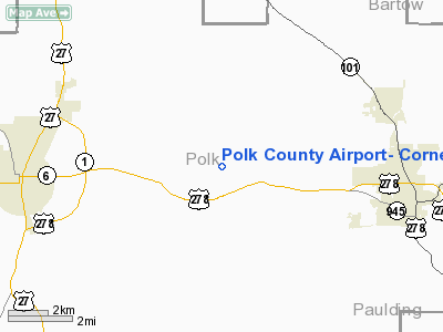
Polk County Airport - Cornelius Moore Field Airport |
|
|
Location
& QuickFacts
|
FAA Information Effective: |
2007-07-05 |
|
Airport
Identifier: |
4A4 |
|
Airport
Status: |
Operational |
|
Longitude/Latitude: |
085-08-47.3000W/34-01-07.3000N
-85.146472/34.018694 (Estimated) |
|
Elevation: |
974 ft / 296.88 m (Surveyed) |
|
Land: |
121 acres |
|
From
nearest city: |
5 nautical miles E of Cedartown, GA |
|
Location: |
Polk County, GA |
|
Magnetic Variation: |
00E (1975) |
Owner
& Manager
|
Ownership: |
Publicly owned |
|
Owner: |
Polk County |
|
Address: |
100 Prior Street
Cedartown, GA 30125 |
|
Phone number: |
770-749-2100 |
|
Manager: |
Wayne Johnson |
|
Address: |
100 Prior Street
Cedartown, GA 30125 |
|
Phone number: |
770-749-2100
FBO 770-684-7136. |
Airport
Operations and Facilities
|
Airport Use: |
Open to public |
|
Wind
indicator: |
Yes |
|
Segmented
Circle: |
Yes |
|
Control
Tower: |
No |
|
Lighting
Schedule: |
DUSK-DAWN
ACTVT MIRL & PAPI RY 09/27- CTAF. |
|
Beacon
Color: |
Clear-Green (lighted land airport) |
|
Landing
fee charge: |
No |
|
Sectional
chart: |
Atlanta |
|
Region: |
ASO - Southern |
|
Boundary
ARTCC: |
ZTL - Atlanta |
|
Tie-in
FSS: |
MCN - Macon |
|
FSS
on Airport: |
No |
|
FSS
Toll Free: |
1-800-WX-BRIEF |
|
NOTAMs
Facility: |
MCN (NOTAM-d service avaliable) |
|
Federal Agreements: |
NGY |
Airport
Communications
|
CTAF: |
122.800 |
|
Unicom: |
122.800 |
Airport
Services
|
Fuel available: |
100LLA1+ |
|
Airframe Repair: |
MINOR |
|
Power Plant Repair: |
MINOR |
|
Bottled
Oxygen: |
NONE |
|
Bulk
Oxygen: |
NONE |
|
Runway Information
Runway 09/27
|
Dimension: |
4004 x 75 ft / 1220.4 x 22.9 m |
|
Surface: |
ASPH, Good Condition |
|
Weight
Limit: |
Single wheel: 20000 lbs. |
|
Edge
Lights: |
Medium |
|
|
Runway 09 |
Runway 27 |
|
Longitude: |
085-09-10.9463W |
085-08-23.7398W |
|
Latitude: |
34-01-09.7604N |
34-01-04.9190N |
|
Elevation: |
971.00
ft |
954.00
ft |
|
Alignment: |
97 |
127 |
|
Traffic
Pattern: |
Left |
Left |
|
Markings: |
Non-precision instrument, Good Condition |
Non-precision instrument, Good Condition |
|
VASI: |
2-light PAPI on left side |
2-light PAPI on left side |
|
Obstruction: |
12 ft trees, 200.0 ft from runway, 150L/ ft
right of centerline
+20 FT TREES AT THLD 160 FT LEFT & 140 FT RIGHT, OUT TO
135 FEET. |
20 ft trees, 200.0 ft from runway, 205 ft right
of centerline
+20 FT TREES AT THLD 205 FT RIGHT. |
|
Radio Navigation
Aids
|
ID |
Type |
Name |
Ch |
Freq |
Var |
Dist |
|
OYD |
NDB |
Floyd |
|
388.00 |
02W |
16.9 nm |
|
EVZ |
NDB |
Cartersville |
|
308.00 |
04W |
18.6 nm |
|
OUK |
NDB |
Calhoun |
|
323.00 |
02W |
25.5 nm |
|
GPQ |
NDB |
Carrollton |
|
278.00 |
02W |
27.2 nm |
|
FT |
NDB |
Flanc |
|
344.00 |
02W |
29.6 nm |
|
DJD |
NDB |
Canton |
|
415.00 |
04W |
35.7 nm |
|
FTP |
NDB |
Fort Payne |
|
426.00 |
01W |
40.0 nm |
|
JZP |
NDB |
Pickens County |
|
285.00 |
04W |
43.1 nm |
|
BR |
NDB |
Redan |
|
266.00 |
02W |
47.4 nm |
|
UWI |
NDB |
Whitfield |
|
400.00 |
03W |
47.4 nm |
|
DOB |
TACAN |
Dobbins |
077X |
|
01W |
32.5 nm |
|
PDK |
VOR/DME |
Peachtree |
113X |
116.60 |
02W |
43.1 nm |
|
GAD |
VOR/DME |
Gadsden |
070X |
112.30 |
02E |
46.8 nm |
|
RMG |
VORTAC |
Rome |
101X |
115.40 |
01E |
8.8 nm |
|
ATL |
VORTAC |
Atlanta |
116X |
116.90 |
00W |
42.5 nm |
|
ATL |
VOT |
Atlanta Muni |
|
111.00 |
|
42.0 nm |
Based
Aircraft
|
Aircraft
based on field: |
79 |
|
Single
Engine Airplanes: |
58 |
|
Multi
Engine Airplanes: |
7 |
|
Gliders: |
10 |
|
Ultralights: |
4 |
Operational Statistics
Time Period: 2006-05-16
- 2007-05-15
|
Aircraft
Operations: |
255/Week |
|
General
Aviation Local: |
52.8% |
|
General
Aviation Itinerant: |
45.3% |
|
Military: |
1.9% |
Polk County Airport- Cornelius Moore Field Airport
Address:
Polk County, GA
Tel:
770-749-2100
Images
and information placed above are from
http://www.airport-data.com/airport/4A4/
We
thank them for the data!
| General
Info |
| Country |
United
States |
| State |
GEORGIA
|
| FAA ID |
4A4
|
| Time |
UTC-5(-4DT)
|
| Latitude |
34.018694
34° 01' 07.30" N |
| Longitude |
-85.146472
085° 08' 47.30" W |
| Elevation |
974 feet
297 meters |
| Type |
Civil
|
| Magnetic
Variation |
003° W
(01/06) |
| Beacon |
Yes
|
| Operating
Agency |
U.S.CIVIL
AIRPORT WHEREIN PERMIT COVERS USE BY TRANSIT MILITARY AIRCRAFT
|
| Near City |
Cedartown
|
| Operating
Hours |
SEE REMARKS
FOR OPERATING HOURS OR COMMUNICATIONS FOR POSSIBLE HOURS |
| Daylight
Saving Time |
Second
Sunday in March at 0200 to first Sunday in November at 0200 local
time (Exception Arizona and that portion of Indiana in the Eastern
Time Zone) |
We don't guarantee the information is fresh and accurate. The data may
be wrong or outdated.
For more up-to-date information please refer to other sources.
|
|


