 |
|
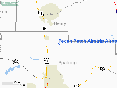
Pecan Patch Airstrip Airport |
Location
& QuickFacts
|
FAA Information Effective: |
2007-07-05 |
|
Airport
Identifier: |
0GE4 |
|
Airport
Status: |
Operational |
|
Longitude/Latitude: |
084-16-00.0000W/33-19-53.0000N
-84.266667/33.331389 (Estimated) |
|
Elevation: |
860 ft / 262.13 m (Estimated) |
|
Land: |
13
acres |
|
From
nearest city: |
3 nautical miles E of Sunnyside, GA |
|
Location: |
Spalding County, GA |
|
Magnetic Variation: |
04W (2000) |
Owner
& Manager
|
Ownership: |
Privately owned |
|
Owner: |
Mark Murdock |
|
Address: |
750 Teamon Road
Griffin, GA 30223 |
|
Phone
number: |
770-227-7558 |
|
Manager: |
Mark Murdock |
|
Address: |
750 Teamon Road
Griffin, GA 30223 |
|
Phone number: |
770-227-7558 |
Airport
Operations and Facilities
|
Airport Use: |
Private |
|
Wind
indicator: |
Yes |
|
Segmented
Circle: |
Yes |
|
Control
Tower: |
No |
|
Sectional
chart: |
Atlanta |
|
Region: |
ASO - Southern |
|
Boundary
ARTCC: |
ZTL - Atlanta |
|
Tie-in
FSS: |
MCN - Macon |
|
FSS
Toll Free: |
1-800-WX-BRIEF |
Airport
Services
|
Fuel available: |
MOGAS
FOR FUEL CALL 770-227-7558. |
|
Runway Information
Runway 09/27
|
Dimension: |
1045 x 80 ft / 318.5 x 24.4 m |
|
Surface: |
TURF, |
|
|
Runway 09 |
Runway 27 |
|
Traffic
Pattern: |
Left |
Left |
|
Obstruction: |
|
30 ft pline, 600.0 ft from runway |
|
Runway 18/36
|
Dimension: |
1000 x 80 ft / 304.8 x 24.4 m |
|
Surface: |
TURF, |
|
|
Runway 18 |
Runway 36 |
|
Traffic
Pattern: |
Left |
Left |
|
Obstruction: |
30 ft pline, 75.0 ft from runway |
|
|
Radio Navigation
Aids
|
ID |
Type |
Name |
Ch |
Freq |
Var |
Dist |
|
JHH |
NDB |
Griffin |
|
412.00 |
04W |
9.1 nm |
|
FF |
NDB |
Pecat |
|
316.00 |
02W |
11.2 nm |
|
BR |
NDB |
Redan |
|
266.00 |
02W |
19.0 nm |
|
EQQ |
NDB |
Coweta County |
|
234.00 |
03W |
22.9 nm |
|
OP |
NDB |
Yates |
|
339.00 |
03W |
25.1 nm |
|
VOF |
NDB |
Alcovy |
|
370.00 |
03W |
30.2 nm |
|
FT |
NDB |
Flanc |
|
344.00 |
02W |
31.9 nm |
|
JNM |
NDB |
Monroe |
|
392.00 |
03W |
36.4 nm |
|
PIM |
NDB |
Pine Mountain |
|
272.00 |
03W |
42.3 nm |
|
GPQ |
NDB |
Carrollton |
|
278.00 |
02W |
45.6 nm |
|
BMW |
NDB |
Barrow County |
|
404.00 |
03W |
49.7 nm |
|
DOB |
TACAN |
Dobbins |
077X |
|
01W |
37.1 nm |
|
PDK |
VOR/DME |
Peachtree |
113X |
116.60 |
02W |
32.8 nm |
|
ATL |
VORTAC |
Atlanta |
116X |
116.90 |
00W |
19.8 nm |
|
MCN |
VORTAC |
Macon |
089X |
114.20 |
01E |
49.6 nm |
|
ATL |
VOT |
Atlanta Muni |
|
111.00 |
|
21.2 nm |
Remarks
- PRVDD
VFR OPNS, PVT USE, ARPT IS LIMITED TO CAT A & CAT B ACFT, ARPT EST
PROCS FOR NON-OVERLAP OF TFC PAT WITH BEAVERBROOK ARPT, AWARE OF 3 ANT
TOWERS 450 FT AGL LCTD 2.15 NM WNW OF ARPT.
Based
Aircraft
|
Aircraft
based on field: |
6 |
|
Single
Engine Airplanes: |
1 |
|
Ultralights: |
5 |
Pecan Patch Airstrip Airport
Address:
Spalding County, GA
Tel:
770-227-7558
Images
and information placed above are from
http://www.airport-data.com/airport/0GE4/
We
thank them for the data!
| General
Info |
| Country |
United
States |
| State |
GEORGIA
|
| FAA ID |
0GE4
|
| Latitude |
33-19-53.000N
|
| Longitude |
084-16-00.000W
|
| Elevation |
860 feet
|
| Near City |
SUNNYSIDE
|
We don't guarantee the information is fresh and accurate. The data may
be wrong or outdated.
For more up-to-date information please refer to other sources.
|
|


