 |
|
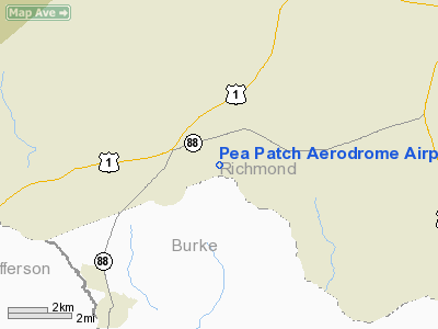
Pea Patch Aerodrome Airport |
Location
& QuickFacts
|
FAA Information Effective: |
2007-07-05 |
|
Airport
Identifier: |
61GA |
|
Airport
Status: |
Operational |
|
Longitude/Latitude: |
082-10-20.4340W/33-18-06.5120N
-82.172343/33.301809 (Estimated) |
|
Elevation: |
434 ft / 132.28 m (Estimated) |
|
Land: |
25
acres |
|
From
nearest city: |
2 nautical miles N of Blythe, GA |
|
Location: |
Richmond County, GA |
|
Magnetic Variation: |
03W (1985) |
Owner
& Manager
|
Ownership: |
Privately owned |
|
Owner: |
Pea Patch Aerodrome |
|
Address: |
C/o J. Jatho--4507 Deer Run
Evans, GA 30809 |
|
Phone number: |
706-860-8585 |
|
Manager: |
Al Patton |
|
Address: |
4511 Boulineau Rd
Blythe, GA 30805 |
|
Phone number: |
706-592-9434 |
Airport
Operations and Facilities
|
Airport Use: |
Private |
|
Wind
indicator: |
Yes |
|
Segmented
Circle: |
No |
|
Control
Tower: |
No |
|
Sectional
chart: |
Atlanta |
|
Region: |
ASO - Southern |
|
Boundary
ARTCC: |
ZTL - Atlanta |
|
Tie-in
FSS: |
MCN - Macon |
|
FSS
on Airport: |
No |
|
FSS
Toll Free: |
1-800-WX-BRIEF |
|
Runway Information
Runway 18/36
|
Dimension: |
2500 x 200 ft / 762.0 x 61.0 m |
|
Surface: |
TURF, |
|
|
Runway 18 |
Runway 36 |
|
Traffic
Pattern: |
Left |
Left |
|
Obstruction: |
|
60 ft tree, 300.0 ft from runway |
|
Radio Navigation
Aids
|
ID |
Type |
Name |
Ch |
Freq |
Var |
Dist |
|
EMR |
NDB |
Emory |
|
385.00 |
04W |
13.1 nm |
|
BXG |
NDB |
Burke County |
|
356.00 |
04W |
17.7 nm |
|
HQU |
NDB |
Thomson-mcduffie |
|
333.00 |
04W |
21.9 nm |
|
AA |
NDB |
Cedar |
|
341.00 |
04W |
26.2 nm |
|
LNH |
NDB |
Millen |
|
205.00 |
05W |
26.6 nm |
|
AIK |
NDB |
Aiken |
|
347.00 |
04W |
32.5 nm |
|
BKO |
NDB |
Barnwell |
|
392.00 |
06W |
37.7 nm |
|
EEX |
NDB |
Emanuel County |
|
309.00 |
04W |
40.7 nm |
|
HIT |
NDB |
Kaolin |
|
360.00 |
05W |
42.2 nm |
|
IIY |
NDB |
Washington/wilkes County |
|
435.00 |
03W |
42.9 nm |
|
VV |
NDB |
Junne |
|
353.00 |
05W |
47.3 nm |
|
JYL |
NDB |
Sylvania |
|
245.00 |
04W |
48.9 nm |
|
ALD |
VOR |
Allendale |
|
116.70 |
01W |
47.6 nm |
|
IRQ |
VORTAC |
Colliers |
086X |
113.90 |
04W |
24.4 nm |
Remarks
Based
Aircraft
|
Aircraft
based on field: |
27 |
|
Single
Engine Airplanes: |
25 |
|
Ultralights: |
2 |
Pea Patch Aerodrome Airport
Address:
Richmond County, GA
Tel:
706-860-8585, 706-592-9434
Images
and information placed above are from
http://www.airport-data.com/airport/61GA/
We
thank them for the data!
| General
Info |
| Country |
United
States |
| State |
GEORGIA
|
| FAA ID |
61GA
|
| Latitude |
33-18-06.512N
|
| Longitude |
082-10-20.434W
|
| Elevation |
434 feet
|
| Near City |
BLYTHE
|
We don't guarantee the information is fresh and accurate. The data may
be wrong or outdated.
For more up-to-date information please refer to other sources.
|
|


