 |
|
|
|
|
|
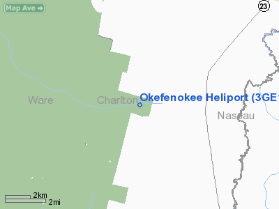
Location
& QuickFacts
|
FAA Information Effective: |
2007-07-05 |
|
Airport
Identifier: |
3GE1 |
|
Airport
Status: |
Operational |
|
Longitude/Latitude: |
082-07-36.0000W/30-44-15.0000N
-82.126667/30.737500 (Estimated) |
|
Elevation: |
125 ft / 38.10 m (Estimated) |
|
Land: |
4
acres |
|
From
nearest city: |
0 nautical miles N of Folkston, GA |
|
Location: |
Charlton County, GA |
|
Magnetic Variation: |
04W (1995) |
Owner
& Manager
|
Ownership: |
Publicly owned |
|
Owner: |
U.s. Fish & Wildlife Service
OKEFENOKEE NATIONAL WILDLIFE REFUGE |
|
Address: |
Route 2 B 3330
Folkston, GA 31537 |
|
Phone
number: |
912-496-4415 |
|
Manager: |
Tony Gooch
OKEFENOKEE NATIONAL WILDLIFE REFUGE MANAGER. |
|
Address: |
Route 2 B 3330
Folkston, GA 31537 |
|
Phone number: |
912-496-7366 |
Airport
Operations and Facilities
|
Airport Use: |
Private
HELIPAD MAY BE USED FOR MEDICAL EMERGENCY OPNS AND FIRE
& RESCUE. |
|
Wind
indicator: |
Yes |
|
Segmented
Circle: |
No |
|
Control
Tower: |
No |
|
Lighting
Schedule: |
PHONE REQ
FOR PERIMETER LGTS CALL 912-496-7366. |
|
Sectional
chart: |
Jacksonville |
|
Region: |
ASO - Southern |
|
Boundary
ARTCC: |
ZJX - Jacksonville |
|
Tie-in
FSS: |
MCN - Macon |
|
FSS
Toll Free: |
1-800-WX-BRIEF |
|
Runway Information
Helipad H1
|
Dimension: |
300 x 300 ft / 91.4 x 91.4 m |
|
Surface: |
TURF, |
|
|
Runway H1 |
Runway |
|
Traffic
Pattern: |
Left |
Left |
|
Radio Navigation
Aids
|
ID |
Type |
Name |
Ch |
Freq |
Var |
Dist |
|
JA |
NDB |
Dinns |
|
344.00 |
03W |
23.5 nm |
|
HEG |
NDB |
Herlong |
|
332.00 |
02W |
32.2 nm |
|
EYA |
NDB |
Eastport |
|
357.00 |
03W |
32.7 nm |
|
HOE |
NDB |
Homerville |
|
209.00 |
03W |
38.4 nm |
|
LCQ |
NDB |
Lake City |
|
204.00 |
03W |
40.6 nm |
|
JUK |
NDB |
Mc Kinnon |
|
353.00 |
05W |
45.5 nm |
|
NZC |
TACAN |
Cecil/dcmsnd |
088X |
|
04W |
33.8 nm |
|
NIP |
TACAN |
Jacksonville |
19X |
|
04W |
38.2 nm |
|
NRB |
TACAN |
Mayport |
051X |
|
03W |
42.0 nm |
|
VQQ |
VOR |
Cecil |
|
117.90 |
03W |
33.8 nm |
|
TAY |
VORTAC |
Taylor |
076X |
112.90 |
03W |
26.1 nm |
|
AYS |
VORTAC |
Waycross |
039X |
110.20 |
00E |
38.9 nm |
|
SSI |
VORTAC |
Brunswick |
035X |
109.80 |
04W |
39.8 nm |
|
CRG |
VORTAC |
Craig |
092X |
114.50 |
03W |
39.9 nm |
|
JAX |
VOT |
Jacksonville Intl |
|
111.00 |
|
27.0 nm |
|
BQK |
VOT |
Brunswick |
|
111.00 |
|
47.2 nm |
Remarks
- 200
FT RADIO TOWER 1/4 NM NORTH OF HELIPAD.
- PRVDD
VFR/PVT USE, AREA IS MKD, WIND INDICATOR IS MAINTAINED, APCH/DEP FROM
060 TO 340 CLKWS.
Based
Aircraft
|
Aircraft
based on field: |
1 |
|
Helicopters: |
1 |
Okefenokee Heliport
Address:
Charlton County, GA
Tel:
912-496-4415,
912-496-7366
Images
and information placed above are from
http://www.airport-data.com/airport/3GE1/
We
thank them for the data!
| General
Info |
| Country |
United
States |
| State |
GEORGIA
|
| FAA ID |
3GE1
|
| Latitude |
30-44-15.000N
|
| Longitude |
082-07-36.000W
|
| Elevation |
125 feet
|
| Near City |
FOLKSTON
|
We don't guarantee the information is fresh and accurate. The data may
be wrong or outdated.
For more up-to-date information please refer to other sources.
|
|


