 |
|
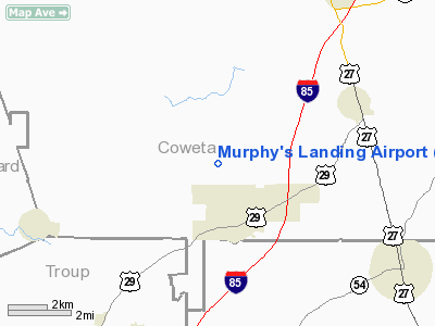
Location
& QuickFacts
|
FAA Information Effective: |
2007-07-05 |
|
Airport
Identifier: |
80GA |
|
Airport
Status: |
Operational |
|
Longitude/Latitude: |
084-50-40.7660W/33-15-31.4280N
-84.844657/33.258730 (Estimated) |
|
Elevation: |
820 ft / 249.94 m (Estimated) |
|
Land: |
12
acres |
|
From
nearest city: |
2 nautical miles N of Grantville, GA |
|
Location: |
Coweta County, GA |
|
Magnetic Variation: |
02W (1990) |
Owner
& Manager
|
Ownership: |
Privately owned |
|
Owner: |
John F. Murphy |
|
Address: |
P.o. Box 13
Grantville, GA 30220 |
|
Phone
number: |
404-583-2101 |
|
Manager: |
John F. Murphy |
|
Address: |
P.o. Box 13
Grantville, GA 30220 |
|
Phone number: |
404-583-2101 |
Airport
Operations and Facilities
|
Airport Use: |
Private |
|
Wind
indicator: |
Yes |
|
Segmented
Circle: |
No |
|
Control
Tower: |
No |
|
Sectional
chart: |
Atlanta |
|
Region: |
ASO - Southern |
|
Boundary
ARTCC: |
ZTL - Atlanta |
|
Tie-in
FSS: |
MCN - Macon |
|
FSS
on Airport: |
No |
|
FSS
Toll Free: |
1-800-WX-BRIEF |
|
Runway Information
Runway 07/25
|
Dimension: |
2000 x 50 ft / 609.6 x 15.2 m |
|
Surface: |
TURF, |
|
|
Runway 07 |
Runway 25 |
|
Traffic
Pattern: |
Left |
Left |
|
Obstruction: |
40 ft , 500.0 ft from runway
40 FT TREES 500 FT FROM THR. |
80 ft , 800.0 ft from runway
80 FT TREES 800 FT FROM THR. |
|
Radio Navigation
Aids
|
ID |
Type |
Name |
Ch |
Freq |
Var |
Dist |
|
EQQ |
NDB |
Coweta County |
|
234.00 |
03W |
6.6 nm |
|
FF |
NDB |
Pecat |
|
316.00 |
02W |
18.2 nm |
|
GPQ |
NDB |
Carrollton |
|
278.00 |
02W |
23.4 nm |
|
PIM |
NDB |
Pine Mountain |
|
272.00 |
03W |
25.0 nm |
|
JHH |
NDB |
Griffin |
|
412.00 |
04W |
31.4 nm |
|
FT |
NDB |
Flanc |
|
344.00 |
02W |
32.0 nm |
|
BR |
NDB |
Redan |
|
266.00 |
02W |
35.4 nm |
|
OP |
NDB |
Yates |
|
339.00 |
03W |
38.9 nm |
|
DOB |
TACAN |
Dobbins |
077X |
|
01W |
42.9 nm |
|
PDK |
VOR/DME |
Peachtree |
113X |
116.60 |
02W |
46.1 nm |
|
LGC |
VORTAC |
Lagrange |
103X |
115.60 |
01E |
22.1 nm |
|
ATL |
VORTAC |
Atlanta |
116X |
116.90 |
00W |
30.3 nm |
|
CSG |
VORTAC |
Columbus |
118X |
117.10 |
01E |
39.7 nm |
|
ATL |
VOT |
Atlanta Muni |
|
111.00 |
|
31.9 nm |
Remarks
- THE
EAST END OF RY 07/25 IS 20 FT HIGHER THAN THE WEST END; IT STARTS TO
RISE 500 FT FROM THE EAST END.
- DEER
OCCAISIONALLY ON RY.
- VFR
WX CONDS; PVT USE ONLY.
Based
Aircraft
|
Aircraft
based on field: |
1 |
|
Single
Engine Airplanes: |
1 |
Murphy's Landing Airport
Address:
Coweta County, GA
Tel:
404-583-2101
Images
and information placed above are from
http://www.airport-data.com/airport/80GA/
We
thank them for the data!
| General
Info |
| Country |
United
States |
| State |
GEORGIA
|
| FAA ID |
80GA
|
| Latitude |
33-15-31.428N
|
| Longitude |
084-50-40.766W
|
| Elevation |
820 feet
|
| Near City |
GRANTVILLE
|
We don't guarantee the information is fresh and accurate. The data may
be wrong or outdated.
For more up-to-date information please refer to other sources.
|
|


