 |
|
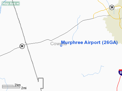
Location
& QuickFacts
|
FAA Information Effective: |
2007-07-05 |
|
Airport
Identifier: |
26GA |
|
Airport
Status: |
Operational |
|
Longitude/Latitude: |
084-54-49.7750W/33-20-10.4210N
-84.913826/33.336228 (Estimated) |
|
Elevation: |
760 ft / 231.65 m (Estimated) |
|
Land: |
26
acres |
|
From
nearest city: |
7 nautical miles NE of Newnan, GA |
|
Location: |
Coweta County, GA |
|
Magnetic Variation: |
02W (1985) |
Owner
& Manager
|
Ownership: |
Privately owned |
|
Owner: |
James W. Murphree |
|
Address: |
546 Dr. Bruce Jackson Rd
Newnan, GA 30263 |
|
Phone
number: |
404-253-1070 |
|
Manager: |
James W. Murphree |
|
Address: |
546 Dr. Bruce Jackson Rd
Newnan, GA 30263 |
|
Phone number: |
404-253-1070 |
Airport
Operations and Facilities
|
Airport Use: |
Private |
|
Wind
indicator: |
Yes |
|
Segmented
Circle: |
No |
|
Control
Tower: |
No |
|
Landing
fee charge: |
No |
|
Sectional
chart: |
Atlanta |
|
Region: |
ASO - Southern |
|
Boundary
ARTCC: |
ZTL - Atlanta |
|
Tie-in
FSS: |
MCN - Macon |
|
FSS
on Airport: |
No |
|
FSS
Toll Free: |
1-800-WX-BRIEF |
|
Runway Information
Runway 09/27
|
Dimension: |
1200
x 30 ft / 365.8 x 9.1 m
HAS 200 FT OVER RUN ON EAST END. |
|
Surface: |
TURF, |
|
|
Runway 09 |
Runway 27 |
|
Traffic
Pattern: |
Right |
Left |
|
Obstruction: |
30 ft trees, 600.0 ft from runway |
15 ft pole, 1000.0 ft from runway |
|
Radio Navigation
Aids
|
ID |
Type |
Name |
Ch |
Freq |
Var |
Dist |
|
EQQ |
NDB |
Coweta County |
|
234.00 |
03W |
11.2 nm |
|
GPQ |
NDB |
Carrollton |
|
278.00 |
02W |
17.6 nm |
|
FF |
NDB |
Pecat |
|
316.00 |
02W |
21.6 nm |
|
FT |
NDB |
Flanc |
|
344.00 |
02W |
29.1 nm |
|
PIM |
NDB |
Pine Mountain |
|
272.00 |
03W |
29.7 nm |
|
BR |
NDB |
Redan |
|
266.00 |
02W |
35.5 nm |
|
JHH |
NDB |
Griffin |
|
412.00 |
04W |
35.7 nm |
|
OP |
NDB |
Yates |
|
339.00 |
03W |
44.3 nm |
|
DOB |
TACAN |
Dobbins |
077X |
|
01W |
40.3 nm |
|
PDK |
VOR/DME |
Peachtree |
113X |
116.60 |
02W |
44.7 nm |
|
LGC |
VORTAC |
Lagrange |
103X |
115.60 |
01E |
22.7 nm |
|
ATL |
VORTAC |
Atlanta |
116X |
116.90 |
00W |
29.8 nm |
|
CSG |
VORTAC |
Columbus |
118X |
117.10 |
01E |
43.7 nm |
|
ATL |
VOT |
Atlanta Muni |
|
111.00 |
|
31.2 nm |
Remarks
- PRVDD
VFR/PR USE; LOA WITH OWNER OF DREDSEN ARPT PROVIDING COMPATIBLE ARPT
TFC PATTERN OPS.
Based
Aircraft
|
Aircraft
based on field: |
2 |
|
Single
Engine Airplanes: |
1 |
|
Ultralights: |
1 |
Murphree Airport
Address:
Coweta County, GA
Tel:
404-253-1070
Images
and information placed above are from
http://www.airport-data.com/airport/26GA/
We
thank them for the data!
| General
Info |
| Country |
United
States |
| State |
GEORGIA
|
| FAA ID |
26GA
|
| Latitude |
33-20-10.421N
|
| Longitude |
084-54-49.775W
|
| Elevation |
760 feet
|
| Near City |
NEWNAN
|
We don't guarantee the information is fresh and accurate. The data may
be wrong or outdated.
For more up-to-date information please refer to other sources.
|
|


