 |
|
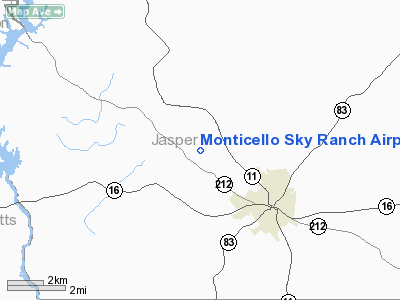
Monticello Sky Ranch Airport |
Location
& QuickFacts
|
FAA Information Effective: |
2007-07-05 |
|
Airport
Identifier: |
GA06 |
|
Airport
Status: |
Operational |
|
Longitude/Latitude: |
083-43-37.0000W/33-19-57.0000N
-83.726944/33.332500 (Estimated) |
|
Elevation: |
690 ft / 210.31 m (Estimated) |
|
Land: |
26
acres |
|
From
nearest city: |
3 nautical miles NW of Monticello, GA |
|
Location: |
Jasper County, GA |
|
Magnetic Variation: |
02W (1985) |
Owner
& Manager
|
Ownership: |
Privately owned |
|
Owner: |
William L. Garvey |
|
Address: |
2466 Hwy 212 West
Monticello, GA 31064 |
|
Phone number: |
706-468-8688 |
|
Manager: |
William L. Garvey |
|
Address: |
2466 Hwy 212 West
Monticello, GA 31064 |
|
Phone number: |
706-468-8688 |
Airport
Operations and Facilities
|
Airport Use: |
Private |
|
Wind indicator: |
Yes |
|
Segmented Circle: |
No |
|
Control Tower: |
No |
|
Landing fee charge: |
No |
|
Sectional chart: |
Atlanta |
|
Region: |
ASO - Southern |
|
Boundary ARTCC: |
ZTL - Atlanta |
|
Tie-in FSS: |
MCN - Macon |
|
FSS on Airport: |
No |
|
FSS Toll Free: |
1-800-WX-BRIEF |
Airport
Services
|
Runway Information
Runway 14/32
|
Dimension: |
3900 x 80 ft / 1188.7 x 24.4 m |
|
Surface: |
TURF, Good Condition |
|
|
Runway 14 |
Runway 32 |
|
Traffic
Pattern: |
Left |
Left |
|
Obstruction: |
10 ft trees, 70 ft left of centerline |
, 40:1 slope to clear |
|
Radio Navigation
Aids
|
ID |
Type |
Name |
Ch |
Freq |
Var |
Dist |
|
VOF |
NDB |
Alcovy |
|
370.00 |
03W |
18.1 nm |
|
JNM |
NDB |
Monroe |
|
392.00 |
03W |
24.4 nm |
|
JHH |
NDB |
Griffin |
|
412.00 |
04W |
26.7 nm |
|
UMB |
NDB |
Culvr |
|
380.00 |
04W |
30.5 nm |
|
OP |
NDB |
Yates |
|
339.00 |
03W |
34.0 nm |
|
BR |
NDB |
Redan |
|
266.00 |
02W |
34.8 nm |
|
BMW |
NDB |
Barrow County |
|
404.00 |
03W |
36.9 nm |
|
FF |
NDB |
Pecat |
|
316.00 |
02W |
38.2 nm |
|
VV |
NDB |
Junne |
|
353.00 |
05W |
40.1 nm |
|
HIT |
NDB |
Kaolin |
|
360.00 |
05W |
43.9 nm |
|
BJT |
NDB |
Bulldog |
|
221.00 |
03W |
45.0 nm |
|
DDA |
NDB |
Commerce |
|
244.00 |
03W |
45.1 nm |
|
EQQ |
NDB |
Coweta County |
|
234.00 |
03W |
49.7 nm |
|
PDK |
VOR/DME |
Peachtree |
113X |
116.60 |
02W |
43.4 nm |
|
MCN |
VORTAC |
Macon |
089X |
114.20 |
01E |
38.8 nm |
|
ATL |
VORTAC |
Atlanta |
116X |
116.90 |
00W |
39.7 nm |
|
AHN |
VORTAC |
Athens |
33 |
109.60 |
00E |
42.1 nm |
|
ATL |
VOT |
Atlanta Muni |
|
111.00 |
|
40.1 nm |
Remarks
Based
Aircraft
|
Aircraft
based on field: |
4 |
|
Single
Engine Airplanes: |
4 |
Operational Statistics
Time Period: 1981-05-11
- 1982-05-10
|
Aircraft
Operations: |
12/Week |
|
General
Aviation Local: |
50.0% |
|
General
Aviation Itinerant: |
50.0% |
Monticello Sky Ranch Airport
Address:
Jasper County, GA
Tel:
706-468-8688
Images
and information placed above are from
http://www.airport-data.com/airport/GA06/
We
thank them for the data!
| General
Info |
| Country |
United
States |
| State |
GEORGIA
|
| FAA ID |
GA06
|
| Latitude |
33-19-57.000N
|
| Longitude |
083-43-37.000W
|
| Elevation |
690 feet
|
| Near City |
MONTICELLO
|
We don't guarantee the information is fresh and accurate. The data may
be wrong or outdated.
For more up-to-date information please refer to other sources.
|
|


