 |
|
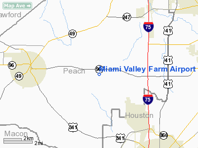
Miami Valley Farm Airport |
Location
& QuickFacts
|
FAA Information Effective: |
2007-07-05 |
|
Airport
Identifier: |
GA99 |
|
Airport
Status: |
Operational |
|
Longitude/Latitude: |
083-48-06.6670W/32-32-55.5310N
-83.801852/32.548759 (Estimated) |
|
Elevation: |
468 ft / 142.65 m (Surveyed) |
|
Land: |
0
acres |
|
From
nearest city: |
4 nautical miles E of Fort Valley, GA |
|
Location: |
Peach County, GA |
|
Magnetic Variation: |
02W (1985) |
Owner
& Manager
|
Ownership: |
Privately owned |
|
Owner: |
W. H. Davidson, Jr. |
|
Address: |
Rt 1 Box 1440
Fort Valley, GA 31030 |
|
Phone
number: |
912-825-2355 |
|
Manager: |
W. H. Davidson, Iii |
|
Address: |
Route 1, Box 1440
Fort Valley, GA 31030 |
|
Phone number: |
912-825-2355 |
Airport
Operations and Facilities
|
Airport Use: |
Private |
|
Wind
indicator: |
Yes |
|
Segmented
Circle: |
No |
|
Control
Tower: |
No |
|
Landing
fee charge: |
No |
|
Sectional
chart: |
Atlanta |
|
Region: |
ASO - Southern |
|
Boundary ARTCC: |
ZTL - Atlanta |
|
Tie-in FSS: |
MCN - Macon |
|
FSS on Airport: |
No |
|
FSS Toll Free: |
1-800-WX-BRIEF |
Airport
Services
|
Airframe Repair: |
NONE |
|
Power Plant Repair: |
NONE |
|
Runway Information
Runway 18/36
|
Dimension: |
3600 x 75 ft / 1097.3 x 22.9 m |
|
Surface: |
TURF, |
|
|
Runway 18 |
Runway 36 |
|
Traffic
Pattern: |
Right |
Left |
|
Obstruction: |
50 ft pline, 50.0 ft from runway |
|
|
Radio Navigation
Aids
|
ID |
Type |
Name |
Ch |
Freq |
Var |
Dist |
|
BEP |
NDB |
Bay Creek |
|
350.00 |
03W |
5.8 nm |
|
IZS |
NDB |
Montezuma |
|
426.00 |
04W |
15.1 nm |
|
LKG |
NDB |
Lindbergh |
|
242.00 |
03W |
27.3 nm |
|
OP |
NDB |
Yates |
|
339.00 |
03W |
29.6 nm |
|
OHY |
NDB |
Coney |
|
400.00 |
02W |
33.3 nm |
|
DB |
NDB |
Creke |
|
251.00 |
04W |
40.3 nm |
|
EZM |
NDB |
Eastman |
|
366.00 |
04W |
41.3 nm |
|
JHH |
NDB |
Griffin |
|
412.00 |
04W |
43.8 nm |
|
UMB |
NDB |
Culvr |
|
380.00 |
04W |
48.6 nm |
|
MCN |
VORTAC |
Macon |
089X |
114.20 |
01E |
11.6 nm |
|
VNA |
VORTAC |
Vienna |
112X |
116.50 |
01E |
25.4 nm |
|
DBN |
VORTAC |
Dublin |
078X |
113.10 |
01W |
49.1 nm |
Remarks
- VFR;
PVT USE. TFC PTN ARE ESTABLISHED WEST OF RWY 18-36 CNTLN. OPNL AGREEMENT
IS MAINT W/OPERATOR OF THE PERRY-FORT VALLEY ARPT.
Based
Aircraft
|
Aircraft
based on field: |
1 |
|
Single
Engine Airplanes: |
1 |
Miami Valley Farm Airport
Address:
Peach County, GA
Tel:
912-825-2355
Images
and information placed above are from
http://www.airport-data.com/airport/GA99/
We
thank them for the data!
| General
Info |
| Country |
United
States |
| State |
GEORGIA
|
| FAA ID |
GA99
|
| Latitude |
32-32-55.531N
|
| Longitude |
083-48-06.667W
|
| Elevation |
468 feet
|
| Near City |
FORT VALLEY
|
We don't guarantee the information is fresh and accurate. The data may
be wrong or outdated.
For more up-to-date information please refer to other sources.
|
|


