 |
|
|
|
|
|
Location
& QuickFacts
|
FAA Information Effective: |
2007-07-05 |
|
Airport
Identifier: |
GA27 |
|
Airport
Status: |
Operational |
|
Longitude/Latitude: |
084-09-39.6980W/34-06-04.3560N
-84.161027/34.101210 (Estimated) |
|
Elevation: |
1170 ft / 356.62 m (Estimated) |
|
Land: |
11
acres |
|
From
nearest city: |
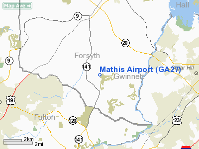
7 nautical miles S of Cumming, GA |
|
Location: |
Forsyth County, GA |
|
Magnetic Variation: |
02W (1985) |
Owner
& Manager
|
Ownership: |
Privately owned |
|
Owner: |
C. J. Mathis |
|
Address: |
1214 Hidden Circle Drive
Sugar Hill, GA 30518 |
|
Phone
number: |
770-887-9255 |
|
Manager: |
C. J. Mathis |
|
Address: |
1214 Hidden Circle Drive
Sugar Hill, GA 30518 |
|
Phone number: |
770-887-9255 |
Airport
Operations and Facilities
|
Airport Use: |
Private |
|
Wind
indicator: |
Yes |
|
Segmented
Circle: |
No |
|
Control
Tower: |
No |
|
Landing
fee charge: |
No |
|
Sectional
chart: |
Atlanta |
|
Region: |
ASO - Southern |
|
Boundary
ARTCC: |
ZTL - Atlanta |
|
Tie-in
FSS: |
MCN - Macon |
|
FSS
on Airport: |
No |
|
FSS
Toll Free: |
1-800-WX-BRIEF |
|
NOTAMs
Facility: |
MCN (NOTAM-d service avaliable) |
Airport
Communications
Airport
Services
|
Fuel available: |
100LLMOGAS |
|
Bottled
Oxygen: |
NONE |
|
Bulk
Oxygen: |
NONE |
|
Runway Information
Runway 03/21
|
Dimension: |
1550 x 20 ft / 472.4 x 6.1 m |
|
Surface: |
ASPH, Good Condition |
|
|
Runway 03 |
Runway 21 |
|
Traffic
Pattern: |
Left |
Left |
|
Obstruction: |
30 ft trees, 200.0 ft from runway, 110 ft left
of centerline
RY 03 HAS +30 FT TREES 100 FT FM THLD & 110 FT LEFT. |
20 ft tree, 200.0 ft from runway
RY 21 HAS +15 FT BRUSH 25 FT FROM THLD & 45 FT LEFT. |
|
Radio Navigation
Aids
|
ID |
Type |
Name |
Ch |
Freq |
Var |
Dist |
|
FKV |
NDB |
Flowery Branch |
|
365.00 |
03W |
14.1 nm |
|
DJD |
NDB |
Canton |
|
415.00 |
04W |
18.6 nm |
|
JZP |
NDB |
Pickens County |
|
285.00 |
04W |
26.0 nm |
|
BR |
NDB |
Redan |
|
266.00 |
02W |
28.4 nm |
|
BMW |
NDB |
Barrow County |
|
404.00 |
03W |
30.2 nm |
|
JNM |
NDB |
Monroe |
|
392.00 |
03W |
30.8 nm |
|
FT |
NDB |
Flanc |
|
344.00 |
02W |
31.3 nm |
|
DDA |
NDB |
Commerce |
|
244.00 |
03W |
32.0 nm |
|
VOF |
NDB |
Alcovy |
|
370.00 |
03W |
34.1 nm |
|
EVZ |
NDB |
Cartersville |
|
308.00 |
04W |
34.4 nm |
|
AJR |
NDB |
Habersham |
|
347.00 |
03W |
38.7 nm |
|
OUK |
NDB |
Calhoun |
|
323.00 |
02W |
42.1 nm |
|
BJT |
NDB |
Bulldog |
|
221.00 |
03W |
47.8 nm |
|
DOB |
TACAN |
Dobbins |
077X |
|
01W |
20.6 nm |
|
PDK |
VOR/DME |
Peachtree |
113X |
116.60 |
02W |
15.2 nm |
|
ATL |
VORTAC |
Atlanta |
116X |
116.90 |
00W |
31.5 nm |
|
AHN |
VORTAC |
Athens |
33 |
109.60 |
00E |
42.7 nm |
|
RMG |
VORTAC |
Rome |
101X |
115.40 |
01E |
47.8 nm |
|
ATL |
VOT |
Atlanta Muni |
|
111.00 |
|
29.7 nm |
Remarks
- AIRPORT
CLOSED DUSK-DAWN.
- ALL
OPNS CONDUCTED IN VFR WX & TFC PTNS ESTAB WEST OF RWY 3-21 CNTRLN
EXTNDD WHEN MEADOW LAKE IS CONSTRUCTED.
Based
Aircraft
|
Aircraft
based on field: |
50 |
|
Single
Engine Airplanes: |
42 |
|
Ultralights: |
8 |
Operational Statistics
Time Period: 1997-12-09
- 1998-12-08
|
Aircraft
Operations: |
116/Week |
|
General
Aviation Local: |
90.0% |
|
General
Aviation Itinerant: |
10.0% |
Mathis Airport
Address:
Forsyth County, GA
Tel:
770-887-9255
Images
and information placed above are from
http://www.airport-data.com/airport/GA27/
We
thank them for the data!
| General
Info |
| Country |
United
States |
| State |
GEORGIA
|
| FAA ID |
GA27
|
| Latitude |
34-06-04.356N
|
| Longitude |
084-09-39.698W
|
| Elevation |
1170 feet
|
| Near City |
CUMMING
|
We don't guarantee the information is fresh and accurate. The data may
be wrong or outdated.
For more up-to-date information please refer to other sources.
|
|


