 |
|
|
|
|
|
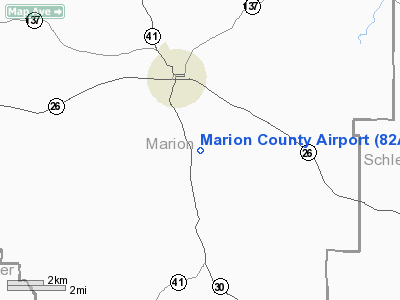
Location
& QuickFacts
|
FAA Information Effective: |
2007-07-05 |
|
Airport
Identifier: |
82A |
|
Airport
Status: |
Operational |
|
Longitude/Latitude: |
084-30-12.7040W/32-16-56.5500N
-84.503529/32.282375 (Estimated) |
|
Elevation: |
682 ft / 207.87 m (Surveyed) |
|
Land: |
206 acres |
|
From
nearest city: |
3 nautical miles SE of Buena Vista, GA |
|
Location: |
Marion County, GA |
|
Magnetic Variation: |
02W (1985) |
Owner
& Manager
|
Ownership: |
Publicly owned |
|
Owner: |
Marion County |
|
Address: |
Po Box 481
Buena Vista, GA 31803 |
|
Phone
number: |
229-649-2603 |
|
Manager: |
Ken Clark |
|
Address: |
Po Box 823
Buena Vista, GA 31803 |
|
Phone number: |
229-649-6303 |
Airport
Operations and Facilities
|
Airport Use: |
Open to public |
|
Wind
indicator: |
Yes |
|
Segmented
Circle: |
No |
|
Control
Tower: |
No |
|
Landing
fee charge: |
No |
|
Sectional
chart: |
Atlanta |
|
Region: |
ASO - Southern |
|
Boundary
ARTCC: |
ZTL - Atlanta |
|
Tie-in
FSS: |
MCN - Macon |
|
FSS
on Airport: |
No |
|
FSS
Toll Free: |
1-800-WX-BRIEF |
|
NOTAMs
Facility: |
MCN (NOTAM-d service avaliable) |
|
Federal Agreements: |
GY |
Airport
Communications
Airport
Services
|
Airframe Repair: |
NONE |
|
Power Plant Repair: |
NONE |
|
Bottled
Oxygen: |
NONE |
|
Bulk
Oxygen: |
NONE |
|
Runway Information
Runway 14/32
|
Dimension: |
3200 x 75 ft / 975.4 x 22.9 m |
|
Surface: |
ASPH, Fair Condition |
|
Weight
Limit: |
Single wheel: 14000 lbs. |
|
|
Runway 14 |
Runway 32 |
|
Traffic
Pattern: |
Left |
Left |
|
Markings: |
Basic, Fair Condition |
Basic, Fair Condition |
|
Obstruction: |
18 ft trees, 452.0 ft from runway, 125 ft right
of centerline, 15:1 slope to clear |
3 ft gnd, 245.0 ft from runway, 125 ft left
of centerline, 15:1 slope to clear |
|
Radio Navigation
Aids
|
ID |
Type |
Name |
Ch |
Freq |
Var |
Dist |
|
LKG |
NDB |
Lindbergh |
|
242.00 |
03W |
21.1 nm |
|
IZS |
NDB |
Montezuma |
|
426.00 |
04W |
25.7 nm |
|
AWS |
NDB |
Lawson |
|
335.00 |
02W |
26.4 nm |
|
OHY |
NDB |
Coney |
|
400.00 |
02W |
36.9 nm |
|
PIM |
NDB |
Pine Mountain |
|
272.00 |
03W |
38.5 nm |
|
BEP |
NDB |
Bay Creek |
|
350.00 |
03W |
38.9 nm |
|
OP |
NDB |
Yates |
|
339.00 |
03W |
41.5 nm |
|
LSF |
VOR/DME |
Lawson |
051X |
111.40 |
02W |
25.1 nm |
|
CSG |
VORTAC |
Columbus |
118X |
117.10 |
01E |
32.9 nm |
|
EUF |
VORTAC |
Eufaula |
029X |
109.20 |
02E |
37.6 nm |
|
PZD |
VORTAC |
Pecan |
108X |
116.10 |
02W |
39.2 nm |
|
MCN |
VORTAC |
Macon |
089X |
114.20 |
01E |
49.9 nm |
Remarks
- PEOPLE
& EQUIPMENT ON & INVOF RY. UNRESTRICTED
ACCESS TO RY.
- VFR
OPNS ONLY.
Operational Statistics
Time Period: 2004-04-07
- 2005-04-06
|
Aircraft
Operations: |
24/Week |
|
General
Aviation Local: |
50.0% |
|
General
Aviation Itinerant: |
50.0% |
Marion County Airport
Address:
Marion County, GA
Tel:
229-649-2603,
229-649-6303
Images
and information placed above are from
http://www.airport-data.com/airport/82A/
We
thank them for the data!
| General
Info |
| Country |
United
States |
| State |
GEORGIA
|
| FAA ID |
82A
|
| Latitude |
32-16-56.550N
|
| Longitude |
084-30-12.704W
|
| Elevation |
682 feet
|
| Near City |
BUENA
VISTA |
We don't guarantee the information is fresh and accurate. The data may
be wrong or outdated.
For more up-to-date information please refer to other sources.
|
|


