 |
|
Location
& QuickFacts
|
FAA Information Effective: |
2007-07-05 |
|
Airport
Identifier: |
6GA7 |
|
Airport
Status: |
Operational |
|
Longitude/Latitude: |
084-17-43.0000W/34-12-22.0000N
-84.295278/34.206111 (Estimated) |
|
Elevation: |
1100 ft / 335.28 m (Estimated) |
|
Land: |
53
acres |
|
From
nearest city: |
7 nautical miles W of Cumming, GA |
|
Location: |
Cherokee County, GA |
|
Magnetic Variation: |
04W (2000) |
Owner
& Manager
|
Ownership: |
Privately owned |
|
Owner: |
Tim Sullivan |
|
Address: |
18570 Birmingham Hwy
Alpharetta, GA 30004 |
|
Phone number: |
770-844-7772 |
|
Manager: |
Tim Sullivan |
|
Address: |
18570 Birmingham Hwy
Alpharetta, GA 30004 |
|
Phone number: |
770-338-0740 |
Airport
Operations and Facilities
|
Airport Use: |
Private |
|
Wind indicator: |
Yes |
|
Segmented Circle: |
No |
|
Control Tower: |
No |
|
Sectional chart: |
Atlanta |
|
Region: |
ASO - Southern |
|
Boundary ARTCC: |
ZTL - Atlanta |
|
Tie-in FSS: |
MCN - Macon |
|
FSS Toll Free: |
1-800-WX-BRIEF |
Airport
Communications
|
Runway Information
Helipad H1
|
Dimension: |
60 x 60 ft / 18.3 x 18.3 m |
|
Surface: |
TURF, |
|
|
Runway H1 |
Runway |
|
Traffic
Pattern: |
Left |
Left |
|
Radio Navigation
Aids
|
ID |
Type |
Name |
Ch |
Freq |
Var |
Dist |
|
DJD |
NDB |
Canton |
|
415.00 |
04W |
10.0 nm |
|
JZP |
NDB |
Pickens County |
|
285.00 |
04W |
17.1 nm |
|
FKV |
NDB |
Flowery Branch |
|
365.00 |
03W |
19.3 nm |
|
EVZ |
NDB |
Cartersville |
|
308.00 |
04W |
27.2 nm |
|
FT |
NDB |
Flanc |
|
344.00 |
02W |
31.7 nm |
|
OUK |
NDB |
Calhoun |
|
323.00 |
02W |
33.5 nm |
|
BR |
NDB |
Redan |
|
266.00 |
02W |
33.7 nm |
|
BMW |
NDB |
Barrow County |
|
404.00 |
03W |
38.7 nm |
|
DDA |
NDB |
Commerce |
|
244.00 |
03W |
39.5 nm |
|
JNM |
NDB |
Monroe |
|
392.00 |
03W |
39.9 nm |
|
AJR |
NDB |
Habersham |
|
347.00 |
03W |
41.0 nm |
|
VOF |
NDB |
Alcovy |
|
370.00 |
03W |
43.1 nm |
|
OYD |
NDB |
Floyd |
|
388.00 |
02W |
43.5 nm |
|
UWI |
NDB |
Whitfield |
|
400.00 |
03W |
47.6 nm |
|
DOB |
TACAN |
Dobbins |
077X |
|
01W |
20.5 nm |
|
PDK |
VOR/DME |
Peachtree |
113X |
116.60 |
02W |
19.9 nm |
|
ATL |
VORTAC |
Atlanta |
116X |
116.90 |
00W |
35.4 nm |
|
RMG |
VORTAC |
Rome |
101X |
115.40 |
01E |
41.1 nm |
|
HRS |
VORTAC |
Harris |
035X |
109.80 |
00E |
48.1 nm |
|
ATL |
VOT |
Atlanta Muni |
|
111.00 |
|
33.6 nm |
Remarks
- PRVDD
VFR OPNS, PVT USE, AREA IS MKD, WIND INDICATOR IS MAINTAINED, TREES
EAST OF HELIPAD ARE REMOVED & POWER LINE SOUTH OF HELIPAD IS MKD.
Based Aircraft
|
Aircraft
based on field: |
1 |
|
Helicopters: |
1 |
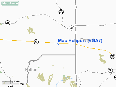
Mac Heliport
Address:
Cherokee County, GA
Tel:
770-844-7772, 770-338-0740
Images
and information placed above are from
http://www.airport-data.com/airport/6GA7/
We
thank them for the data!
| General
Info |
| Country |
United
States |
| State |
GEORGIA
|
| FAA ID |
6GA7
|
| Latitude |
34-12-22.000N
|
| Longitude |
084-17-43.000W
|
| Elevation |
1100 feet
|
| Near City |
CUMMING
|
We don't guarantee the information is fresh and accurate. The data may
be wrong or outdated.
For more up-to-date information please refer to other sources.
|
|


