 |
|
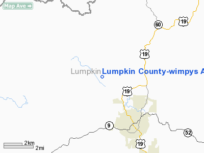
Lumpkin County - Wimpys Airport |
|
|
Location
& QuickFacts
|
FAA Information Effective: |
2007-07-05 |
|
Airport
Identifier: |
9A0 |
|
Airport
Status: |
Operational |
|
Longitude/Latitude: |
084-01-14.6820W/34-34-45.3330N
-84.020745/34.579259 (Estimated) |
|
Elevation: |
1311 ft / 399.59 m (Estimated) |
|
Land: |
64
acres |
|
From
nearest city: |
3 nautical miles NW of Dahlonega, GA |
|
Location: |
Lumpkin County, GA |
|
Magnetic Variation: |
03W (1985) |
Owner
& Manager
|
Ownership: |
Publicly owned |
|
Owner: |
Lumpkin County |
|
Address: |
280 Courthouse Hill
Dahlonega, GA 30533 |
|
Phone
number: |
706-864-3742 |
|
Manager: |
Charles Trammell |
|
Address: |
99 Courthouse Hill, Suite A
Dahlonega, GA 30533 |
|
Phone number: |
706-864-3742 |
Airport
Operations and Facilities
|
Airport Use: |
Open to public |
|
Wind
indicator: |
Yes |
|
Segmented
Circle: |
No |
|
Control
Tower: |
No |
|
Lighting
Schedule: |
RDO CTL |
|
Landing
fee charge: |
No |
|
Sectional
chart: |
Atlanta |
|
Region: |
ASO - Southern |
|
Boundary
ARTCC: |
ZTL - Atlanta |
|
Tie-in
FSS: |
MCN - Macon |
|
FSS
on Airport: |
No |
|
FSS
Toll Free: |
1-800-WX-BRIEF |
|
NOTAMs
Facility: |
MCN (NOTAM-d service avaliable) |
Airport
Communications
Airport
Services
|
Fuel available: |
100LL |
|
Airframe Repair: |
NONE |
|
Power Plant Repair: |
NONE |
|
Bottled
Oxygen: |
NONE |
|
Bulk
Oxygen: |
NONE |
|
Runway Information
Runway 15/33
|
Dimension: |
3090 x 50 ft / 941.8 x 15.2 m |
|
Surface: |
ASPH, Fair Condition |
|
Weight
Limit: |
Single wheel: 12000 lbs. |
|
Edge
Lights: |
Non-standard lighting system
NSTD LIRL THE LENGTH OF THE RWY. NO
THRESHOLD LIGHTS. |
|
|
Runway 15 |
Runway 33 |
|
Traffic
Pattern: |
Left |
Left |
|
Markings: |
Basic, Good Condition |
Basic, Fair Condition |
|
Displaced
threshold: |
754.00
ft |
695.00
ft |
|
Obstruction: |
151 ft trees, 1257.0 ft from runway, 225 ft
left of centerline, 7:1 slope to clear
TREE 200' LEFT OF CNRLN.
10:1 APPROACH SLOPE TO DISPLACED THLD. |
131 ft trees, 1641.0 ft from runway, 11:1 slope
to clear
TREE 150' LEFT OF CNTRLN.
RWY
33 20:1 TO DSPLCD THLD. |
|
Radio Navigation
Aids
|
ID |
Type |
Name |
Ch |
Freq |
Var |
Dist |
|
JZP |
NDB |
Pickens County |
|
285.00 |
04W |
23.0 nm |
|
FKV |
NDB |
Flowery Branch |
|
365.00 |
03W |
23.3 nm |
|
AJR |
NDB |
Habersham |
|
347.00 |
03W |
23.8 nm |
|
DJD |
NDB |
Canton |
|
415.00 |
04W |
30.4 nm |
|
TTQ |
NDB |
Tomotla |
|
335.00 |
01W |
32.4 nm |
|
DDA |
NDB |
Commerce |
|
244.00 |
03W |
39.8 nm |
|
BMW |
NDB |
Barrow County |
|
404.00 |
03W |
44.2 nm |
|
OUK |
NDB |
Calhoun |
|
323.00 |
02W |
46.1 nm |
|
EVZ |
NDB |
Cartersville |
|
308.00 |
04W |
46.7 nm |
|
UWI |
NDB |
Whitfield |
|
400.00 |
03W |
47.4 nm |
|
DOB |
TACAN |
Dobbins |
077X |
|
01W |
46.7 nm |
|
PDK |
VOR/DME |
Peachtree |
113X |
116.60 |
02W |
44.5 nm |
|
HRS |
VORTAC |
Harris |
035X |
109.80 |
00E |
22.5 nm |
|
ODF |
VORTAC |
Foothills |
081X |
113.40 |
00E |
36.4 nm |
Remarks
- RY
15/33 HAS SEVERAL VIOLATIONS TO 7:1 TRANSITIONAL SFC W SIDE OF RY.
- ARPT
CLSD TO TRANSIENT ACFT AT NIGHT.
- EXISTED
PRIOR TO 1959.
Based
Aircraft
|
Aircraft
based on field: |
27 |
|
Single
Engine Airplanes: |
21 |
|
Multi
Engine Airplanes: |
2 |
|
Helicopters: |
2 |
|
Ultralights: |
2 |
Operational Statistics
Time Period: 2004-07-27
- 2005-07-26
|
Aircraft
Operations: |
89/Week |
|
General
Aviation Local: |
43.5% |
|
General
Aviation Itinerant: |
43.5% |
|
Military: |
13.0% |
Lumpkin County-wimpys Airport
Address:
Lumpkin County, GA
Tel:
706-864-3742
Images
and information placed above are from
http://www.airport-data.com/airport/9A0/
We
thank them for the data!
| General
Info |
| Country |
United
States |
| State |
GEORGIA
|
| FAA ID |
9A0
|
| Latitude |
34-34-45.333N
|
| Longitude |
084-01-14.682W
|
| Elevation |
1311 feet
|
| Near City |
DAHLONEGA
|
We don't guarantee the information is fresh and accurate. The data may
be wrong or outdated.
For more up-to-date information please refer to other sources.
|
|


