 |
|
Location
& QuickFacts
|
FAA Information Effective: |
2007-07-05 |
|
Airport
Identifier: |
14GA |
|
Airport
Status: |
Operational |
|
Longitude/Latitude: |
083-56-36.6600W/34-20-11.3540N
-83.943517/34.336487 (Estimated) |
|
Elevation: |
1120 ft / 341.38 m (Estimated) |
|
Land: |
39
acres |
|
From
nearest city: |
5 nautical miles NW of Gainesville, GA |
|
Location: |
Hall County, GA |
|
Magnetic Variation: |
03W (1985) |
Owner
& Manager
|
Ownership: |
Privately owned |
|
Owner: |
F. T. Sullivan |
|
Address: |
2009 Flightway Dr
Atlanta, GA 30341 |
|
Phone number: |
404-451-4365 |
|
Manager: |
T. Sullivan |
|
Address: |
2009 Flightway Drive
Atlanta, GA 30341 |
|
Phone number: |
404-451-4365 |
Airport
Operations and Facilities
|
Airport Use: |
Private |
|
Wind
indicator: |
Yes |
|
Segmented
Circle: |
No |
|
Control
Tower: |
No |
|
Sectional
chart: |
Atlanta |
|
Region: |
ASO - Southern |
|
Boundary
ARTCC: |
ZTL - Atlanta |
|
Tie-in
FSS: |
MCN - Macon |
|
FSS
on Airport: |
No |
|
FSS
Toll Free: |
1-800-WX-BRIEF |
|
Runway Information
Helipad H1
|
Dimension: |
20
x 20 ft / 6.1 x 6.1 m |
|
Surface: |
TURF, |
|
|
Runway H1 |
Runway |
|
Traffic
Pattern: |
Left |
Left |
|
Radio Navigation
Aids
|
ID |
Type |
Name |
Ch |
Freq |
Var |
Dist |
|
FKV |
NDB |
Flowery Branch |
|
365.00 |
03W |
8.2 nm |
|
AJR |
NDB |
Habersham |
|
347.00 |
03W |
21.9 nm |
|
JZP |
NDB |
Pickens County |
|
285.00 |
04W |
26.6 nm |
|
DDA |
NDB |
Commerce |
|
244.00 |
03W |
26.7 nm |
|
DJD |
NDB |
Canton |
|
415.00 |
04W |
27.5 nm |
|
BMW |
NDB |
Barrow County |
|
404.00 |
03W |
29.9 nm |
|
JNM |
NDB |
Monroe |
|
392.00 |
03W |
37.6 nm |
|
BJT |
NDB |
Bulldog |
|
221.00 |
03W |
42.8 nm |
|
VOF |
NDB |
Alcovy |
|
370.00 |
03W |
43.2 nm |
|
BR |
NDB |
Redan |
|
266.00 |
02W |
45.4 nm |
|
EVZ |
NDB |
Cartersville |
|
308.00 |
04W |
45.4 nm |
|
TTQ |
NDB |
Tomotla |
|
335.00 |
01W |
46.9 nm |
|
FT |
NDB |
Flanc |
|
344.00 |
02W |
48.9 nm |
|
OUK |
NDB |
Calhoun |
|
323.00 |
02W |
48.9 nm |
|
DOB |
TACAN |
Dobbins |
077X |
|
01W |
37.8 nm |
|
PDK |
VOR/DME |
Peachtree |
113X |
116.60 |
02W |
32.9 nm |
|
HRS |
VORTAC |
Harris |
035X |
109.80 |
00E |
36.5 nm |
|
ODF |
VORTAC |
Foothills |
081X |
113.40 |
00E |
38.6 nm |
|
AHN |
VORTAC |
Athens |
33 |
109.60 |
00E |
38.7 nm |
|
ATL |
VORTAC |
Atlanta |
116X |
116.90 |
00W |
49.1 nm |
|
ATL |
VOT |
Atlanta Muni |
|
111.00 |
|
47.3 nm |
Remarks
- TREES
ALL QUADRANTS
- VFR
ONLY, PRIVATE USE.
Based Aircraft
|
Aircraft
based on field: |
1 |
|
Helicopters: |
1 |
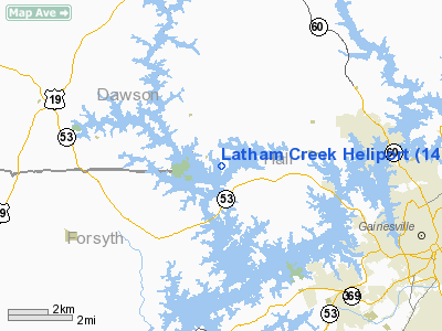
Latham Creek Heliport
Address:
Hall County, GA
Tel:
404-451-4365
Images
and information placed above are from
http://www.airport-data.com/airport/14GA/
We
thank them for the data!
| General
Info |
| Country |
United
States |
| State |
GEORGIA
|
| FAA ID |
14GA
|
| Latitude |
34-20-11.354N
|
| Longitude |
083-56-36.660W
|
| Elevation |
1120 feet
|
| Near City |
GAINESVILLE
|
We don't guarantee the information is fresh and accurate. The data may
be wrong or outdated.
For more up-to-date information please refer to other sources.
|
|


