 |
|
Lagrange-callaway Airport |
| LaGrange-Callaway Airport |
| IATA: LGC â ICAO: KLGC â FAA LID: LGC |
| Summary |
| Airport type |
Public |
| Owner |
City of LaGrange & Troup County |
| Serves |
LaGrange, Georgia |
| Elevation AMSL |
693 ft / 211 m |
| Coordinates |
33°00â²32â³N 085°04â²21â³W / 33.00889°N 85.0725°W / 33.00889; -85.0725 |
| Website |
LaGrangeAirport.com |
| Runways |
| Direction |
Length |
Surface |
| ft |
m |
| 13/31 |
5,600 |
1,707 |
Asphalt |
| 3/21 |
5,000 |
1,524 |
Asphalt |
| Statistics (2008) |
| Aircraft operations |
17,100 |
| Based aircraft |
62 |
| Source: Federal Aviation Administration |
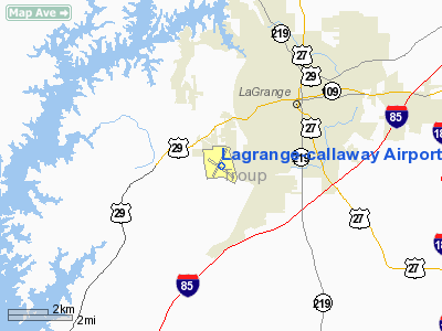
LaGrange-Callaway Airport (IATA: LGC, ICAO: KLGC, FAA LID: LGC) is a public use airport located three nautical miles (6 km) southwest of the central business district of LaGrange, a city in Troup County, Georgia, United States. It is owned by the City of LaGrange and Troup County. As per the FAA's National Plan of Integrated Airport Systems for 2009-2013, it is classified as a general aviation airport.
Facilities and aircraft
LaGrange-Callaway Airport covers an area of 751 acres (304 ha) at an elevation of 693 feet (211 m) above mean sea level. It has two asphalt paved runways: 13/31 is 5,600 by 150 feet (1,707 x 46 m) and 3/21 is 5,000 by 100 feet (1,524 x 30 m).
For the 12-month period ending April 30, 2008, the airport had 17,100 aircraft operations, an average of 46 per day: 99% general aviation and 1% military. At that time there were 62 aircraft based at this airport: 82% single-engine, 10% multi-engine, 2% jet and 6% glider.
The above content comes from Wikipedia and is published under free licenses – click here to read more.
|
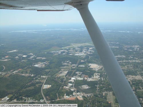 |
(Click on the photo to enlarge) |
Location
& QuickFacts
|
FAA Information Effective: |
2007-07-05 |
|
Airport
Identifier: |
LGC |
|
Airport
Status: |
Operational |
|
Longitude/Latitude: |
085-04-21.3510W/33-00-31.8690N
-85.072598/33.008853 (Estimated) |
|
Elevation: |
693 ft / 211.23 m (Surveyed) |
|
Land: |
751 acres |
|
From
nearest city: |
3 nautical miles SW of Lagrange, GA |
|
Location: |
Troup County, GA |
|
Magnetic Variation: |
01W (1985) |
Owner
& Manager
|
Ownership: |
Publicly owned |
|
Owner: |
City Of La Grange & Troup Co |
|
Address: |
Troup County, 100 Ridley Ave
Lagrange, GA 30241 |
|
Phone number: |
706-883-1610 |
|
Manager: |
Glen Boyd |
|
Address: |
200 Airport Parkway
Lagrange, GA 30240 |
|
Phone number: |
706-884-2121 |
Airport
Operations and Facilities
|
Airport Use: |
Open to public |
|
Wind
indicator: |
Yes |
|
Segmented
Circle: |
Yes |
|
Control
Tower: |
No |
|
Lighting
Schedule: |
DUSK-DAWN
MIRL RY 13/31 & REIL RY 13 PRESET ON LOW INTST; TO INCR
INTST ACTVT - CTAF.
ACTVT MALSR RY 31, PAPI RYS 13 & 31 &
TWY LGTS - CTAF. |
|
Beacon
Color: |
Clear-Green (lighted land airport) |
|
Landing
fee charge: |
No |
|
Sectional
chart: |
Atlanta |
|
Region: |
ASO - Southern |
|
Traffic
Pattern Alt: |
1007 ft |
|
Boundary
ARTCC: |
ZTL - Atlanta |
|
Tie-in
FSS: |
MCN - Macon |
|
FSS
on Airport: |
No |
|
FSS
Toll Free: |
1-800-WX-BRIEF |
|
NOTAMs
Facility: |
LGC (NOTAM-d service avaliable) |
|
Federal Agreements: |
NGY3 |
Airport
Communications
|
CTAF: |
122.975 |
|
Unicom: |
122.975 |
Airport
Services
|
Fuel available: |
100LLA1+ |
|
Airframe Repair: |
MINOR |
|
Power Plant Repair: |
MAJOR |
|
Bulk
Oxygen: |
NONE |
|
Runway Information
Runway 03/21
|
Dimension: |
5000 x 100 ft / 1524.0 x 30.5 m |
|
Surface: |
ASPH, Fair Condition |
|
Weight
Limit: |
Single wheel: 30000 lbs. |
|
|
Runway 03 |
Runway 21 |
|
Longitude: |
085-04-36.5310W |
085-04-12.2840W |
|
Latitude: |
33-00-15.4690N |
33-01-00.5240N |
|
Elevation: |
678.00
ft |
693.00
ft |
|
Alignment: |
24 |
127 |
|
Traffic
Pattern: |
Left |
Left |
|
Markings: |
Basic, Poor Condition
RY MARKINGS BADLY FADED. |
Basic, Poor Condition
RY MARKINGS BADLY FADED. |
|
Obstruction: |
71 ft trees, 1478.0 ft from runway, 400 ft
right of centerline, 18:1 slope to clear |
52 ft trees, 720.0 ft from runway, 370 ft left
of centerline, 10:1 slope to clear |
|
Runway 13/31
|
Dimension: |
5600 x 150 ft / 1706.9 x 45.7 m |
|
Surface: |
ASPH, Good Condition |
|
Surface
Treatment: |
Saw-cut or plastic Grooved |
|
Weight
Limit: |
Single wheel: 45000 lbs.
Dual wheel: 60000 lbs. |
|
Edge
Lights: |
Medium |
|
|
Runway 13 |
Runway 31 |
|
Longitude: |
085-04-44.9770W |
085-03-52.2670W |
|
Latitude: |
33-00-42.9550N |
33-00-09.8390N |
|
Elevation: |
681.00
ft |
675.00
ft |
|
Alignment: |
127 |
127 |
|
ILS
Type: |
|
ILS |
|
Traffic
Pattern: |
Left |
Left |
|
Markings: |
Precision instrument, Good Condition |
Precision instrument, Good Condition |
|
Crossing
Height: |
52.00
ft |
43.00
ft |
|
VASI: |
4-light PAPI on left side |
4-light PAPI on right side |
|
Visual
Glide Angle: |
3.50° |
3.00° |
|
Approach
lights: |
|
MALSR |
|
Runway
End Identifier: |
Yes |
|
|
Obstruction: |
80 ft trees, 2440.0 ft from runway, 600 ft
right of centerline, 28:1 slope to clear |
, 50:1 slope to clear |
|
Radio Navigation
Aids
|
ID |
Type |
Name |
Ch |
Freq |
Var |
Dist |
|
PIM |
NDB |
Pine Mountain |
|
272.00 |
03W |
14.2 nm |
|
EQQ |
NDB |
Coweta County |
|
234.00 |
03W |
23.5 nm |
|
GPQ |
NDB |
Carrollton |
|
278.00 |
02W |
33.6 nm |
|
FF |
NDB |
Pecat |
|
316.00 |
02W |
34.3 nm |
|
AWS |
NDB |
Lawson |
|
335.00 |
02W |
43.1 nm |
|
JHH |
NDB |
Griffin |
|
412.00 |
04W |
43.8 nm |
|
OP |
NDB |
Yates |
|
339.00 |
03W |
45.0 nm |
|
DER |
NDB |
Alexander City |
|
382.00 |
01W |
45.5 nm |
|
LSF |
VOR/DME |
Lawson |
051X |
111.40 |
02W |
40.9 nm |
|
TGE |
VOR/DME |
Tuskegee |
120X |
117.30 |
02E |
43.6 nm |
|
LGC |
VORTAC |
Lagrange |
103X |
115.60 |
01E |
7.2 nm |
|
CSG |
VORTAC |
Columbus |
118X |
117.10 |
01E |
23.8 nm |
|
ATL |
VORTAC |
Atlanta |
116X |
116.90 |
00W |
49.1 nm |
Remarks
- DEER
ON & INVOF ARPT.
- GLIDER
OPNS ON & INVOF ARPT DURG DALGT HRS SAT-SUN.
Based
Aircraft
|
Aircraft
based on field: |
68 |
|
Single
Engine Airplanes: |
61 |
|
Multi
Engine Airplanes: |
3 |
|
Jet Engine
Airplanes: |
1 |
|
Gliders: |
3 |
Operational Statistics
Time Period: 2005-04-20
- 2006-04-19
|
Aircraft
Operations: |
296/Week |
|
General
Aviation Local: |
39.7% |
|
General
Aviation Itinerant: |
59.6% |
|
Military: |
0.7% |
Lagrange-callaway Airport
Address:
Troup County, GA
Tel:
706-883-1610, 706-884-2121
Images
and information placed above are from
http://www.airport-data.com/airport/LGC/
We
thank them for the data!
| General
Info |
| Country |
United
States |
| State |
GEORGIA
|
| FAA ID |
LGC
|
| Latitude |
33-00-31.849N
|
| Longitude |
085-04-21.380W
|
| Elevation |
693 feet
|
| Near City |
LAGRANGE
|
We don't guarantee the information is fresh and accurate. The data may
be wrong or outdated.
For more up-to-date information please refer to other sources.
|
|


