 |
|
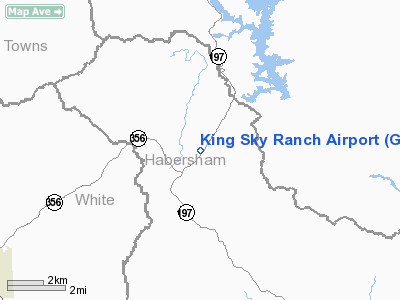
Location
& QuickFacts
|
FAA Information Effective: |
2007-07-05 |
|
Airport
Identifier: |
GA67 |
|
Airport
Status: |
Operational |
|
Longitude/Latitude: |
083-35-34.6180W/34-46-05.3380N
-83.592949/34.768149 (Estimated) |
|
Elevation: |
1840 ft / 560.83 m (Estimated) |
|
Land: |
0
acres |
|
From
nearest city: |
13 nautical miles N of Clarkesville, GA |
|
Location: |
Habersham County, GA |
|
Magnetic Variation: |
03W (1985) |
Owner
& Manager
|
Ownership: |
Privately owned |
|
Owner: |
Dean King |
|
Address: |
Po Box 303, Floyd Rd
Loganville, GA 30249 |
|
Phone
number: |
404-466-8282 |
|
Manager: |
Dean King |
|
Address: |
Po Box 303 Floyd Rd
Loganville, GA 30249 |
|
Phone number: |
404-466-8282 |
Airport
Operations and Facilities
|
Airport Use: |
Private |
|
Wind indicator: |
Yes |
|
Segmented Circle: |
No |
|
Control Tower: |
No |
|
Landing fee charge: |
Yes |
|
Sectional chart: |
Atlanta |
|
Region: |
ASO - Southern |
|
Boundary ARTCC: |
ZTL - Atlanta |
|
Tie-in FSS: |
MCN - Macon |
|
FSS on Airport: |
No |
|
FSS Toll Free: |
1-800-WX-BRIEF |
Airport
Services
|
Airframe Repair: |
NONE |
|
Power Plant Repair: |
NONE |
|
Runway Information
Runway 03/21
|
Dimension: |
1610 x 100 ft / 490.7 x 30.5 m |
|
Surface: |
TURF, |
|
|
Runway 03 |
Runway 21 |
|
Traffic
Pattern: |
Left |
Left |
|
Radio Navigation
Aids
|
ID |
Type |
Name |
Ch |
Freq |
Var |
Dist |
|
AJR |
NDB |
Habersham |
|
347.00 |
03W |
16.2 nm |
|
TTQ |
NDB |
Tomotla |
|
335.00 |
01W |
27.6 nm |
|
CEU |
NDB |
Clemson |
|
257.00 |
05W |
35.3 nm |
|
FKV |
NDB |
Flowery Branch |
|
365.00 |
03W |
37.3 nm |
|
DDA |
NDB |
Commerce |
|
244.00 |
03W |
42.6 nm |
|
LQK |
NDB |
Lake Keowee |
|
408.00 |
04W |
44.0 nm |
|
AND |
NDB |
Anderson County |
|
230.00 |
04W |
46.7 nm |
|
JZP |
NDB |
Pickens County |
|
285.00 |
04W |
46.8 nm |
|
ODF |
VORTAC |
Foothills |
081X |
113.40 |
00E |
15.2 nm |
|
HRS |
VORTAC |
Harris |
035X |
109.80 |
00E |
19.1 nm |
|
ELW |
VORTAC |
Electric City |
023X |
108.60 |
00E |
45.2 nm |
Remarks
Based
Aircraft
|
Aircraft
based on field: |
3 |
|
Single
Engine Airplanes: |
3 |
Operational Statistics
|
Aircraft
Operations: |
50/Week |
|
General
Aviation Local: |
76.9% |
|
General
Aviation Itinerant: |
23.1% |
King Sky Ranch Airport
Address:
Habersham County, GA
Tel:
404-466-8282
Images
and information placed above are from
http://www.airport-data.com/airport/GA67/
We
thank them for the data!
| General
Info |
| Country |
United
States |
| State |
GEORGIA
|
| FAA ID |
GA67
|
| Latitude |
34-46-05.338N
|
| Longitude |
083-35-34.618W
|
| Elevation |
1840 feet
|
| Near City |
CLARKESVILLE
|
We don't guarantee the information is fresh and accurate. The data may
be wrong or outdated.
For more up-to-date information please refer to other sources.
|
|


