 |
|
Location
& QuickFacts
|
FAA Information Effective: |
2007-07-05 |
|
Airport
Identifier: |
GA08 |
|
Airport
Status: |
Operational |
|
Longitude/Latitude: |
084-29-49.7140W/32-41-30.4930N
-84.497143/32.691804 (Estimated) |
|
Elevation: |
659 ft / 200.86 m (Surveyed) |
|
Land: |
0
acres |
|
From
nearest city: |
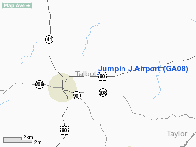
3 nautical miles E of Talbotton, GA |
|
Location: |
Talbot County, GA |
|
Magnetic Variation: |
02W (1985) |
Owner
& Manager
|
Ownership: |
Privately owned |
|
Owner: |
David Jordan |
|
Address: |
P.o. Box 66
Talbotton, GA 31827 |
|
Phone
number: |
404-665-8717 |
|
Manager: |
David C. Jordan |
|
Address: |
P.o. Box 66
Talbotton, GA 31827 |
|
Phone number: |
404-665-8717 |
Airport
Operations and Facilities
|
Airport Use: |
Private |
|
Wind indicator: |
Yes |
|
Segmented Circle: |
No |
|
Control Tower: |
No |
|
Landing fee charge: |
No |
|
Sectional chart: |
Atlanta |
|
Region: |
ASO - Southern |
|
Boundary ARTCC: |
ZTL - Atlanta |
|
Tie-in FSS: |
MCN - Macon |
|
FSS on Airport: |
No |
|
FSS Toll Free: |
1-800-WX-BRIEF |
Airport
Communications
Airport
Services
|
Airframe Repair: |
NONE |
|
Power Plant Repair: |
NONE |
|
Runway Information
Runway 17/35
|
Dimension: |
1965 x 65 ft / 598.9 x 19.8 m |
|
Surface: |
TURF, |
|
|
Runway 17 |
Runway 35 |
|
Traffic
Pattern: |
Left |
Left |
|
Radio Navigation
Aids
|
ID |
Type |
Name |
Ch |
Freq |
Var |
Dist |
|
OP |
NDB |
Yates |
|
339.00 |
03W |
20.8 nm |
|
PIM |
NDB |
Pine Mountain |
|
272.00 |
03W |
21.0 nm |
|
IZS |
NDB |
Montezuma |
|
426.00 |
04W |
31.6 nm |
|
JHH |
NDB |
Griffin |
|
412.00 |
04W |
32.6 nm |
|
EQQ |
NDB |
Coweta County |
|
234.00 |
03W |
35.7 nm |
|
AWS |
NDB |
Lawson |
|
335.00 |
02W |
35.9 nm |
|
FF |
NDB |
Pecat |
|
316.00 |
02W |
36.6 nm |
|
LKG |
NDB |
Lindbergh |
|
242.00 |
03W |
36.8 nm |
|
BEP |
NDB |
Bay Creek |
|
350.00 |
03W |
39.6 nm |
|
LSF |
VOR/DME |
Lawson |
051X |
111.40 |
02W |
33.2 nm |
|
CSG |
VORTAC |
Columbus |
118X |
117.10 |
01E |
26.7 nm |
|
LGC |
VORTAC |
Lagrange |
103X |
115.60 |
01E |
41.7 nm |
|
MCN |
VORTAC |
Macon |
089X |
114.20 |
01E |
43.0 nm |
Remarks
Based
Aircraft
|
Aircraft
based on field: |
2 |
|
Single
Engine Airplanes: |
2 |
Operational Statistics
Time Period: 1980-07-23
- 1981-07-22
|
Aircraft
Operations: |
9/Month |
|
General
Aviation Itinerant: |
100.0% |
Jumpin J Airport
Address:
Talbot County, GA
Tel:
404-665-8717
Images
and information placed above are from
http://www.airport-data.com/airport/GA08/
We
thank them for the data!
| General
Info |
| Country |
United
States |
| State |
GEORGIA
|
| FAA ID |
GA08
|
| Latitude |
32-41-30.493N
|
| Longitude |
084-29-49.714W
|
| Elevation |
659 feet
|
| Near City |
TALBOTTON
|
We don't guarantee the information is fresh and accurate. The data may
be wrong or outdated.
For more up-to-date information please refer to other sources.
|
|


