 |
|
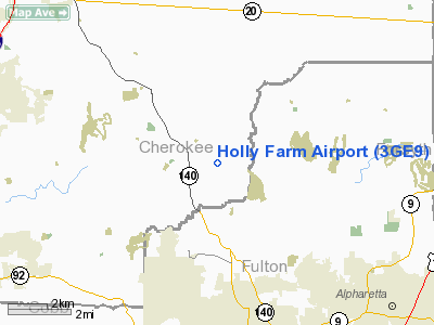
Location
& QuickFacts
|
FAA Information Effective: |
2007-07-05 |
|
Airport
Identifier: |
3GE9 |
|
Airport
Status: |
Operational |
|
Longitude/Latitude: |
084-22-41.0000W/34-08-24.0000N
-84.378056/34.140000 (Estimated) |
|
Elevation: |
900 ft / 274.32 m (Estimated) |
|
Land: |
150 acres |
|
From
nearest city: |
9 nautical miles E of Woodstock, GA |
|
Location: |
Cherokee County, GA |
|
Magnetic Variation: |
04W (2000) |
Owner
& Manager
|
Ownership: |
Privately owned |
|
Owner: |
Bradbury Family Partnership |
|
Address: |
110 Londonderry Court, Suite 136
Woodstock, GA 30188 |
|
Phone number: |
770-928-0092
EXT 4500. |
|
Manager: |
Thomas L. Bradbury |
|
Address: |
800 Riverlake Court
Woodstock, GA 30188 |
Airport
Operations and Facilities
|
Airport Use: |
Private |
|
Segmented
Circle: |
No |
|
Control
Tower: |
No |
|
Lighting
Schedule: |
DUSK-DAWN
LIRL RY 12/30 IN OPN ONLY WHEN ACTIVATED BY OWNER AT HANGAR
WHEN FLYING AT NIGHT. |
|
Sectional
chart: |
Atlanta |
|
Region: |
ASO - Southern |
|
Boundary
ARTCC: |
ZTL - Atlanta |
|
Tie-in
FSS: |
MCN - Macon |
|
FSS
Toll Free: |
1-800-WX-BRIEF |
|
Runway Information
Runway 12/30
|
Dimension: |
1500 x 40 ft / 457.2 x 12.2 m |
|
Surface: |
TURF, |
|
Edge
Lights: |
Low |
|
|
Runway 12 |
Runway 30 |
|
Traffic
Pattern: |
Left |
Left |
|
Obstruction: |
|
90 ft trees, 1000.0 ft from runway |
|
Radio Navigation
Aids
|
ID |
Type |
Name |
Ch |
Freq |
Var |
Dist |
|
DJD |
NDB |
Canton |
|
415.00 |
04W |
8.7 nm |
|
JZP |
NDB |
Pickens County |
|
285.00 |
04W |
19.4 nm |
|
EVZ |
NDB |
Cartersville |
|
308.00 |
04W |
23.4 nm |
|
FKV |
NDB |
Flowery Branch |
|
365.00 |
03W |
23.8 nm |
|
FT |
NDB |
Flanc |
|
344.00 |
02W |
26.2 nm |
|
BR |
NDB |
Redan |
|
266.00 |
02W |
29.9 nm |
|
OUK |
NDB |
Calhoun |
|
323.00 |
02W |
31.5 nm |
|
OYD |
NDB |
Floyd |
|
388.00 |
02W |
40.2 nm |
|
JNM |
NDB |
Monroe |
|
392.00 |
03W |
40.5 nm |
|
BMW |
NDB |
Barrow County |
|
404.00 |
03W |
41.2 nm |
|
VOF |
NDB |
Alcovy |
|
370.00 |
03W |
42.7 nm |
|
DDA |
NDB |
Commerce |
|
244.00 |
03W |
42.9 nm |
|
AJR |
NDB |
Habersham |
|
347.00 |
03W |
46.5 nm |
|
UWI |
NDB |
Whitfield |
|
400.00 |
03W |
48.1 nm |
|
DOB |
TACAN |
Dobbins |
077X |
|
01W |
15.0 nm |
|
PDK |
VOR/DME |
Peachtree |
113X |
116.60 |
02W |
16.4 nm |
|
ATL |
VORTAC |
Atlanta |
116X |
116.90 |
00W |
30.8 nm |
|
RMG |
VORTAC |
Rome |
101X |
115.40 |
01E |
36.9 nm |
|
ATL |
VOT |
Atlanta Muni |
|
111.00 |
|
29.1 nm |
Remarks
Based
Aircraft
|
Aircraft
based on field: |
1 |
|
Single
Engine Airplanes: |
1 |
Holly Farm Airport
Address:
Cherokee County, GA
Tel:
770-928-0092
Images
and information placed above are from
http://www.airport-data.com/airport/3GE9/
We
thank them for the data!
| General
Info |
| Country |
United
States |
| State |
GEORGIA
|
| FAA ID |
3GE9
|
| Latitude |
34-08-24.000N
|
| Longitude |
084-22-41.000W
|
| Elevation |
900 feet
|
| Near City |
WOODSTOCK
|
We don't guarantee the information is fresh and accurate. The data may
be wrong or outdated.
For more up-to-date information please refer to other sources.
|
|


