 |
|
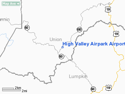
High Valley Airpark Airport |
Location
& QuickFacts
|
FAA Information Effective: |
2007-07-05 |
|
Airport Identifier: |
GA87 |
|
Airport Status: |
Operational |
|
Longitude/Latitude: |
084-00-45.6880W/34-41-53.3240N
-84.012691/34.698146 (Estimated) |
|
Elevation: |
2800 ft / 853.44 m (Estimated) |
|
Land: |
40 acres |
|
From nearest city: |
0 nautical miles N of Suches, GA |
|
Location: |
Union County, GA |
|
Magnetic Variation: |
02W (1985) |
Owner
& Manager
|
Ownership: |
Privately owned |
|
Owner: |
Frank L. Cheek |
|
Address: |
Rt. 1 Bx 89a, Hwy 180
Suches, GA 30572 |
|
Phone
number: |
404-747-5011 |
|
Manager: |
Frank L. Cheek |
|
Address: |
Rt.1 Bx 89a, Hwy 180
Suches, GA 30572 |
|
Phone number: |
404-747-5011 |
Airport
Operations and Facilities
|
Airport Use: |
Private |
|
Wind
indicator: |
Yes |
|
Segmented
Circle: |
No |
|
Control
Tower: |
No |
|
Sectional
chart: |
Atlanta |
|
Region: |
ASO - Southern |
|
Boundary
ARTCC: |
ZTL - Atlanta |
|
Tie-in
FSS: |
MCN - Macon |
|
FSS
Toll Free: |
1-800-WX-BRIEF |
|
Runway Information
Runway 02/20
|
Dimension: |
2000 x 60 ft / 609.6 x 18.3 m |
|
Surface: |
TURF, Good Condition |
|
|
Runway 02 |
Runway 20 |
|
Traffic
Pattern: |
Right |
Left |
|
Radio Navigation
Aids
|
ID |
Type |
Name |
Ch |
Freq |
Var |
Dist |
|
TTQ |
NDB |
Tomotla |
|
335.00 |
01W |
25.3 nm |
|
AJR |
NDB |
Habersham |
|
347.00 |
03W |
25.8 nm |
|
JZP |
NDB |
Pickens County |
|
285.00 |
04W |
26.5 nm |
|
FKV |
NDB |
Flowery Branch |
|
365.00 |
03W |
30.2 nm |
|
DJD |
NDB |
Canton |
|
415.00 |
04W |
35.7 nm |
|
DDA |
NDB |
Commerce |
|
244.00 |
03W |
45.3 nm |
|
UWI |
NDB |
Whitfield |
|
400.00 |
03W |
46.4 nm |
|
OUK |
NDB |
Calhoun |
|
323.00 |
02W |
48.6 nm |
|
MMI |
NDB |
Mc Minn County |
|
242.00 |
03W |
49.8 nm |
|
HRS |
VORTAC |
Harris |
035X |
109.80 |
00E |
15.5 nm |
|
ODF |
VORTAC |
Foothills |
081X |
113.40 |
00E |
35.3 nm |
Remarks
High Valley Airpark Airport
Address:
Union County, GA
Tel:
404-747-5011
Images
and information placed above are from
http://www.airport-data.com/airport/GA87/
We
thank them for the data!
| General
Info |
| Country |
United
States |
| State |
GEORGIA
|
| FAA ID |
GA87
|
| Latitude |
34-41-53.324N
|
| Longitude |
084-00-45.688W
|
| Elevation |
2800 feet
|
| Near City |
SUCHES
|
We don't guarantee the information is fresh and accurate. The data may
be wrong or outdated.
For more up-to-date information please refer to other sources.
|
|


