 |
|
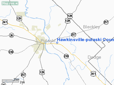
Hawkinsville-pulaski County Airport |
|
|
Location
& QuickFacts
|
FAA Information Effective: |
2007-07-05 |
|
Airport
Identifier: |
51A |
|
Airport
Status: |
Operational |
|
Longitude/Latitude: |
083-26-18.6130W/32-17-00.5870N
-83.438504/32.283496 (Estimated) |
|
Elevation: |
270 ft / 82.30 m (Surveyed) |
|
Land: |
25
acres |
|
From
nearest city: |
2 nautical miles E of Hawkinsville, GA |
|
Location: |
Pulaski County, GA |
|
Magnetic Variation: |
02W (1985) |
Owner
& Manager
|
Ownership: |
Publicly owned |
|
Owner: |
City Of Hawkinsville
AND PULASKI COUTNY. |
|
Address: |
P.o. Box 120
Hawkinsville, GA 31036 |
|
Phone
number: |
478-892-3240 |
|
Manager: |
Jerry Murkerson, City Manager
CITY MANAGER. |
|
Address: |
P.o. Box 120, 319 Broad Street
Hawkinsville, GA 31036 |
|
Phone number: |
478-892-3240 |
Airport
Operations and Facilities
|
Airport Use: |
Open to public |
|
Wind
indicator: |
Yes |
|
Segmented
Circle: |
No |
|
Control
Tower: |
No |
|
Lighting
Schedule: |
DUSK-DAWN
MIRL RY 10/28 PRESET MED INTST DUSK-2300; TO INCR INTST
AND ACTVT AFTER 2300 - CTAF. |
|
Beacon
Color: |
Clear-Green (lighted land airport) |
|
Landing
fee charge: |
No |
|
Sectional
chart: |
Atlanta |
|
Region: |
ASO - Southern |
|
Boundary
ARTCC: |
ZTL - Atlanta |
|
Tie-in
FSS: |
MCN - Macon |
|
FSS
on Airport: |
No |
|
FSS
Toll Free: |
1-800-WX-BRIEF |
|
NOTAMs
Facility: |
MCN (NOTAM-d service avaliable) |
Airport
Communications
Airport
Services
|
Airframe Repair: |
NONE |
|
Power Plant Repair: |
NONE |
|
Bottled
Oxygen: |
NONE |
|
Bulk
Oxygen: |
NONE |
|
Runway Information
Runway 10/28
|
Dimension: |
3000 x 60 ft / 914.4 x 18.3 m |
|
Surface: |
ASPH, Good Condition |
|
Weight
Limit: |
Single wheel: 12500 lbs. |
|
Edge
Lights: |
Medium |
|
|
Runway 10 |
Runway 28 |
|
Traffic
Pattern: |
Left |
Left |
|
Markings: |
Basic, Good Condition |
Basic, Good Condition
RY 28 - BLACKING OVER OLD DISPLACED THRESHOLD FADED.
OLD
DSPLD THLD MARKINGS ARE VISIBLE. |
|
Obstruction: |
28 ft trees, 592.0 ft from runway, 165 ft left
of centerline, 14:1 slope to clear |
9 ft trees, 326.0 ft from runway, 130 ft right
of centerline, 14:1 slope to clear |
|
Radio Navigation
Aids
|
ID |
Type |
Name |
Ch |
Freq |
Var |
Dist |
|
EZM |
NDB |
Eastman |
|
366.00 |
04W |
17.0 nm |
|
BEP |
NDB |
Bay Creek |
|
350.00 |
03W |
19.6 nm |
|
DB |
NDB |
Creke |
|
251.00 |
04W |
24.8 nm |
|
OHY |
NDB |
Coney |
|
400.00 |
02W |
27.5 nm |
|
IZS |
NDB |
Montezuma |
|
426.00 |
04W |
29.3 nm |
|
MQW |
NDB |
Mc Rae |
|
280.00 |
03W |
30.4 nm |
|
LKG |
NDB |
Lindbergh |
|
242.00 |
03W |
34.7 nm |
|
SUR |
NDB |
Fitzgerald |
|
362.00 |
03W |
41.0 nm |
|
AZE |
NDB |
Hazlehurst |
|
414.00 |
03W |
47.0 nm |
|
VNA |
VORTAC |
Vienna |
112X |
116.50 |
01E |
5.2 nm |
|
MCN |
VORTAC |
Macon |
089X |
114.20 |
01E |
26.7 nm |
|
DBN |
VORTAC |
Dublin |
078X |
113.10 |
01W |
34.9 nm |
Remarks
- DEER
ON & INVOF ARPT.
- EXISTED
PRIOR TO 1959.
Based
Aircraft
|
Aircraft
based on field: |
8 |
|
Single
Engine Airplanes: |
8 |
Operational Statistics
Time Period: 2003-12-02
- 2004-11-30
|
Aircraft
Operations: |
87/Week |
|
General
Aviation Local: |
66.7% |
|
General
Aviation Itinerant: |
33.3% |
Hawkinsville-pulaski County Airport
Address:
Pulaski County, GA
Tel:
478-892-3240
Images
and information placed above are from
http://www.airport-data.com/airport/51A/
We
thank them for the data!
| General
Info |
| Country |
United
States |
| State |
GEORGIA
|
| FAA ID |
51A
|
| Latitude |
32-17-00.587N
|
| Longitude |
083-26-18.613W
|
| Elevation |
270 feet
|
| Near City |
HAWKINSVILLE
|
We don't guarantee the information is fresh and accurate. The data may
be wrong or outdated.
For more up-to-date information please refer to other sources.
|
|


