 |
|
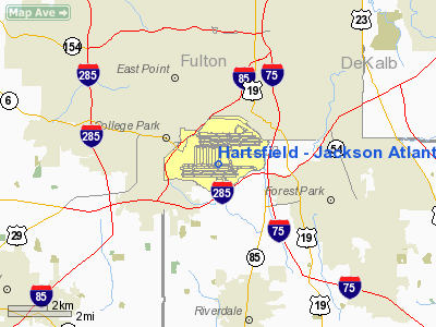
Hartsfield - Jackson Atlanta International Airport |
|
|
| HartsfieldâJackson Atlanta International Airport |
 |
 |
| IATA: ATL â ICAO: KATL â FAA LID: ATL
Location of ATL
|
| Summary |
| Airport type |
Public |
| Owner |
City of Atlanta |
| Operator |
Department of Aviation |
| Serves |
Atlanta, Georgia |
| Location |
unincorporated areas, Atlanta, College Park, and Hapeville
Fulton & Clayton Counties |
| Hub for |
- AirTran Airways
- Delta Air Lines
- GeorgiaSkies
|
| Elevation AMSL |
1,026 ft / 313 m |
| Coordinates |
33°38â²12â³N 084°25â²41â³W / 33.63667°N 84.42806°W / 33.63667; -84.42806Coordinates: 33°38â²12â³N 084°25â²41â³W / 33.63667°N 84.42806°W / 33.63667; -84.42806 |
| Website |
atlanta-airport.com |
| Runways |
| Direction |
Length |
Surface |
| ft |
m |
| 8L/26R |
9,000 |
2,743 |
Concrete |
| 8R/26L |
10,000 |
3,048 |
Concrete |
| 9L/27R |
11,890 |
3,624 |
Concrete |
| 9R/27L |
9,001 |
2,743 |
Concrete |
| 10/28 |
9,000 |
2,743 |
Concrete |
| Helipads |
| Number |
Length |
Surface |
| ft |
m |
| H1 |
52 |
16 |
Asphalt |
| Statistics (2009) |
| Aircraft operations |
970,235 |
| Passengers |
88,032,086 |

HartsfieldâJackson International Airport's Diagram
|
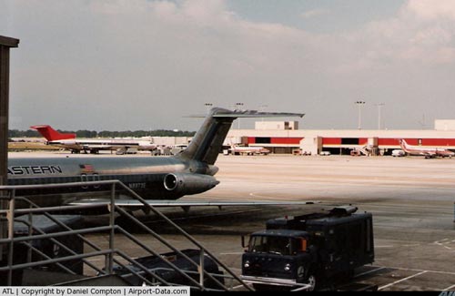
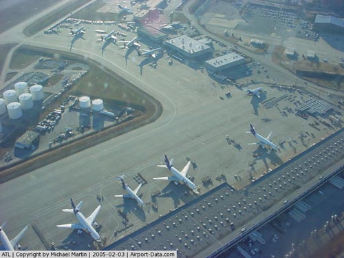
A line of automated and staffed ticketing counters for Delta, Atlanta's major tenant airline. HartsfieldâJackson Atlanta International Airport (IATA: ATL, ICAO: KATL, FAA LID: ATL), known locally as Atlanta Airport, Hartsfield Airport, and HartsfieldâJackson, is located seven miles (11 km) south of the central business district of Atlanta, Georgia, United States. It has been the world's busiest airport by passenger traffic and number of landings and take-offs since 1999, serving 88 million passengers per year. The airport is the primary hub of AirTran Airways, Delta Air Lines, and Delta Connection partner Atlantic Southeast Airlines; the Delta hub is the world's largest airline hub. Delta Air Lines flew 55.96% of passengers from the airport in 2009, AirTran flew 17.75%, and Atlantic Southeast Airlines flew 14.35%. The airport has 171 domestic and 28 international gates.
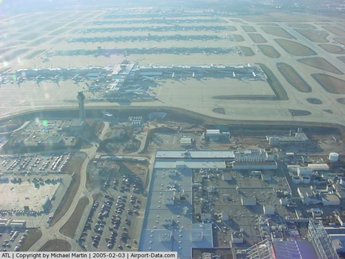
HartsfieldâJackson held its ranking as the world's busiest airport in 2009, both in terms of passengers and number of flights, by accommodating 88 million passengers and 970,235 flights. Many of the nearly one million flights are domestic flights from within the United States where Atlanta serves as a major hub for travel throughout the Southeastern United States.
HartsfieldâJackson International Airport has international service to North America, South America, Central America, Europe, Asia, and Africa. As an international gateway to the United States, HartsfieldâJackson ranks seventh.
The airport is located mostly in unincorporated areas in Fulton and Clayton counties; the city limits of Atlanta, College Park, and Hapeville extend to the airport grounds. The airport is served by MARTA's Red/Gold rail line. History
 | |
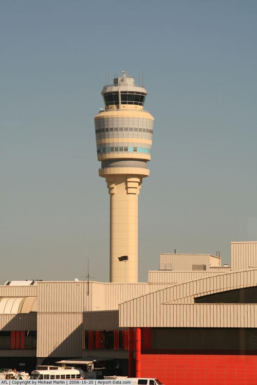
Hartsfield-Jackson Atlanta International Airport's Air Traffic Control Tower |
HartsfieldâJackson had its beginnings with a five-year, rent free lease on 287 acres (116 ha) that had been the home of an abandoned auto racetrack. The lease was signed on April 16, 1925, by Mayor Walter Sims, who committed the city to develop it into an airfield. As part of the agreement, the property was renamed Candler Field after its former owner, Coca-Cola tycoon and former Atlanta mayor Asa Candler. The first flight into Candler Field was on September 15, 1926, a Florida Airways mail plane flying from Jacksonville, Florida. In May 1928, Pitcairn Aviation began service to Atlanta, followed in June 1930 by Delta Air Service. Later these two airlines, known as Eastern Air Lines and Delta Air Lines, respectively, would both use Atlanta as their chief hubs.
It was a busy airport from its inception and by the end of 1930 it placed third behind New York City and Chicago for regular daily flights with sixteen arriving and departing. Candler Field's first control tower was opened March 1939.
- For the military use of the airport during World War II, see Atlanta Army Airfield
In October 1940 the U.S. government declared it a military airfield and the United States Army Air Force operated Atlanta Army Airfield jointly with Candler Field. The Air Force used the airport primarily for the servicing of transient aircraft, with many different types of combat aircraft being maintained at the airport. During World War II, the airport doubled in size and set a record of 1,700 takeoffs and landings in a single day, making it the nation's busiest airport in terms of flight operation. Atlanta Army Airfield closed after war's end.
In 1946 Candler Field was renamed Atlanta Municipal Airport. In 1948, more than one million passengers passed through a war surplus hangar that served as a terminal building. On June 1, 1956, an Eastern Airlines flight to Montreal, Canada was the first international flight out of Atlanta. In 1957, Atlanta had its first jet flight: a Sud Aviation Caravelle from Washington D.C. That same year, work on a new terminal began to help alleviate congestion. Atlanta was the busiest airport in the country with more than two million passengers passing through that year and, between noon and 2 p.m. each day, it became the busiest airport in the world.
On May 3, 1961, a new $21 million terminal opened, the largest in the country, being able to accommodate over six million travelers a year. The new airport was stretched past its capacity the very first year when nine and half million people passed through. In 1967, the city of Atlanta and the airlines began to work on a master plan for future development of Atlanta Municipal Airport.
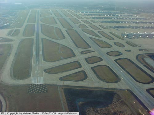
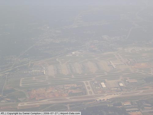
Construction had begun on the present midfield terminal in January 1977 under the administration of Mayor Maynard Jackson. It was the largest construction project in the South, costing $500 million. Named for former Atlanta mayor William Berry Hartsfield, who did much to promote air travel, William B. Hartsfield Atlanta International Airport opened on September 21, 1980, on-time and under budget. It was designed to accommodate up to 55 million passengers per year and covered 2.5 million square feet (230,000 m²). In December 1984 a 9,000-foot (2,700 m) fourth parallel runway was completed, and another runway was extended to 11,889 feet (3,624 m) the following year.
In May 2001, construction of a 9,000-foot (2,700 m) fifth runway (10-28) began. It was completed at a cost of $1.28 billion and opened on May 27, 2006, and was the first runway added since 1984. It bridges Interstate 285 (the Perimeter) on the south side of the airport. The massive project, which involved putting fill dirt eleven stories high in some places, destroyed some surrounding neighborhoods, and dramatically changed the scenery of two cemeteries on the property, Flat Rock Cemetery and Hart Cemetery. It was added to help ease some of the traffic problems caused by landing small- and mid-size aircraft on the longer runways which are also used by larger planes such as the Boeing 777, which generally require longer takeoff distances than the smaller planes. With the fifth runway, HartsfieldâJackson is one of only a few airports that can perform triple simultaneous landings. The fifth runway is expected to increase the capacity for landings and take-offs by 40%, from an average of 184 flights per hour to 237 flights per hour.
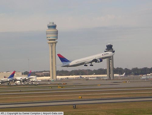
Along with the construction of the fifth runway, a new control tower was built to see the entire length of the runway. The new control tower is the tallest airport control tower in the United States, with a height of over 398 feet (121 m). The old control tower, 585 feet (178 m) away from the new control tower, was demolished August 5, 2006.
In 2003, Atlanta's city council voted on October 20 to change the name from Hartsfield Atlanta International Airport to the current HartsfieldâJackson Atlanta International Airport, in honor of former mayor Maynard Jackson, the first African-American mayor of Atlanta, who had died on June 23, 2003. The council had initially planned on renaming the airport solely for Mayor Jackson, but public outcry, especially by Mayor Hartsfield's descendants, prompted the compromise.
In April 2007, an "end-around taxiway" opened, called Taxiway Victor. It is expected to save an estimated $26 million to $30 million in fuel by allowing airplanes landing on the northernmost runway to taxi to the gate area without preventing other aircraft from taking off. The taxiway drops approximately 30 feet (9.1 m) from the runway elevation to allow takeoffs to continue.
As a result of the Southeastern U.S. drought of 2007, the airport (the eighth-largest water user in the state) has made changes to reduce water usage. This includes adjusting toilets, of which there are 725 commodes and 338 urinals, in addition to 601 sinks. (The two terminals alone use 917,000 gallons or about 3.5 million liters each day in average.) It also suspended the practice of using firetrucks to spray water over aircraft when the pilot made a last landing before retirement (a water salute). The city of Macon offered to sell water to the airport, through a proposed pipeline.
The airport today employs approximately 55,300 airline, ground transportation, concessionaire, security, federal government, City of Atlanta and Airport tenant employees and is considered the largest employment center in the State of Georgia. With a payroll of $2.4 billion, the airport has a direct and indirect economic impact of $3.2 billion on the local and regional economy and a total annual, regional economic impact of more than $19.8 billion.
Expansion
 | |
A view of the International Concourse E and Control Tower at night |
In 1999, HartsfieldâJackson's leadership established the Development Program: "Focus On the Future" involving multiple construction projects with the intention of preparing the airport to handle a projected demand of 121 million passengers in 2015. The program was originally budgeted at $5.4 billion over a ten-year period, but due to project delays and increased construction costs, the total is now projected at over $9 billion.
HartsfieldâJackson Rental Car Center
Main Article: ATL Skytrain
The HartsfieldâJackson Rental Car Center, which opened on December 8, 2009, houses all ten current airport rental agencies with capacity for additional companies. The complex features 9,900 parking spaces split up between two four-story parking decks that together cover 2,800,000 square feet (260,000 m), a 137,000-square-foot (12,700 m) customer service center, and a maintenance center for vehicles, which features 140 gas pumps,and 30 bays for washing with each one equipped with a water recovery system. The automated people mover, nicknamed the ATL Skytrain, (using Mitsubishi Crystal Mover equipment) connects the facility to the airport and to the Gateway Center of the Georgia International Convention Center and the HartsfieldâJackson Rental Car Center. A four-lane roadway was built across Interstate 85 to connect the HartsfieldâJackson Rental Car Center to the existing airport road network.
Maynard Holbrook Jackson, Jr. International Terminal
In July 2003, former Atlanta mayor Shirley Franklin announced a new terminal to be named for Maynard Holbrook Jackson, Jr.. The new international terminal would be built on the east side of the airport near International Concourse E, on a site that has been occupied by air cargo facilities and the midfield control tower. It would add twelve new gates able to hold wide-body jets, which can be converted to sixteen narrow-body gates, as well as new check-in desks and a baggage claim area solely for international carriers. Additionally, the international terminal would have its own parking lot just for international passengers with over 1,100 spots. Arriving international passengers whose final destination is Atlanta will be able to keep possession of their luggage as they proceed to exit the airport. (Currently, such passengers must "recheck" their luggage and clear security at Concourse E to enter the underground Transportation Mall to get to the main terminal where they must "reclaim" their luggage.) The new terminal will be affixed to Terminal E by the people mover tram and will also have new ground transportation access from I-75.
It was slated to open in 2006. However, time and cost overruns led general manager Ben DeCosta to cancel the design contract in August 2005. The very next day the company sued the airport claiming "fraud" and "bad faith", blaming the airport authority for the problems. Recently, Ben DeCosta awarded a new design contract on the new international terminal to Atlanta Gateway Designers (AGD). Estimated prices place the terminal's cost at $1.4 billion and expected to open in April 2012.
Also scheduled to be completed after the new international terminal and concourse is a new terminal south of the current terminals. The new terminal is expected to include up to 70 gates. The project is currently known as the South Gate Complex, and is estimated to cost around $1.8 billion. The new terminal will be connected to the main terminal by an expanded automated people mover system. When the South Gate Complex is completed, it is expected that most domestic carriers other than Delta will move to the SGC. This would leave Delta as the sole domestic carrier at the current terminal, which it will share with its SkyTeam partners. Since the SGC is not planned to have Customs and Border Protection facilities, international arrivals other than pre-cleared flights will also continue to use the current terminal (specifically British Airways and Lufthansa).
Layout
HartsfieldâJackson Atlanta International Airport has terminal and concourse space totaling 5.8 million square feet (~0.54 km²). The airport has two terminals where passengers check in and claim bags, the North Terminal and the South Terminal. The two terminals are parts of a larger building. The portions of the building in between the two terminals include the Atrium, which is a large, open seating area that features concessionaires and a bank as well as conference rooms, an interfaith chapel, and offices on the upper floors, the main security checkpoint, the Ground Transportation Center, and a Metropolitan Atlanta Rapid Transit Authority (MARTA) train station.
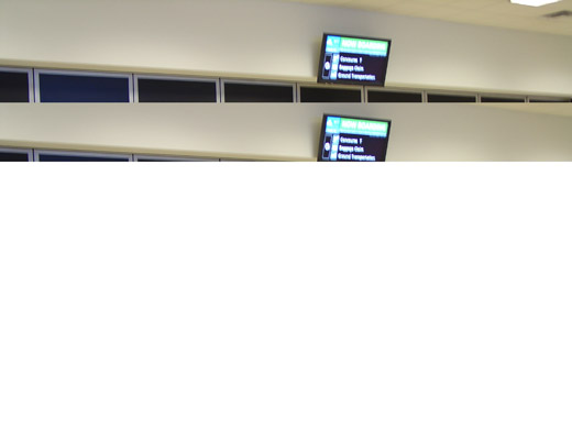
Six concourse buildings, parallel to one another, are used for passenger boarding. The first concourse is directly connected to the main terminal, and is known as the T-Gates (for Terminal). The remaining five concourses are arranged successively in distance from the terminal as Concourses A, B, C, D, and E. Concourse E replaced Concourse T as the international terminal when it opened in 1994 in time for the 1996 Summer Olympic Games, which were held in Atlanta . International passengers who arrive in Atlanta are subjected to a security re-check after clearing customs due to the fact that the facility exits into the concourse instead of the main terminal lobby. The concourses are connected by an underground Transportation Mall, which begins at the main terminal and passes under the center of each concourse. There used to be a second underground walkway between Concourses B and C located at the north end of the two concourses, that made it possible to transfer without returning all the way to the center of the concourse. This was originally constructed for Eastern Airlines, who occupied these two terminals. This is now blocked off and the old entrance at Terminal B has been replaced by a bank of arrival/departure monitors.
 | |
A concourse entrance to the underground people mover. |
The Automated People MoverIn addition to a pedestrian walkway, which includes a series of moving walkways, connecting the concourses, the Transportation Mall also features an automated people mover. The Automated People Mover has a station at the east end of the main terminal for passengers entering the Transportation Mall after passing through security (this station also serves as the station for Concourse T), and a station at each of the remaining five concourses. There is an additional station for the Baggage Claim area, which is located directly underneath the Main Terminal. Only hand luggage can be carried on the people mover. It is the world's busiest automated people mover, with over 64 million riders in 2002.
On August 10, 2010, the automated people mover was named "The Plane Train."
MARTA StationHartsfieldâJackson also has its own train station on the city's rapid transit system, MARTA. The above-ground station is inside in the main building, between the north and south terminals on the west end. The Airport train station is currently the southernmost station in the MARTA system.
Terminals, airlines, and destinations
The six concourses and their gates are:
- Concourse T â 15 gates (T1âT15)
- Concourse A â 34 gates (A1âA34)
- Concourse B â 35 gates (B1âB35)
- Concourse C â 48 gates (C1âC22, C30âC57)
- Concourse D â 36 gates (D1, D1AâD8, D8AâD11, D11AâD16, D21âD37)
- Concourse E â 29 gates (E1âE12, E14âE17, E26âE37)
- Note: All international arrivals (except flights with customs pre-clearance) are handled at Concourse E. International departures are often but not exclusively handled at gates in the concourse E.
| Airlines |
Destinations |
Concourse |
| Air Canada Jazz |
Toronto-Pearson |
D |
| Air France |
Paris-Charles de Gaulle |
E |
| AirTran Airways |
Akron/Canton, Aruba, Atlantic City, Baltimore, Bloomington/Normal, Boston, Branson, Buffalo, Cancún, Charlotte, Chicago-Midway, Columbus (OH), Dallas/Fort Worth, Dayton, Denver, Detroit, Flint, Fort Lauderdale, Fort Myers, Gulfport/Biloxi, Houston-Hobby, Indianapolis, Jacksonville (FL), Kansas City, Las Vegas, Los Angeles, Memphis, Miami [ends October 6], Milwaukee, Minneapolis/St. Paul, Moline/Quad Cities [ends November 30], Montego Bay, Nassau, New Orleans, New York-LaGuardia, Newport News, Orlando, Pensacola, Philadelphia, Phoenix, Pittsburgh, Punta Cana [Begins February 16], Raleigh/Durham, Richmond, Rochester (NY), St. Louis, San Antonio, San Francisco, San Juan, Sarasota/Bradenton, Seattle/Tacoma, Tampa, Tunica, Washington-Dulles, Washington-Reagan, West Palm Beach, White Plains, Wichita
Seasonal: Allentown/Bethlehem, Harrisburg, Portland (ME) |
C, D
|
| Alaska Airlines |
Seattle/Tacoma |
D |
| American Airlines |
Dallas/Fort Worth, Miami |
T |
| American Eagle |
Chicago-O'Hare, Miami, New York-LaGuardia |
T |
| British Airways |
London-Heathrow |
E |
| Continental Airlines |
Houston-Intercontinental, Newark |
D |
| Continental Express operated by Chautauqua Airlines |
Cleveland, Houston-Intercontinental |
D |
| Continental Express operated by ExpressJet Airlines |
Cleveland, Houston-Intercontinental, Newark |
D
|
| Delta Air Lines |
Albuquerque, Allentown/Bethlehem, Austin, Baltimore, Bermuda, Birmingham (AL), Boston, Buffalo, Charleston (SC), Charlotte, Chicago-Midway, Chicago-O'Hare, Cincinnati/Northern Kentucky, Cleveland, Colorado Springs, Columbia (SC), Columbus (OH), Dallas/Fort Worth, Dayton, Daytona Beach, Denver, Detroit, El Paso, Flint, Fort Lauderdale, Fort Myers, Freeport, Grand Rapids, Green Bay, Greensboro, Greenville/Spartanburg, Gulfport/Biloxi, Harrisburg, Hartford, Honolulu, Houston-Hobby, Houston-Intercontinental, Huntsville/Decatur, Indianapolis, Jackson (MS), Jacksonville (FL), Kansas City, Key West, Knoxville, Las Vegas, Little Rock, Los Angeles, Louisville, Manchester (NH), Melbourne (FL), Memphis, Miami, Milwaukee, Minneapolis/St. Paul, Mobile, Myrtle Beach, Nashville, Nassau, New Orleans, New York-JFK, New York-LaGuardia, Newark, Newport News, Norfolk, Oakland [seasonal], Oklahoma City, Omaha, Ontario, Orange County, Orlando, Panama City (FL), Pensacola, Philadelphia, Phoenix, Pittsburgh, Portland (ME), Portland (OR), Providence, Raleigh/Durham, Richmond, Rochester (NY), Sacramento, St. Croix, St. Louis, St. Thomas, Salt Lake City, San Antonio, San Diego, San Francisco, San Jose (CA), San Juan, Sarasota/Bradenton, Savannah, Seattle/Tacoma, Tallahassee, Tampa, Tucson, Tulsa, Washington-Dulles, Washington-Reagan, West Palm Beach
Seasonal: Albany (NY), Anchorage, Bozeman, Eagle/Vail, Fort Walton Beach, Hayden/Steamboat Springs, Jackson Hole, Kalispell, Lexington, Montrose/Telluride, Reno/Tahoe, Syracuse, Vancouver |
T, A, B, D, E
|
| Delta Air Lines |
Accra, Amsterdam, Antigua, Aruba, Barbados, Barcelona, Belize City, Bonaire, Bogotá, Brasilia, Brussels, Buenos Aires-Ezeiza, Cancún, Caracas, Copenhagen, Cozumel, Dakar [resumes January 20], Dubai, Dublin, Düsseldorf, Frankfurt, Grand Cayman, Guadalajara, Guatemala City, Johannesburg, Lagos, Liberia (Costa Rica), Lima, London-Gatwick, London-Heathrow, Luanda [begins January 20], Madrid, Managua, Manaus [ends January 29], Manchester (UK), Mexico City, Milan-Malpensa, Monrovia, Montego Bay, Munich, Panama City, Paris-Charles de Gaulle, Providenciales, Puerto Vallarta, Punta Cana, Quito, Rio de Janeiro-Galeão, Roatán, Rome-Fiumicino, St. Lucia, St. Maarten, San José de Costa Rica, San José del Cabo, San Salvador, Santiago de Chile, Santo Domingo, São Paulo-Guarulhos, San Pedro Sula, Stuttgart, Tegucigalpa, Tel Aviv, Tobago, Tokyo-Narita, Zürich
Seasonal: Athens, Curaçao, Guayaquil, Kingston, Moscow-Sheremetyevo, Prague, Puerto Plata, St. Kitts, Venice-Marco Polo |
T*, E
*Departing flights only
|
| Delta Connection operated by Atlantic Southeast Airlines |
Akron/Canton, Albany (GA), Albany (NY), Alexandria, Allentown/Bethlehem, Appleton, Asheville, Augusta (GA), Austin, Baton Rouge, Birmingham (AL), Bloomington/Normal, Blountville/Tri-Cities, Brunswick, Charleston (SC), Charleston (WV), Charlotte, Charlottesville, Chattanooga, Chicago-Midway, Cleveland, Columbia (SC), Columbus (GA), Columbus (MS), Dayton, Des Moines, Dothan, Evansville, Fayetteville (AR), Fayetteville (NC), Flint, Florence, Fort Wayne, Fort Walton Beach, Gainesville, George Town/Great Exuma Island, Greensboro, Greenville/Spartanburg, Gulfport/Biloxi, Halifax, Harrisburg, Houston-Hobby, Houston-Intercontinental, Huntsville/Decatur, Jackson (MS), Jacksonville (NC), Killeen, Key West, Knoxville, Lafayette, Lewisburg (WV), Lexington, Little Rock, Louisville, Lynchburg, Madison [begins November 3], Melbourne (FL), Meridian, Milwaukee, Mobile, Moline/Quad Cities, Monroe, Montgomery, Montréal-Trudeau, Myrtle Beach, Nashville, New Bern, Newburgh, Newport News, New Orleans, Norfolk, Oklahoma City, Omaha, Panama City (FL), Pensacola, Pittsburgh, Providence, Richmond, Roanoke, Rochester (NY), St. Louis, Savannah, Shreveport, Sioux Falls, South Bend, Springfield (MO), Syracuse, Tallahassee, Toronto-Pearson, Tri-Cities (TN/VA), Tulsa, Valdosta, White Plains, Wichita, Wilmington (NC) |
C, D
|
| Delta Connection operated by Comair |
Asheville, Birmingham (AL), Charleston (SC), Chattanooga, Cincinnati/Northern Kentucky, Cleveland, Chicago-O'Hare, Columbus (OH), Flint, Fort Walton Beach, Freeport, Greensboro, Harrisburg, Huntsville/Decatur, Houston-Hobby, Knoxville, Lexington [ends September 30], Louisville, Manchester (NH), Nashville, New Orleans, Oklahoma City, Omaha, Panama City (FL), Providence, Springfield (MO), Syracuse, Tulsa |
D
|
| Delta Connection operated by Compass Airlines |
Albany (NY), Charlotte, Chicago-O'Hare, Houston-Intercontinental, Louisville, Savannah |
A
|
| Delta Connection operated by Mesaba Airlines |
Austin, Chattanooga, Columbus (MS), Florence (SC), Muscle Shoals, Nashville, Omaha, Providence, San Antonio, Tupelo
Seasonal: Hilton Head Island |
D
|
| Delta Connection operated by Pinnacle Airlines |
Austin, Birmingham (AL), Charlotte, Chicago-O'Hare, Chicago-Midway, Cincinnati/Northern Kentucky, Cleveland, Dayton, Fort Wayne, Greenville/Spartanburg, Houston-Hobby, Houston-Intercontinental, Huntsville/Decatur, Kansas City, Knoxville, Louisville, Memphis, Milwaukee, Nashville, New Orleans, Norfolk, Oklahoma City, Panama City (FL), Portland (ME), Providence, Richmond, St. Croix, St. Louis, San Antonio, Savannah, Tallahassee, Washington-Dulles, Washington-Reagan, White Plains, Wichita |
B
|
| Delta Connection operated by Pinnacle Airlines |
Monterrey
Seasonal: Belize City, Cozumel, Guadalajara, Providenciales |
E
|
| Delta Connection operated by Shuttle America |
Charlotte, Chicago-Midway, Chicago-O'Hare, Charleston (SC), Cincinnati/Northern Kentucky, Columbus (OH), Houston-Hobby, Indianapolis, Knoxville, Louisville, Memphis, Milwaukee, Nashville, Norfolk, Pittsburgh, St. Louis, San Antonio, Sarasota/Bradenton, Washington-Reagan |
A
|
| Delta Connection operated by SkyWest Airlines |
Chicago-O'Hare, St. Louis
Seasonal: Montrose/Telluride |
B
|
| Frontier Airlines |
Denver |
D |
| Frontier Airlines operated by Republic Airlines |
Denver |
D |
| GeorgiaSkies |
Athens (GA), Macon |
E |
| KLM |
Amsterdam |
E |
| Korean Air |
Seoul-Incheon |
E |
| Lufthansa |
Frankfurt |
E |
| Spirit Airlines |
Fort Lauderdale
Seasonal: Myrtle Beach |
D |
| United Airlines |
Chicago-O'Hare |
T |
| United Express operated by Mesa Airlines |
Chicago-O'Hare, Washington-Dulles |
T |
| United Express operated by Shuttle America |
Chicago-O'Hare, Denver, Washington-Dulles |
T |
| United Express operated by SkyWest Airlines |
Denver |
T |
| US Airways |
Charlotte, Philadelphia, Phoenix |
D |
| US Airways Express operated by Air Wisconsin |
Philadelphia |
D |
| US Airways Express operated by Mesa Airlines |
Charlotte |
D |
| US Airways Express operated by PSA Airlines |
Charlotte |
D |
| US Airways Express operated by Republic Airlines |
Charlotte, Philadelphia |
D |
Atlantic Aviation
Due to access restrictions, Wings Air (USA) currently operates from the Atlantic Aviation Fixed base operator facility and provides shuttle transportation for passengers connecting to the main passenger terminals. GeorgiaSkies won gate access at the airport and moved its operations from the Atlantic Aviation facility to the International Concourse E at the main passenger terminal.
| Airlines |
Destinations |
| Wings Air (USA) |
Lawrenceville |
Cargo airlinesNotable events
Crashes en route
- April 4, 1977 Southern Airways Flight 242 (Huntsville to Atlanta, crashed en route a few dozen miles from Atlanta Airport)
- September 6, 1985 Midwest Express Airlines Flight 105 (Milwaukee to Atlanta, crashed on takeoff at the airport in Milwaukee, Wisconsin)
- August 21, 1995 Atlantic Southeast Airlines Flight 529, crashed near Carrollton, Georgia while on a flight from the Hartsfield-Jackson Atlanta International Airport to Gulfport-Biloxi International Airport in Gulfport, Mississippi.
- May 11, 1996 ValuJet Flight 592 (Miami to Atlanta, crashed en route from Miami International Airport in the Florida Everglades)
- August 27, 2006 Comair Flight 191 operating as Delta Connection Flight 5191 (Lexington to Atlanta, crashed on takeoff at the Blue Grass Airport) 49 fatalities were reported.
Ground facility events
Public safety
On November 16, 2001, a man left the secure area to retrieve his camera bag, which he had left behind, and then tried to bypass the wait at the security checkpoint by running the wrong way down the escalators at the secure area's exit. As a result, the entire airport was evacuated, including all aircraft, and operations halted for three hours.
The man said that he tried to bypass the security line because he would be late for a flight he was taking to see a Georgia Bulldogs football game. As part of his sentence, he was not allowed to attend any Bulldogs games for the 2002 season.
From December 2006 to March 2007, there were 30 arrests for indecent exposure involving reported sex acts in airport bathrooms. Several prominent persons were arrested, including an advisor for the Centers for Disease Control and Prevention, a Spelman College professor, and the Chairman of the Metropolitan Atlanta Rapid Transit Authority board of directors.
Lightning strike
In 2009, a severe thunderstorm on the evening of April 23 caused a lightning strike directly to the control tower at 8:45 (20:45) EDT. The airport was already in a ground stop due to dangerous wind shear, and four minutes after the strike, the tower was evacuated after a smoke odor was detected. After returning at 9:10, a power outage at 9:20 caused further problems, including major flight delays and diversions due also to the lightning (at over 1000 strikes per hour) and large amounts of hail that continued in the vicinity. Partial power outages continued to affect the airport and the northern runway lighting for more than an hour afterward, leaving only three other runways to handle the backlog. An FAA official said that neither the new nor the old tower had been struck in at least 18 years. Several storm chasers 4â5 miles east of the airport reported a wall cloud and descending funnel during the severe thunderstorm.
In culture
 | |
Best Buy Express vending machine in a terminal |
As the dominant airport in the Southern United States, and the nation's busiest in terms of passengers handled (mainly due to being Delta's flagship hub), there is an old joke in the South which states that, upon one's death, regardless of whether he or she goes to Heaven or Hell he or she will connect in Atlanta to get there.
Other notes
Air traffic controllers for tower and ground control operations refer to the letter "D" using the word "Dixie" instead of the ICAO phonetic term "Delta" to avoid confusion with Delta Air Lines aircraft (note the use of "DIXIE" for taxiway "D" in the FAA's airport diagram, listed in the external links below).
The People Mover's recorded announcements list "Concourse D as in David," rather than "Delta" or "Dixie."
The above content comes from Wikipedia and is published under free licenses – click here to read more.
|
 |
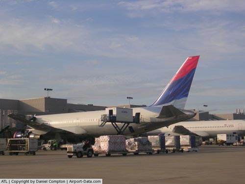
(Click on the photo to enlarge) |
|
 |
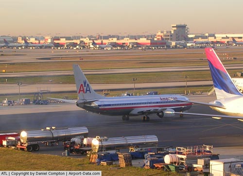
(Click on the photo to enlarge) |
|
 |
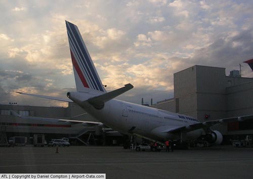
(Click on the photo to enlarge) |
|
 |
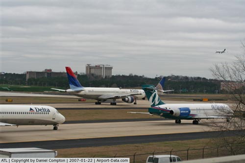
(Click on the photo to enlarge) |
|
 |
(Click on the photo to enlarge) |
|
 |
(Click on the photo to enlarge) |
|
 |
(Click on the photo to enlarge) |
|
 |
(Click on the photo to enlarge) |
|
 |
(Click on the photo to enlarge) |
|
 |
(Click on the photo to enlarge) |
|
 |
(Click on the photo to enlarge) |
|
 |
(Click on the photo to enlarge) |
|
 |
(Click on the photo to enlarge) |
|
 |
(Click on the photo to enlarge) |
|
 |
(Click on the photo to enlarge) |
|
 |
(Click on the photo to enlarge) |
|
 |
(Click on the photo to enlarge) |
|
 |
(Click on the photo to enlarge) |
|
 |
(Click on the photo to enlarge) |
|
 |
(Click on the photo to enlarge) |
|
 |
(Click on the photo to enlarge) |
|
 |
(Click on the photo to enlarge) |
|
 |
(Click on the photo to enlarge) |
|
 |
(Click on the photo to enlarge) |
Location
& QuickFacts
|
FAA Information Effective: |
2007-07-05 |
|
Airport
Identifier: |
ATL |
|
Airport
Status: |
Operational |
|
Longitude/Latitude: |
084-25-41.0380W/33-38-12.1920N
-84.428066/33.636720 (Estimated) |
|
Elevation: |
1026 ft / 312.72 m (Surveyed) |
|
Land: |
4700 acres |
|
From
nearest city: |
7 nautical miles S of Atlanta, GA |
|
Location: |
Fulton County, GA |
|
Magnetic Variation: |
02W (1985) |
Owner
& Manager
|
Ownership: |
Publicly owned |
|
Owner: |
City Of Atlanta |
|
Address: |
City Hall
Atlanta, GA 30303 |
|
Phone
number: |
404-330-6000 |
|
Manager: |
Benjamin Decosta |
|
Address: |
Po Box 20509 Airport Opns
Atlanta, GA 30320 |
|
Phone number: |
404-530-6600 |
Airport
Operations and Facilities
|
Airport Use: |
Open to public |
|
Wind
indicator: |
Yes |
|
Segmented
Circle: |
No |
|
Control
Tower: |
Yes |
|
Lighting
Schedule: |
DUSK-DAWN |
|
Beacon
Color: |
Clear-Green (lighted land airport)
ROTG BCN LCTD ATOP FIRE STATION NUMBER 40, SOUTH SIDE OF
ARPT. |
|
Landing
fee charge: |
Yes |
|
Sectional
chart: |
Atlanta |
|
Region: |
ASO - Southern |
|
Boundary
ARTCC: |
ZTL - Atlanta |
|
Tie-in
FSS: |
MCN - Macon |
|
FSS
on Airport: |
No |
|
FSS
Toll Free: |
1-800-WX-BRIEF |
|
NOTAMs
Facility: |
ATL (NOTAM-d service avaliable) |
|
Certification type/date: |
I E S 05/1973 |
|
Federal Agreements: |
NGPY3 |
Airport
Communications
Airport
Services
|
Fuel available: |
100 100LLA |
|
Airframe Repair: |
MAJOR |
|
Power Plant Repair: |
MAJOR |
|
Bottled
Oxygen: |
HIGH/LOW |
|
Bulk
Oxygen: |
HIGH/LOW |
|
Runway Information
Runway 08L/26R
|
Dimension: |
9000 x 150 ft / 2743.2 x 45.7 m |
|
Surface: |
CONC, Good Condition |
|
Surface
Treatment: |
Saw-cut or plastic Grooved |
|
Weight
Limit: |
Single wheel: 120000 lbs.
Dual wheel: 200000 lbs.
Dual
tandem wheel: 360000 lbs. |
|
Edge
Lights: |
High
PERIMETER LGTS. |
|
|
Runway 08L |
Runway 26R |
|
Longitude: |
084-26-20.4917W |
084-24-34.0325W |
|
Latitude: |
33-38-58.3235N |
33-38-58.3505N |
|
Elevation: |
1015.00
ft |
990.00
ft |
|
Alignment: |
90 |
127 |
|
ILS
Type: |
ILS/DME |
ILS/DME |
|
Traffic
Pattern: |
Left |
Left |
|
Markings: |
Precision instrument, Good Condition |
Precision instrument, Good Condition |
|
Crossing
Height: |
70.00
ft |
0.00 ft |
|
VASI: |
4-light PAPI on left side |
4-light PAPI on left side |
|
Visual
Glide Angle: |
3.00° |
0.00° |
|
RVR
Equipment: |
touchdown, midfield, rollout |
touchdown, midfield, rollout |
|
Approach
lights: |
ALSF2 |
MALSR |
|
Centerline
Lights: |
Yes |
Yes |
|
Touchdown
Lights: |
Yes |
Yes |
|
Obstruction: |
14 ft sign, 610.0 ft from runway, 400 ft left
of centerline, 28:1 slope to clear |
53 ft ant, 2400.0 ft from runway, 800 ft right
of centerline, 41:1 slope to clear |
|
Decleard
distances: |
Take off run available 9000.00 ft
Take off distance available 9000.00 ft
Actual stop distance available 8800.00 ft
Landing distance available 8800.00 ft |
Take off run available 9000.00 ft
Take off distance available 9000.00 ft
Actual stop distance available 8800.00 ft
Landing distance available 8800.00 ft |
|
Runway 08R/26L
|
Dimension: |
10000 x 150 ft / 3048.0 x 45.7 m |
|
Surface: |
CONC, Good Condition |
|
Surface
Treatment: |
Saw-cut or plastic Grooved |
|
Weight
Limit: |
Single wheel: 120000 lbs.
Dual wheel: 200000 lbs.
Dual
tandem wheel: 360000 lbs. |
|
Edge
Lights: |
High
PERIMETER LGTS. |
|
|
Runway 08R |
Runway 26L |
|
Longitude: |
084-26-18.1137W |
084-24-19.8299W |
|
Latitude: |
33-38-48.4338N |
33-38-48.4601N |
|
Elevation: |
1024.00
ft |
995.00
ft |
|
Alignment: |
90 |
127 |
|
ILS
Type: |
ILS/DME |
ILS/DME |
|
Traffic
Pattern: |
Left |
Left |
|
Markings: |
Precision instrument, Good Condition |
Precision instrument, Good Condition |
|
Crossing
Height: |
67.00
ft |
0.00 ft |
|
VASI: |
4-light PAPI on left side |
4-light PAPI on left side |
|
Visual
Glide Angle: |
3.00° |
0.00° |
|
RVR
Equipment: |
touchdown, midfield, rollout |
touchdown, midfield, rollout |
|
Approach
lights: |
|
MALSR |
|
Centerline
Lights: |
Yes |
Yes |
|
Touchdown
Lights: |
Yes |
No |
|
Obstruction: |
64 ft rr, 2600.0 ft from runway, 500 ft right
of centerline, 37:1 slope to clear |
13 ft vent, 790.0 ft from runway, 560 ft right
of centerline, 45:1 slope to clear |
|
Runway 09L/27R
|
Dimension: |
11890 x 150 ft / 3624.1 x 45.7 m |
|
Surface: |
CONC, Good Condition |
|
Surface
Treatment: |
Saw-cut or plastic Grooved |
|
Weight
Limit: |
Single wheel: 120000 lbs.
Dual wheel: 200000 lbs.
Dual
tandem wheel: 360000 lbs. |
|
Edge
Lights: |
High
PERIMETER LGTS. |
|
|
Runway 09L |
Runway 27R |
|
Longitude: |
084-26-52.6807W |
084-24-32.0708W |
|
Latitude: |
33-38-04.9360N |
33-38-04.9314N |
|
Elevation: |
1019.00
ft |
978.00
ft |
|
Alignment: |
90 |
127 |
|
ILS
Type: |
ILS/DME |
ILS/DME |
|
Traffic
Pattern: |
Left |
Left |
|
Markings: |
Precision instrument, Good Condition |
Precision instrument, Good Condition |
|
Crossing
Height: |
71.00
ft |
72.00
ft |
|
VASI: |
4-light PAPI on right side |
4-light PAPI on right side |
|
Visual
Glide Angle: |
3.00° |
3.00° |
|
RVR
Equipment: |
touchdown, midfield, rollout |
touchdown, midfield, rollout |
|
Approach
lights: |
MALSR |
MALS |
|
Centerline
Lights: |
Yes |
Yes |
|
Touchdown
Lights: |
No |
No |
|
Obstruction: |
108 ft other, 3920.0 ft from runway, 200 ft
left of centerline, 34:1 slope to clear |
, 50:1 slope to clear |
|
Decleard
distances: |
Take off run available 11890.00 ft
Take off distance available 11890.00 ft
Actual stop distance available 11890.00 ft
Landing distance available 11890.00 ft |
Take off run available 11890.00 ft
Take off distance available 11890.00 ft
Actual stop distance available 11740.00 ft
Landing distance available 11740.00 ft |
|
Runway 09R/27L
|
Dimension: |
9001 x 150 ft / 2743.5 x 45.7 m |
|
Surface: |
CONC, Good Condition |
|
Surface
Treatment: |
Saw-cut or plastic Grooved |
|
Weight
Limit: |
Single wheel: 120000 lbs.
Dual wheel: 200000 lbs.
Dual
tandem wheel: 360000 lbs. |
|
Edge
Lights: |
High
PERIMETER LGTS. |
|
|
Runway 09R |
Runway 27L |
|
Longitude: |
084-26-52.6782W |
084-25-06.2383W |
|
Latitude: |
33-37-54.5297N |
33-37-54.5620N |
|
Elevation: |
1026.00
ft |
985.00
ft |
|
Alignment: |
90 |
127 |
|
ILS
Type: |
ILS/DME |
ILS/DME |
|
Traffic
Pattern: |
Left |
Left |
|
Markings: |
Precision instrument, Good Condition |
Precision instrument, Good Condition |
|
Crossing
Height: |
70.00
ft |
72.00
ft |
|
VASI: |
4-light PAPI on left side |
4-light PAPI on right side |
|
Visual
Glide Angle: |
3.00° |
3.00° |
|
RVR
Equipment: |
touchdown, midfield, rollout |
touchdown, midfield, rollout |
|
Approach
lights: |
ALSF2 |
MALSR |
|
Centerline
Lights: |
Yes |
Yes |
|
Touchdown
Lights: |
Yes |
Yes |
|
Obstruction: |
88 ft tower, 4480.0 ft from runway, 1000 ft
right of centerline, 48:1 slope to clear |
, 50:1 slope to clear |
|
Decleard
distances: |
Take off run available 9000.00 ft
Take off distance available 9000.00 ft
Actual stop distance available 9000.00 ft
Landing distance available 9000.00 ft |
Take off run available 9000.00 ft
Take off distance available 9000.00 ft
Actual stop distance available 8865.00 ft
Landing distance available 8865.00 ft |
|
Runway 10/28
|
Dimension: |
9000 x 150 ft / 2743.2 x 45.7 m |
|
Surface: |
CONC, Good Condition |
|
Surface
Treatment: |
Saw-cut or plastic Grooved |
|
Weight
Limit: |
Single wheel: 75000 lbs.
Dual wheel: 209000 lbs.
Dual tandem wheel: 600000 lbs.
Dual dual tandem wheel: 900000 lbs. |
|
Edge
Lights: |
High
PERIMETER LGTS. |
|
|
Runway 10 |
Runway 28 |
|
Longitude: |
084-26-52.3560W |
084-25-05.9367W |
|
Latitude: |
33-37-12.9834N |
33-37-13.0158N |
|
Elevation: |
1000.00
ft |
998.00
ft |
|
Alignment: |
90 |
127 |
|
ILS
Type: |
ILS/DME |
ILS/DME |
|
Traffic
Pattern: |
Right |
Left |
|
Markings: |
Precision instrument, Good Condition |
Precision instrument, Good Condition |
|
RVR
Equipment: |
touchdown, midfield, rollout |
touchdown, midfield, rollout |
|
Approach
lights: |
ALSF2 |
ALSF2 |
|
Centerline
Lights: |
Yes |
Yes |
|
Touchdown
Lights: |
Yes |
Yes |
|
Obstruction: |
51 ft sign, 2002.0 ft from runway, 770 ft right
of centerline, 35:1 slope to clear |
136 ft tower, 4240.0 ft from runway, 410 ft
right of centerline, 30:1 slope to clear |
|
Helipad H1
|
Dimension: |
52 x 52 ft / 15.8 x 15.8 m |
|
Surface: |
ASPH, |
|
|
Runway H1 |
Runway |
|
Traffic
Pattern: |
Left |
Left |
|
Radio Navigation
Aids
|
ID |
Type |
Name |
Ch |
Freq |
Var |
Dist |
|
BR |
NDB |
Redan |
|
266.00 |
02W |
5.9 nm |
|
FT |
NDB |
Flanc |
|
344.00 |
02W |
13.0 nm |
|
FF |
NDB |
Pecat |
|
316.00 |
02W |
20.4 nm |
|
EQQ |
NDB |
Coweta County |
|
234.00 |
03W |
26.9 nm |
|
JHH |
NDB |
Griffin |
|
412.00 |
04W |
29.0 nm |
|
VOF |
NDB |
Alcovy |
|
370.00 |
03W |
32.3 nm |
|
GPQ |
NDB |
Carrollton |
|
278.00 |
02W |
35.4 nm |
|
JNM |
NDB |
Monroe |
|
392.00 |
03W |
35.6 nm |
|
DJD |
NDB |
Canton |
|
415.00 |
04W |
37.1 nm |
|
EVZ |
NDB |
Cartersville |
|
308.00 |
04W |
39.7 nm |
|
FKV |
NDB |
Flowery Branch |
|
365.00 |
03W |
42.9 nm |
|
OP |
NDB |
Yates |
|
339.00 |
03W |
44.8 nm |
|
BMW |
NDB |
Barrow County |
|
404.00 |
03W |
45.6 nm |
|
JZP |
NDB |
Pickens County |
|
285.00 |
04W |
49.3 nm |
|
DOB |
TACAN |
Dobbins |
077X |
|
01W |
17.2 nm |
|
PDK |
VOR/DME |
Peachtree |
113X |
116.60 |
02W |
15.7 nm |
|
ATL |
VORTAC |
Atlanta |
116X |
116.90 |
00W |
0.6 nm |
|
RMG |
VORTAC |
Rome |
101X |
115.40 |
01E |
46.8 nm |
|
ATL |
VOT |
Atlanta Muni |
|
111.00 |
|
1.3 nm |
Remarks
- EXTENSIVE
AIRFIELD CONSTRUCTION IN PROGRESS SOUTH OF TWY R MAY CREATE OPTICAL
ILLUSION OF RUNWAY AND TAXIWAYS.
- ALL
RYS, TOUCH AND GO OPERATIONS, LOW APPROACHES, AND PRACTICE INSTRUMENT
APPROACHES NOT PERMITTED.
- CATEGORY
VI ACFT(LOCKHEED GALAXY-5; ANTONOV AN-124 & AN-125) WITH A WINGSPAN
OF GREATER THAN 214 FT ARE RESTRICTED FM USING TWY 'L' EAST OF RAMP
5 SOUTH TO THE WEST SIDE OF RAMP 6 SOUTH.
- TWY
C SOUTH OF TWY A AND NORTH OF RY 08L/26R CLSD. TWY C NORTH OF TWY B
AND SOUTH OF RY 08L/26R CLSD.
- ASDE-X
SURVEILLANCE SYSTEM IN USE: PILOTS SHOULD OPERATE TRANSPONDERS WITH
MODE C ON ALL TWYS AND RWYS.
- ACFT
WITH WINGSPAN GREATER THAN 171 FT ARE RSTRD FROM USING TWY V.
- BE
ALERT TO RY CROSSING CLEARANCES. READBACK OF ALL RY HOLDING INSTRUCTIONS
IS REQUIRED.
- PREFERENTIAL
RY USE IN EFFECT, EXPECT TO USE RYS 08R/26L, 09L/27R FOR DEPS; RYS 08L/26R,
09R/27L ARE USED PRIMARILY FOR ARRIVALS.
- RUNUPS
ARE PERMITTED AT VARIOUS SITES; COORDINATE USE OF CITY FACILITIES, MOVEMENT
AREAS, ALLOWABLE NON-MOVEMENT AREAS WITH DEPT OF AVIATION OPNS, 404-530-6620;
AND COORDINATE THE USE OF THE AIRLINES' FACILITIES WITH THEM.
- NOISE
& OPNS MONITORING SYSTEM (NOMS) PROGRAM IN EFFECT; CALL THE ATLANTA
DEPT OF AVIATION 770-43-NOISE OR 770-436-6473 FOR MORE INFO.
Based
Aircraft
|
Aircraft
based on field: |
3 |
|
Helicopters: |
3 |
Major Carriers
Serving This Airport
| Delta Air Lines Inc. |
40.8% |
| Atlantic Southeast Airlines |
29.4% |
| AirTran Airways Corporation |
20.2% |
| American Airlines Inc. |
2.0% |
| Comair Inc. |
1.9% |
| Northwest Airlines Inc. |
1.2% |
| Continental Air Lines Inc. |
1.2% |
| US Airways Inc. |
0.7% |
| Expressjet Airlines Inc. |
0.7% |
| United Air Lines Inc. |
0.6% |
Most Popular Destinations
|
La Guardia (LGA) |
2.5% |
|
Dallas/fort
Worth Intl (DFW) |
2.5% |
|
Newark Liberty Intl (EWR) |
2.1% |
|
Orlando Intl (MCO) |
2.1% |
|
Detroit
Metropolitan Wayne County (DTW) |
1.8% |
|
Chicago O'hare Intl (ORD) |
1.7% |
|
Ronald
Reagan Washington National (DCA) |
1.7% |
|
Fort
Lauderdale/hollywood Intl (FLL) |
1.7% |
|
Tampa Intl (TPA) |
1.6% |
|
Baltimore/washington
Intl Thurgood Marshal (BWI) |
1.6% |
Most Popular Aircraft
|
N637AS |
0.3% |
|
N633AS |
0.3% |
|
N641AS |
0.3% |
|
N642AS |
0.3% |
|
N640AS |
0.3% |
|
N886AS |
0.3% |
|
N878AS |
0.3% |
|
N921EV |
0.3% |
|
N643AS |
0.2% |
|
N884AS |
0.2% |
Operational Statistics
Time Period: 2005-01-01
- 2005-12-31
|
Aircraft
Operations: |
2686/Day |
|
Commerical: |
70.6% |
|
Air Taxi: |
28.1% |
|
General
Aviation Local: |
1.1% |
|
Military: |
0.2% |
Hartsfield - Jackson Atlanta International Airport
Address:
Fulton County, GA
Tel:
404-330-6000
Images
and information placed above are from
http://www.airport-data.com/airport/ATL/
We
thank them for the data!
| General
Info |
| Country |
United
States |
| State |
GEORGIA
|
| ICAO ID |
KATL
|
| FAA ID |
ATL
|
| Time |
UTC-5(-4DT)
|
| Latitude |
33.636719
33° 38' 12.19" N |
| Longitude |
-84.428067
084° 25' 41.04" W |
| Elevation |
1026 feet
313 meters |
| Type |
Civil
|
| Magnetic
Variation |
004° W
(01/06) |
| Beacon |
Yes
|
| Operating
Agency |
U.S.CIVIL
AIRPORT WHEREIN PERMIT COVERS USE BY TRANSIT MILITARY AIRCRAFT
|
| Near City |
Atlanta
|
| International
Clearance Status |
- Airport
of Entry
- Landing Rights Airport |
| Daylight
Saving Time |
Second
Sunday in March at 0200 to first Sunday in November at 0200 local
time (Exception Arizona and that portion of Indiana in the Eastern
Time Zone) |
We don't guarantee the information is fresh and accurate. The data may
be wrong or outdated.
For more up-to-date information please refer to other sources.
|
|


