 |
|
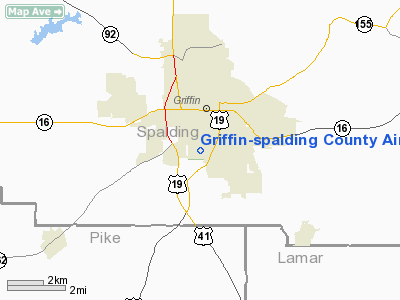
Griffin-spalding County Airport |
|
|
Location
& QuickFacts
|
FAA Information Effective: |
2007-01-18 |
|
Airport
Identifier: |
6A2 |
|
Airport
Status: |
Operational |
|
Longitude/Latitude: |
084-16-29.8000W/33-13-37.1000N
-84.274944/33.226972 (Estimated) |
|
Elevation: |
958 ft / 292.00 m (Surveyed) |
|
Land: |
198 acres |
|
From
nearest city: |
1 nautical miles S of Griffin, GA |
|
Location: |
Spalding County, GA |
|
Magnetic Variation: |
04W (2000) |
Owner
& Manager
|
Ownership: |
Privately owned |
|
Owner: |
City Of Griffin
AND SPALDING COUNTY. |
|
Address: |
231 East Solomon Street
Griffin, GA 30224 |
|
Phone
number: |
770-229-6425 |
|
Manager: |
Barry Griffith |
|
Address: |
1035 S Hill Street
Griffin, GA 30224 |
|
Phone number: |
770-229-2928 |
Airport
Operations and Facilities
|
Airport Use: |
Open to public |
|
Wind
indicator: |
Yes |
|
Segmented
Circle: |
No |
|
Control
Tower: |
No |
|
Lighting
Schedule: |
DUSK-DAWN
MIRL RY 14/32 AND PAPI RY 32 PRESET LOW INTST DUSK TO DAWN;
TO INCR INTST - CTAF. |
|
Beacon
Color: |
Clear-Green (lighted land airport) |
|
Landing
fee charge: |
No |
|
Sectional
chart: |
Atlanta |
|
Region: |
ASO - Southern |
|
Traffic
Pattern Alt: |
842 ft |
|
Boundary
ARTCC: |
ZTL - Atlanta |
|
Tie-in
FSS: |
MCN - Macon |
|
FSS
on Airport: |
No |
|
FSS
Phone: |
478-784-1155 |
|
FSS
Toll Free: |
1-800-WX-BRIEF |
|
NOTAMs
Facility: |
MCN (NOTAM-d service avaliable) |
|
Federal Agreements: |
NGY |
Airport
Communications
|
CTAF: |
123.075 |
|
Unicom: |
123.075 |
Airport
Services
|
Fuel available: |
100LLA
24 HR SELF-SVC FUEL AVBL. |
|
Airframe Repair: |
MAJOR |
|
Power Plant Repair: |
MAJOR |
|
Bottled
Oxygen: |
NONE |
|
Bulk
Oxygen: |
NONE |
|
Runway Information
Runway 14/32
|
Dimension: |
3701 x 75 ft / 1128.1 x 22.9 m |
|
Surface: |
ASPH, Fair Condition |
|
Weight
Limit: |
Single wheel: 26000 lbs.
Dual wheel: 30000 lbs. |
|
Edge
Lights: |
Medium |
|
|
Runway 14 |
Runway 32 |
|
Longitude: |
084-16-44.6555W |
084-16-14.8874W |
|
Latitude: |
33-13-50.5102N |
33-13-23.7752N |
|
Elevation: |
958.00
ft |
937.00
ft |
|
Alignment: |
127 |
127 |
|
Traffic
Pattern: |
Left |
Left |
|
Markings: |
Non-precision instrument, Fair Condition |
Non-precision instrument, Fair Condition |
|
Crossing
Height: |
0.00 ft |
25.00
ft |
|
Displaced
threshold: |
200.00
ft |
200.00
ft |
|
VASI: |
|
2-light PAPI on left side |
|
Visual
Glide Angle: |
0.00° |
3.00° |
|
Runway
End Identifier: |
Yes |
Yes |
|
Centerline
Lights: |
No |
No |
|
Touchdown
Lights: |
No |
No |
|
Obstruction: |
43 ft trees, 544.0 ft from runway, 250 ft right
of centerline, 8:1 slope to clear
RY 14 12:1 TO DSPLCD THLD, 43 FT TREES 725 FT FM DISP THLD,
190 FT L.
6 FT FENCE, +16 FT TREES AND BRUSH 145 FT R OF THLD. |
19 ft pole, 200.0 ft from runway, 210 ft right
of centerline
RWY 32 9:1 TO DSPLCD THLD, 19 FT POLE 371 FT FM DISP THLD,
210 FT R.
6 FT FENCE 78 FT R AND 94 FT L, 199 FT FM RY END. |
|
Radio Navigation
Aids
|
ID |
Type |
Name |
Ch |
Freq |
Var |
Dist |
|
JHH |
NDB |
Griffin |
|
412.00 |
04W |
3.5 nm |
|
FF |
NDB |
Pecat |
|
316.00 |
02W |
11.5 nm |
|
OP |
NDB |
Yates |
|
339.00 |
03W |
19.0 nm |
|
EQQ |
NDB |
Coweta County |
|
234.00 |
03W |
22.1 nm |
|
BR |
NDB |
Redan |
|
266.00 |
02W |
25.2 nm |
|
VOF |
NDB |
Alcovy |
|
370.00 |
03W |
34.6 nm |
|
FT |
NDB |
Flanc |
|
344.00 |
02W |
37.0 nm |
|
PIM |
NDB |
Pine Mountain |
|
272.00 |
03W |
37.9 nm |
|
JNM |
NDB |
Monroe |
|
392.00 |
03W |
41.2 nm |
|
GPQ |
NDB |
Carrollton |
|
278.00 |
02W |
47.5 nm |
|
DOB |
TACAN |
Dobbins |
077X |
|
01W |
42.9 nm |
|
PDK |
VOR/DME |
Peachtree |
113X |
116.60 |
02W |
39.0 nm |
|
ATL |
VORTAC |
Atlanta |
116X |
116.90 |
00W |
25.5 nm |
|
MCN |
VORTAC |
Macon |
089X |
114.20 |
01E |
45.2 nm |
|
LGC |
VORTAC |
Lagrange |
103X |
115.60 |
01E |
48.1 nm |
|
ATL |
VOT |
Atlanta Muni |
|
111.00 |
|
27.0 nm |
Remarks
Based Aircraft
|
Aircraft
based on field: |
101 |
|
Single
Engine Airplanes: |
73 |
|
Multi
Engine Airplanes: |
17 |
|
Jet Engine
Airplanes: |
4 |
|
Helicopters: |
4 |
|
Ultralights: |
3 |
Operational Statistics
Time Period: 2005-03-08
- 2006-03-07
|
Aircraft
Operations: |
55/Day |
|
General
Aviation Local: |
50.0% |
|
General
Aviation Itinerant: |
50.0% |
Griffin-spalding County Airport
Address:
Spalding County, GA
Tel:
770-229-6425,
770-229-2928
Images
and information placed above are from
http://www.airport-data.com/airport/6A2/
We
thank them for the data!
| General
Info |
| Country |
United
States |
| State |
GEORGIA
|
| FAA ID |
6A2
|
| Latitude |
33-13-37.100N
|
| Longitude |
084-16-29.800W
|
| Elevation |
958 feet
|
| Near City |
GRIFFIN
|
We don't guarantee the information is fresh and accurate. The data may
be wrong or outdated.
For more up-to-date information please refer to other sources.
|
|


