 |
|
|
|
|
|
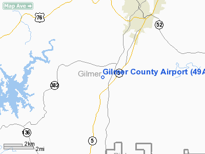
Location
& QuickFacts
|
FAA Information Effective: |
2007-01-18 |
|
Airport
Identifier: |
49A |
|
Airport
Status: |
Operational |
|
Longitude/Latitude: |
084-31-29.7440W/34-37-40.3110N
-84.524929/34.627864 (Estimated) |
|
Elevation: |
1486 ft / 452.93 m (Estimated) |
|
Land: |
80
acres |
|
From
nearest city: |
4 nautical miles S of Ellijay, GA |
|
Location: |
Gilmer County, GA |
|
Magnetic Variation: |
02W (1985) |
Owner
& Manager
|
Ownership: |
Publicly owned |
|
Owner: |
Gilmer County |
|
Address: |
County Courthouse
Ellijay, GA 30540 |
|
Phone number: |
706-635-4361 |
|
Manager: |
Jim Smith |
|
Address: |
51 Broad Street
Ellijay, GA 30540 |
|
Phone number: |
706-635-3406 |
Airport
Operations and Facilities
|
Airport Use: |
Open to public |
|
Wind
indicator: |
Yes |
|
Segmented
Circle: |
Yes |
|
Control
Tower: |
No |
|
Lighting
Schedule: |
DUSK-DAWN
RWY 03/21 MIRL - CTAF |
|
Beacon
Color: |
Clear-Green (lighted land airport) |
|
Landing
fee charge: |
No |
|
Sectional
chart: |
Atlanta |
|
Region: |
ASO - Southern |
|
Boundary
ARTCC: |
ZTL - Atlanta |
|
Tie-in
FSS: |
MCN - Macon |
|
FSS
on Airport: |
No |
|
FSS
Phone: |
478-784-1155 |
|
FSS
Toll Free: |
1-800-WX-BRIEF |
|
NOTAMs
Facility: |
MCN (NOTAM-d service avaliable) |
|
Federal Agreements: |
NY1 |
Airport
Communications
|
CTAF: |
123.000 |
|
Unicom: |
123.000 |
Airport
Services
|
Airframe Repair: |
NONE |
|
Power Plant Repair: |
NONE |
|
Bottled
Oxygen: |
NONE |
|
Bulk
Oxygen: |
NONE |
|
Runway Information
Runway 03/21
|
Dimension: |
3500 x 75 ft / 1066.8 x 22.9 m |
|
Surface: |
ASPH, Good Condition |
|
Weight
Limit: |
Single wheel: 30000 lbs.
Dual wheel: 41000 lbs. |
|
Edge
Lights: |
Medium |
|
|
Runway 03 |
Runway 21 |
|
Traffic
Pattern: |
Left |
Left |
|
Markings: |
Basic, Good Condition |
Basic, Good Condition |
|
Obstruction: |
14 ft trees, 760.0 ft from runway, 175 ft left
of centerline, 40:1 slope to clear |
31 ft trees, 1099.0 ft from runway, 125 ft
right of centerline, 29:1 slope to clear |
|
Radio Navigation
Aids
|
ID |
Type |
Name |
Ch |
Freq |
Var |
Dist |
|
JZP |
NDB |
Pickens County |
|
285.00 |
04W |
10.8 nm |
|
DJD |
NDB |
Canton |
|
415.00 |
04W |
22.6 nm |
|
UWI |
NDB |
Whitfield |
|
400.00 |
03W |
23.0 nm |
|
OUK |
NDB |
Calhoun |
|
323.00 |
02W |
24.1 nm |
|
EVZ |
NDB |
Cartersville |
|
308.00 |
04W |
30.2 nm |
|
HDI |
NDB |
Hardwick |
|
369.00 |
01W |
36.8 nm |
|
OYD |
NDB |
Floyd |
|
388.00 |
02W |
37.3 nm |
|
FKV |
NDB |
Flowery Branch |
|
365.00 |
03W |
39.9 nm |
|
TTQ |
NDB |
Tomotla |
|
335.00 |
01W |
40.6 nm |
|
CQN |
NDB |
Daisy |
|
341.00 |
02W |
44.9 nm |
|
MMI |
NDB |
Mc Minn County |
|
242.00 |
03W |
46.1 nm |
|
AJR |
NDB |
Habersham |
|
347.00 |
03W |
48.9 nm |
|
DOB |
TACAN |
Dobbins |
077X |
|
01W |
42.9 nm |
|
PDK |
VOR/DME |
Peachtree |
113X |
116.60 |
02W |
46.6 nm |
|
HRS |
VORTAC |
Harris |
035X |
109.80 |
00E |
35.5 nm |
|
GQO |
VORTAC |
Choo Choo |
105X |
115.80 |
01E |
36.9 nm |
|
RMG |
VORTAC |
Rome |
101X |
115.40 |
01E |
40.6 nm |
Based
Aircraft
|
Aircraft
based on field: |
1 |
|
Single
Engine Airplanes: |
1 |
Operational Statistics
Time Period: 2005-05-27
- 2006-05-26
|
Aircraft
Operations: |
49/Week |
|
General
Aviation Local: |
60.0% |
|
General
Aviation Itinerant: |
40.0% |
Gilmer County Airport
Address:
Gilmer County, GA
Tel:
706-635-4361, 706-635-3406
Images
and information placed above are from
http://www.airport-data.com/airport/49A/
We
thank them for the data!
| General
Info |
| Country |
United
States |
| State |
GEORGIA
|
| FAA ID |
49A
|
| Latitude |
34-37-40.311N
|
| Longitude |
084-31-29.744W
|
| Elevation |
1486 feet
|
| Near City |
ELLIJAY
|
We don't guarantee the information is fresh and accurate. The data may
be wrong or outdated.
For more up-to-date information please refer to other sources.
|
|


