 |
|
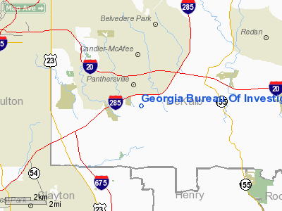
Georgia Bureau Of Investigation Heliport |
Location
& QuickFacts
|
FAA Information Effective: |
2007-01-18 |
|
Airport
Identifier: |
2GE4 |
|
Airport
Status: |
Operational |
|
Longitude/Latitude: |
084-16-20.0000W/33-41-28.0000N
-84.272222/33.691111 (Estimated) |
|
Elevation: |
800 ft / 243.84 m (Estimated) |
|
Land: |
0
acres |
|
From
nearest city: |
0 nautical miles N of Decatur, GA |
|
Location: |
De Kalb County, GA |
|
Magnetic Variation: |
03W (1995) |
Owner
& Manager
|
Ownership: |
Publicly owned |
|
Owner: |
Georgia Bureau Of Investigation |
|
Address: |
3121 Panthersville Road
Decatur, GA 30037 |
|
Phone
number: |
404-244-2600 |
|
Manager: |
E. Scott Cown |
|
Address: |
P.o. Box 370808
Decatur, GA 30037-0808 |
|
Phone number: |
404-244-2515 |
Airport
Operations and Facilities
|
Airport Use: |
Private
HELIPORT UTILIZED FOR STATE & FEDERAL LAW ENFORCEMENT
OPNS. |
|
Wind
indicator: |
Yes |
|
Segmented
Circle: |
No |
|
Control
Tower: |
No |
|
Sectional
chart: |
Atlanta |
|
Region: |
ASO - Southern |
|
Boundary
ARTCC: |
ZTL - Atlanta |
|
Tie-in
FSS: |
MCN - Macon |
|
FSS
Phone: |
478-784-1155 |
|
FSS
Toll Free: |
1-800-WX-BRIEF |
|
Runway Information
Helipad H1
|
Dimension: |
40 x 20 ft / 12.2 x 6.1 m |
|
Surface: |
CONC, Good Condition |
|
|
Runway H1 |
Runway |
|
Traffic
Pattern: |
Left |
Left |
|
Markings: |
Basic, |
, |
|
Radio Navigation
Aids
|
ID |
Type |
Name |
Ch |
Freq |
Var |
Dist |
|
BR |
NDB |
Redan |
|
266.00 |
02W |
3.4 nm |
|
FT |
NDB |
Flanc |
|
344.00 |
02W |
18.8 nm |
|
VOF |
NDB |
Alcovy |
|
370.00 |
03W |
24.8 nm |
|
FF |
NDB |
Pecat |
|
316.00 |
02W |
25.8 nm |
|
JNM |
NDB |
Monroe |
|
392.00 |
03W |
27.4 nm |
|
JHH |
NDB |
Griffin |
|
412.00 |
04W |
30.5 nm |
|
EQQ |
NDB |
Coweta County |
|
234.00 |
03W |
34.2 nm |
|
DJD |
NDB |
Canton |
|
415.00 |
04W |
35.4 nm |
|
FKV |
NDB |
Flowery Branch |
|
365.00 |
03W |
35.8 nm |
|
BMW |
NDB |
Barrow County |
|
404.00 |
03W |
37.1 nm |
|
EVZ |
NDB |
Cartersville |
|
308.00 |
04W |
41.8 nm |
|
DDA |
NDB |
Commerce |
|
244.00 |
03W |
43.6 nm |
|
GPQ |
NDB |
Carrollton |
|
278.00 |
02W |
43.6 nm |
|
OP |
NDB |
Yates |
|
339.00 |
03W |
46.6 nm |
|
JZP |
NDB |
Pickens County |
|
285.00 |
04W |
46.9 nm |
|
DOB |
TACAN |
Dobbins |
077X |
|
01W |
17.8 nm |
|
PDK |
VOR/DME |
Peachtree |
113X |
116.60 |
02W |
11.2 nm |
|
ATL |
VORTAC |
Atlanta |
116X |
116.90 |
00W |
9.0 nm |
|
AHN |
VORTAC |
Athens |
33 |
109.60 |
00E |
49.8 nm |
|
ATL |
VOT |
Atlanta Muni |
|
111.00 |
|
7.9 nm |
Remarks
- PRVDD
VFR/PVT USE, APCH/DEP 080-100 CLKWS AND 240-360 CLKWS, AREA IS MKD,
WIND INDICATOR IS MAINTAINED.
Georgia Bureau Of Investigation Heliport
Address:
De Kalb County, GA
Tel:
404-244-2600,
404-244-2515
Images
and information placed above are from
http://www.airport-data.com/airport/2GE4/
We
thank them for the data!
| General
Info |
| Country |
United
States |
| State |
GEORGIA
|
| FAA ID |
2GE4
|
| Latitude |
33-41-28.000N
|
| Longitude |
084-16-20.000W
|
| Elevation |
800 feet
|
| Near City |
DECATUR
|
We don't guarantee the information is fresh and accurate. The data may
be wrong or outdated.
For more up-to-date information please refer to other sources.
|
|


