 |
|
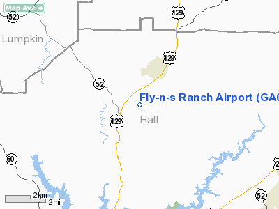
Location
& QuickFacts
|
FAA Information Effective: |
2007-01-18 |
|
Airport
Identifier: |
GA09 |
|
Airport
Status: |
Operational |
|
Longitude/Latitude: |
083-47-19.0000W/34-27-06.0000N
-83.788611/34.451667 (Estimated) |
|
Elevation: |
1330 ft / 405.38 m (Estimated) |
|
Land: |
150 acres |
|
From
nearest city: |
2 nautical miles SW of Clermont, GA |
|
Location: |
Hall County, GA |
|
Magnetic Variation: |
04W (1995) |
Owner
& Manager
|
Ownership: |
Privately owned |
|
Owner: |
Anthony D. Sosebee |
|
Address: |
P.o. Box 232
Clermont, GA 30527 |
|
Phone
number: |
770-983-9794 |
|
Manager: |
Anthony D. Sosebee |
|
Address: |
P.o. Box 232
Clermont, GA 30527 |
|
Phone number: |
770-983-9794 |
Airport
Operations and Facilities
|
Airport Use: |
Private |
|
Wind
indicator: |
Yes |
|
Segmented
Circle: |
No |
|
Control
Tower: |
No |
|
Sectional
chart: |
Atlanta |
|
Region: |
ASO - Southern |
|
Boundary
ARTCC: |
ZTL - Atlanta |
|
Tie-in
FSS: |
MCN - Macon |
|
FSS
Phone: |
478-784-1155 |
|
FSS
Toll Free: |
1-800-WX-BRIEF |
|
Runway Information
Runway 03/21
|
Dimension: |
1850 x 24 ft / 563.9 x 7.3 m |
|
Surface: |
ASPH, |
|
|
Runway 03 |
Runway 21 |
|
Traffic
Pattern: |
Left |
Left |
|
Markings: |
Nonstandard,
RY 03/21 MKD WITH CNTRLN STRIPE, EDGE STRIPES & RY 03
NRS. NO
RY 21 NRS. |
Nonstandard, |
|
Obstruction: |
|
75 ft pline, 300.0 ft from runway |
|
Radio Navigation
Aids
|
ID |
Type |
Name |
Ch |
Freq |
Var |
Dist |
|
AJR |
NDB |
Habersham |
|
347.00 |
03W |
12.2 nm |
|
FKV |
NDB |
Flowery Branch |
|
365.00 |
03W |
16.0 nm |
|
DDA |
NDB |
Commerce |
|
244.00 |
03W |
26.9 nm |
|
BMW |
NDB |
Barrow County |
|
404.00 |
03W |
32.6 nm |
|
JZP |
NDB |
Pickens County |
|
285.00 |
04W |
33.3 nm |
|
DJD |
NDB |
Canton |
|
415.00 |
04W |
36.7 nm |
|
TTQ |
NDB |
Tomotla |
|
335.00 |
01W |
40.8 nm |
|
BJT |
NDB |
Bulldog |
|
221.00 |
03W |
41.3 nm |
|
JNM |
NDB |
Monroe |
|
392.00 |
03W |
43.0 nm |
|
CEU |
NDB |
Clemson |
|
257.00 |
05W |
46.6 nm |
|
VOF |
NDB |
Alcovy |
|
370.00 |
03W |
49.4 nm |
|
DOB |
TACAN |
Dobbins |
077X |
|
01W |
48.2 nm |
|
PDK |
VOR/DME |
Peachtree |
113X |
116.60 |
02W |
42.9 nm |
|
ODF |
VORTAC |
Foothills |
081X |
113.40 |
00E |
28.4 nm |
|
HRS |
VORTAC |
Harris |
035X |
109.80 |
00E |
30.2 nm |
|
AHN |
VORTAC |
Athens |
33 |
109.60 |
00E |
38.1 nm |
|
ELW |
VORTAC |
Electric City |
023X |
108.60 |
00E |
49.8 nm |
Remarks
Based
Aircraft
|
Aircraft
based on field: |
1 |
|
Single
Engine Airplanes: |
1 |
Fly-n-s Ranch Airport
Address:
Hall County, GA
Tel:
770-983-9794
Images
and information placed above are from
http://www.airport-data.com/airport/GA09/
We
thank them for the data!
| General
Info |
| Country |
United
States |
| State |
GEORGIA
|
| FAA ID |
GA09
|
| Latitude |
34-27-06.000N
|
| Longitude |
083-47-19.000W
|
| Elevation |
1330 feet
|
| Near City |
CLERMONT
|
We don't guarantee the information is fresh and accurate. The data may
be wrong or outdated.
For more up-to-date information please refer to other sources.
|
|


