 |
|
Fitzgerald Municipal Airport |
|
|
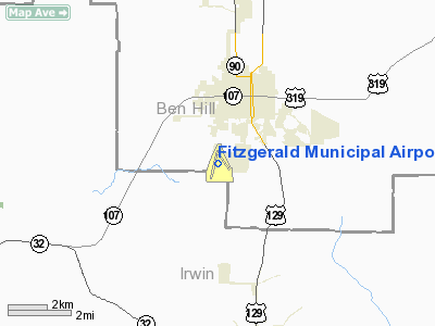
Location
& QuickFacts
|
FAA Information Effective: |
2007-01-18 |
|
Airport
Identifier: |
FZG |
|
Airport
Status: |
Operational |
|
Longitude/Latitude: |
083-16-13.6580W/31-41-01.2720N
-83.270461/31.683687 (Estimated) |
|
Elevation: |
365 ft / 111.25 m (Estimated) |
|
Land: |
271 acres |
|
From
nearest city: |
2 nautical miles SW of Fitzgerald, GA |
|
Location: |
Ben Hill County, GA |
|
Magnetic Variation: |
03W (1990) |
Owner
& Manager
|
Ownership: |
Publicly owned |
|
Owner: |
City Of Fitzgerald & Ben Hill |
|
Address: |
Po Box 963
Fitzgerald, GA 31750 |
|
Phone
number: |
229-426-5060 |
|
Manager: |
Barbara Mc Donald |
|
Address: |
Box 963, 125 Terminal Drive
Fitzgerald, GA 31750 |
|
Phone number: |
229-426-5071 |
Airport
Operations and Facilities
|
Airport Use: |
Open to public |
|
Wind
indicator: |
Yes |
|
Segmented
Circle: |
Yes |
|
Control
Tower: |
No |
|
Lighting
Schedule: |
DUSK-DAWN
MIRL RY 01/19 & VASI RYS 01 & 19 PRESET MED INTST
DUSK-2200; AFT 2200 ACTVT - CTAF. ACTVT ODALS RY 01 - CTAF. |
|
Beacon
Color: |
Clear-Green (lighted land airport) |
|
Landing
fee charge: |
No |
|
Sectional
chart: |
Jacksonville |
|
Region: |
ASO - Southern |
|
Boundary
ARTCC: |
ZJX - Jacksonville |
|
Tie-in
FSS: |
MCN - Macon |
|
FSS
on Airport: |
No |
|
FSS
Phone: |
478-784-1155 |
|
FSS
Toll Free: |
1-800-WX-BRIEF |
|
NOTAMs
Facility: |
MCN (NOTAM-d service avaliable) |
|
Federal Agreements: |
NGY |
Airport
Communications
|
CTAF: |
123.000 |
|
Unicom: |
123.000 |
Airport
Services
|
Fuel available: |
100LLA1+ |
|
Airframe Repair: |
MAJOR |
|
Power Plant Repair: |
MAJOR |
|
Bottled
Oxygen: |
NONE |
|
Bulk
Oxygen: |
NONE |
|
Runway Information
Runway 01/19
|
Dimension: |
5002 x 100 ft / 1524.6 x 30.5 m |
|
Surface: |
ASPH, Good Condition |
|
Weight
Limit: |
Dual wheel: 28000 lbs. |
|
Edge
Lights: |
Medium |
|
|
Runway 01 |
Runway 19 |
|
Longitude: |
083-16-28.6750W |
083-16-16.7520W |
|
Latitude: |
31-40-35.4620N |
31-41-23.8970N |
|
Elevation: |
356.00
ft |
364.00
ft |
|
Alignment: |
12 |
127 |
|
ILS
Type: |
LOCALIZER |
|
|
Traffic
Pattern: |
Left |
Left |
|
Markings: |
Non-precision instrument, Good Condition |
Non-precision instrument, Good Condition |
|
VASI: |
4-box on left side |
4-box on left side |
|
Approach
lights: |
ODALS |
|
|
Obstruction: |
41 ft trees, 1553.0 ft from runway, 450 ft
right of centerline, 33:1 slope to clear |
72 ft trees, 2000.0 ft from runway, 25 ft right
of centerline, 25:1 slope to clear |
|
Runway 15/33
|
Dimension: |
3400 x 300 ft / 1036.3 x 91.4 m |
|
Surface: |
TURF, Good Condition |
|
|
Runway 15 |
Runway 33 |
|
Longitude: |
083-16-13.5580W |
083-15-48.5570W |
|
Latitude: |
31-41-17.6710N |
31-40-51.6720N |
|
Elevation: |
365.00
ft |
332.00
ft |
|
Alignment: |
127 |
127 |
|
Traffic
Pattern: |
Left |
Left |
|
Obstruction: |
50 ft trees, 1100.0 ft from runway, 200 ft
right of centerline, 22:1 slope to clear |
36 ft trees, 324.0 ft from runway, 150 ft right
of centerline, 9:1 slope to clear
20:1 APCH SLOPE TO DSPLCD THLD. |
|
Radio Navigation
Aids
|
ID |
Type |
Name |
Ch |
Freq |
Var |
Dist |
|
SUR |
NDB |
Fitzgerald |
|
362.00 |
03W |
4.4 nm |
|
TM |
NDB |
Tifto |
|
409.00 |
03W |
21.2 nm |
|
OWC |
NDB |
Coffee County |
|
390.00 |
03W |
24.4 nm |
|
EZM |
NDB |
Eastman |
|
366.00 |
04W |
27.7 nm |
|
MQW |
NDB |
Mc Rae |
|
280.00 |
03W |
31.6 nm |
|
AZE |
NDB |
Hazlehurst |
|
414.00 |
03W |
34.0 nm |
|
OHY |
NDB |
Coney |
|
400.00 |
02W |
35.6 nm |
|
BHC |
NDB |
Baxley |
|
376.00 |
04W |
45.1 nm |
|
HOE |
NDB |
Homerville |
|
209.00 |
03W |
45.6 nm |
|
DB |
NDB |
Creke |
|
251.00 |
04W |
49.9 nm |
|
IFM |
VOR |
Tift Myers |
|
112.50 |
01W |
19.0 nm |
|
MGR |
VOR/DME |
Moultrie |
025X |
108.80 |
02W |
45.4 nm |
|
VNA |
VORTAC |
Vienna |
112X |
116.50 |
01E |
33.9 nm |
|
AMG |
VORTAC |
Alma |
098X |
115.10 |
00E |
40.0 nm |
|
VAD |
VORTAC |
Moody |
080X |
113.30 |
03W |
43.7 nm |
|
AYS |
VORTAC |
Waycross |
039X |
110.20 |
00E |
44.3 nm |
Remarks
- PAEW
ADJ RY 01/19.
- GCO
AVBL ON FREQ 121.725 THRU MACON FSS.
Based
Aircraft
|
Aircraft
based on field: |
20 |
|
Single
Engine Airplanes: |
18 |
|
Multi
Engine Airplanes: |
1 |
|
Ultralights: |
1 |
Operational Statistics
Time Period: 2005-03-15
- 2006-03-14
|
Aircraft
Operations: |
212/Week |
|
General
Aviation Local: |
72.7% |
|
General
Aviation Itinerant: |
27.3% |
Fitzgerald Municipal Airport
Address:
Ben Hill County, GA
Tel:
229-426-5060,
229-426-5071
Images
and information placed above are from
http://www.airport-data.com/airport/FZG/
We
thank them for the data!
| General
Info |
| Country |
United
States |
| State |
GEORGIA
|
| FAA ID |
FZG
|
| Latitude |
31-41-01.272N
|
| Longitude |
083-16-13.658W
|
| Elevation |
365 feet
|
| Near City |
FITZGERALD
|
We don't guarantee the information is fresh and accurate. The data may
be wrong or outdated.
For more up-to-date information please refer to other sources.
|
|


