 |
|
Emory University Hospital Heliport |
|
|
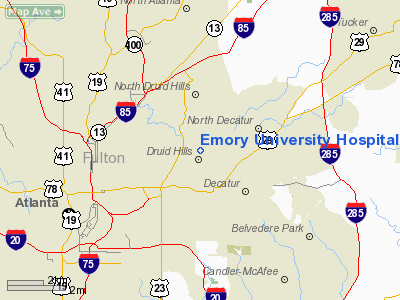
Location
& QuickFacts
|
FAA Information Effective: |
2007-01-18 |
|
Airport
Identifier: |
7GA8 |
|
Airport
Status: |
Operational |
|
Longitude/Latitude: |
084-19-31.7280W/33-47-32.3780N
-84.325480/33.792327 (Estimated) |
|
Elevation: |
1051 ft / 320.34 m (Estimated) |
|
Land: |
0
acres |
|
From
nearest city: |
0 nautical miles N of Atlanta, GA |
|
Location: |
De Kalb County, GA |
|
Magnetic Variation: |
02W (1985) |
Owner
& Manager
|
Ownership: |
Privately owned |
|
Owner: |
Emory University Hospital |
|
Address: |
1364 Clifton Road Ne
Atlanta, GA 30322 |
|
Phone
number: |
404-727-4881 |
|
Manager: |
Jim Speelman |
|
Address: |
Emory Univ Hospital Room Hb40, 1364 Clifton
Rd Ne
Atlanta, GA 30322 |
|
Phone number: |
404-727-4881 |
Airport
Operations and Facilities
|
Airport Use: |
Private
MEDICAL USE. |
|
Wind
indicator: |
Yes |
|
Segmented
Circle: |
No |
|
Control
Tower: |
No |
|
Lighting
Schedule: |
RDO-CTL
ACTVT ROTG BCN AND PERIMETER LIGHTS - 123.05. |
|
Beacon
Color: |
Clear-Green-Yellow (heliport) |
|
Sectional
chart: |
Atlanta |
|
Region: |
ASO - Southern |
|
Boundary
ARTCC: |
ZTL - Atlanta |
|
Tie-in
FSS: |
MCN - Macon |
|
FSS
on Airport: |
No |
|
FSS
Phone: |
478-784-1155 |
|
FSS
Toll Free: |
1-800-WX-BRIEF |
|
Runway Information
Helipad H1
|
Dimension: |
39 x 39 ft / 11.9 x 11.9 m |
|
Surface: |
CONC,
ROOFTOP PAD. |
|
|
Runway H1 |
Runway |
|
Traffic
Pattern: |
Left |
Left |
|
Radio Navigation
Aids
|
ID |
Type |
Name |
Ch |
Freq |
Var |
Dist |
|
BR |
NDB |
Redan |
|
266.00 |
02W |
8.9 nm |
|
FT |
NDB |
Flanc |
|
344.00 |
02W |
15.8 nm |
|
DJD |
NDB |
Canton |
|
415.00 |
04W |
28.8 nm |
|
VOF |
NDB |
Alcovy |
|
370.00 |
03W |
28.9 nm |
|
JNM |
NDB |
Monroe |
|
392.00 |
03W |
30.1 nm |
|
FF |
NDB |
Pecat |
|
316.00 |
02W |
30.6 nm |
|
FKV |
NDB |
Flowery Branch |
|
365.00 |
03W |
32.4 nm |
|
EVZ |
NDB |
Cartersville |
|
308.00 |
04W |
35.6 nm |
|
JHH |
NDB |
Griffin |
|
412.00 |
04W |
36.9 nm |
|
EQQ |
NDB |
Coweta County |
|
234.00 |
03W |
37.6 nm |
|
BMW |
NDB |
Barrow County |
|
404.00 |
03W |
37.7 nm |
|
JZP |
NDB |
Pickens County |
|
285.00 |
04W |
40.5 nm |
|
GPQ |
NDB |
Carrollton |
|
278.00 |
02W |
42.5 nm |
|
DDA |
NDB |
Commerce |
|
244.00 |
03W |
43.3 nm |
|
OUK |
NDB |
Calhoun |
|
323.00 |
02W |
47.3 nm |
|
DOB |
TACAN |
Dobbins |
077X |
|
01W |
11.7 nm |
|
PDK |
VOR/DME |
Peachtree |
113X |
116.60 |
02W |
5.2 nm |
|
ATL |
VORTAC |
Atlanta |
116X |
116.90 |
00W |
11.2 nm |
|
RMG |
VORTAC |
Rome |
101X |
115.40 |
01E |
45.4 nm |
|
ATL |
VOT |
Atlanta Muni |
|
111.00 |
|
9.5 nm |
Remarks
- FOR
NOISE ABATEMENT USE STEEP APCH ANGLE, MAINTAIN 100 FT AGL IF POSSIBLE
BUT NO LESS THAN 500 FT AGL UNTIL APCH ANGLE IS INTERCEPTED; ALL APCH/DEP
ALONG 150/330.
- MAXIMUM
ACFT WEIGHT 10000 LBS.
- PRVDD
ALL OPNS ARE CONDUCTED IN VFR WX CONDS; LIMITED TO PVT USE; TAKEOFF/LANDING
AREA IS MARKED; A NON-OBSTR WIND INDICATOR IS MAINTAINED; APCH/DEP OPNS
CONDUCTED FROM 085 TO 120 AND FROM 200 TO 020; AN OPNL LOA IS EXECUTED
AND MAINTAINED WITH VA MEDICAL CENTER HELIPORT.
Emory University Hospital Heliport
Address:
De Kalb County, GA
Tel:
404-727-4881
Images
and information placed above are from
http://www.airport-data.com/airport/7GA8/
We
thank them for the data!
| General
Info |
| Country |
United
States |
| State |
GEORGIA
|
| FAA ID |
7GA8
|
| Latitude |
33-47-32.378N
|
| Longitude |
084-19-31.728W
|
| Elevation |
1051 feet
|
| Near City |
ATLANTA
|
We don't guarantee the information is fresh and accurate. The data may
be wrong or outdated.
For more up-to-date information please refer to other sources.
|
|


