 |
|
|
|
|
|
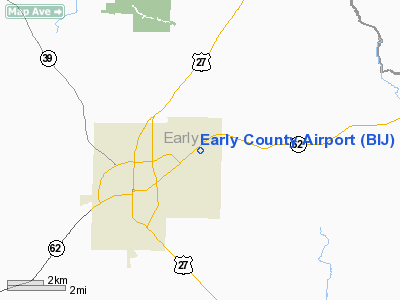
Location
& QuickFacts
|
FAA Information Effective: |
2007-01-18 |
|
Airport
Identifier: |
BIJ |
|
Airport
Status: |
Operational |
|
Longitude/Latitude: |
084-53-41.2720W/31-23-51.0310N
-84.894798/31.397509 (Estimated) |
|
Elevation: |
214 ft / 65.23 m (Surveyed) |
|
Land: |
80
acres |
|
From
nearest city: |
3 nautical miles E of Blakely, GA |
|
Location: |
Early County, GA |
|
Magnetic Variation: |
03W (2000) |
Owner
& Manager
|
Ownership: |
Publicly owned |
|
Owner: |
Early County |
|
Address: |
County Courthouse, Po Box 693
Blakely, GA 39823 |
|
Phone number: |
220-723-4304 |
|
Manager: |
David Record |
|
Address: |
Po Box 567
Blakely, GA 39823 |
|
Phone number: |
229-723-5056 |
Airport
Operations and Facilities
|
Airport Use: |
Open to public |
|
Wind
indicator: |
Yes |
|
Segmented
Circle: |
Yes |
|
Control
Tower: |
No |
|
Lighting
Schedule: |
DUSK-DAWN
ACTVT MIRL RY 05/23 AND PAPI RYS 05 AND 23 - CTAF. |
|
Beacon
Color: |
Clear-Green (lighted land airport) |
|
Landing
fee charge: |
No |
|
Sectional
chart: |
Jacksonville |
|
Region: |
ASO - Southern |
|
Traffic
Pattern Alt: |
987 ft |
|
Boundary
ARTCC: |
ZJX - Jacksonville |
|
Tie-in
FSS: |
MCN - Macon |
|
FSS
on Airport: |
No |
|
FSS
Phone: |
478-784-1155 |
|
FSS
Toll Free: |
1-800-WX-BRIEF |
|
NOTAMs
Facility: |
MCN (NOTAM-d service avaliable) |
|
Federal Agreements: |
NGY |
Airport
Communications
Airport
Services
|
Airframe Repair: |
MAJOR |
|
Power Plant Repair: |
MINOR |
|
Bottled
Oxygen: |
NONE |
|
Bulk
Oxygen: |
NONE |
|
Runway Information
Runway 05/23
|
Dimension: |
5500 x 100 ft / 1676.4 x 30.5 m |
|
Surface: |
ASPH, Fair Condition |
|
Weight
Limit: |
Single wheel: 21000 lbs. |
|
Edge
Lights: |
Medium |
|
|
Runway 05 |
Runway 23 |
|
Longitude: |
084-54-05.4170W |
084-53-17.1260W |
|
Latitude: |
31-23-33.3750N |
31-24-08.6870N |
|
Elevation: |
214.00
ft |
205.00
ft |
|
Alignment: |
50 |
127 |
|
ILS
Type: |
|
LOCALIZER |
|
Traffic
Pattern: |
Left |
Left |
|
Markings: |
Non-precision instrument, Good Condition |
Non-precision instrument, Good Condition |
|
Crossing
Height: |
36.00
ft |
30.00
ft |
|
VASI: |
2-light PAPI on left side |
2-light PAPI on left side |
|
Visual
Glide Angle: |
3.00° |
3.00° |
|
Approach
lights: |
|
MALSF |
|
Obstruction: |
49 ft trees, 592.0 ft from runway, 200 ft left
of centerline, 8:1 slope to clear |
30 ft trees, 200.0 ft from runway, 490 ft left
of centerline
+30 FT TREES 90 FT FROM RWY END AND 170 FT TO 500+ FT LEFT;
AND +19 FT TREES 190 FT FROM RWY END AND 180 FT RIGHT. |
|
Radio Navigation
Aids
|
ID |
Type |
Name |
Ch |
Freq |
Var |
Dist |
|
IWJ |
NDB |
Blaak |
|
344.00 |
03W |
5.2 nm |
|
LYZ |
NDB |
Willis |
|
359.00 |
01W |
31.8 nm |
|
AB |
NDB |
Putny |
|
227.00 |
02W |
31.9 nm |
|
CXU |
NDB |
Camilla |
|
369.00 |
02W |
35.5 nm |
|
SMY |
NDB |
Soyya |
|
329.00 |
02W |
35.9 nm |
|
HYE |
NDB |
Hanchey |
|
221.00 |
00E |
38.8 nm |
|
LOR |
NDB |
Lowe |
|
269.00 |
03W |
43.6 nm |
|
OZ |
NDB |
Ruckr |
|
212.00 |
00E |
48.4 nm |
|
CYR |
NDB |
Caidy |
|
338.00 |
01W |
48.7 nm |
|
BKK |
NDB |
Tri County |
|
275.00 |
02W |
49.0 nm |
|
HEY |
VOR |
Hanchey |
|
110.60 |
02E |
38.9 nm |
|
FYL |
VOR |
Tri County |
|
108.40 |
08W |
49.6 nm |
|
OZR |
VOR/DME |
Cairns |
049X |
111.20 |
02E |
43.4 nm |
|
RRS |
VORTAC |
Wiregrass |
053X |
111.60 |
02E |
28.4 nm |
|
PZD |
VORTAC |
Pecan |
108X |
116.10 |
02W |
34.5 nm |
|
EUF |
VORTAC |
Eufaula |
029X |
109.20 |
02E |
35.3 nm |
|
MAI |
VORTAC |
Marianna |
087X |
114.00 |
00E |
38.6 nm |
Remarks
- GCO
AVBL ON FREQ 121.725 THRU MCN FSS.
- VFR
OPERATIONS ONLY.
Based
Aircraft
|
Aircraft
based on field: |
5 |
|
Single
Engine Airplanes: |
4 |
|
Ultralights: |
1 |
Operational Statistics
Time Period: 2005-04-07
- 2006-04-06
|
Aircraft
Operations: |
154/Week |
|
General
Aviation Local: |
31.3% |
|
General
Aviation Itinerant: |
18.8% |
|
Military: |
50.0% |
Early County Airport
Address:
Early County, GA
Tel:
220-723-4304, 229-723-5056
Images
and information placed above are from
http://www.airport-data.com/airport/BIJ/
We
thank them for the data!
| General
Info |
| Country |
United
States |
| State |
GEORGIA
|
| FAA ID |
BIJ
|
| Latitude |
31.397508
31° 23' 51.03" N |
| Longitude |
-84.894797
084° 53' 41.27" W |
| Elevation |
214 feet
65 meters |
| Magnetic
Variation |
003° W
(01/06) |
| Beacon |
Yes
|
| Operating
Agency |
U.S.CIVIL
AIRPORT WHEREIN PERMIT COVERS USE BY TRANSIT MILITARY AIRCRAFT
|
| Daylight
Saving Time |
Second
Sunday in March at 0200 to first Sunday in November at 0200 local
time (Exception Arizona and that portion of Indiana in the Eastern
Time Zone) |
We don't guarantee the information is fresh and accurate. The data may
be wrong or outdated.
For more up-to-date information please refer to other sources.
|
|


