|
|
| DeKalb-Peachtree Airport |
 |
| IATA: PDK â ICAO: KPDK |
| Summary |
| Airport type |
Public |
| Operator |
DeKalb County |
| Location |
Atlanta, Georgia |
| Coordinates |
33°52â²32.2â³N 84°18â²07.1â³W / 33.875611°N 84.301972°W / 33.875611; -84.301972Coordinates: 33°52â²32.2â³N 84°18â²07.1â³W / 33.875611°N 84.301972°W / 33.875611; -84.301972 |
| Runways |
| Direction |
Length |
Surface |
| ft |
m |
| 2R/20L |
6,000 |
1,829 |
Concrete |
| 2L/20R |
3,746 |
1,142 |
Asphalt |
| 16/34 |
3,967 |
1,209 |
Asphalt |
| 9/27 |
3,383 |
1,031 |
Asphalt |
| Helipads |
| Number |
Length |
Surface |
| ft |
m |
| H1 |
56 |
17 |
Concrete |
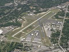
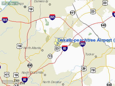
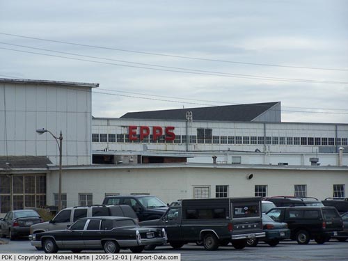
DeKalb-Peachtree Airport (IATA: PDK, ICAO: KPDK) is a municipal general aviation airport located in Chamblee, Georgia, just northeast of Atlanta. It is operated by the local government of DeKalb County, Georgia, and is also known commonly as Peachtree-DeKalb Airport, or simply PDK. Other names (rarely used) include Peachtree Airport, DeKalb Airport, or DeKalb County Airport. It is more commonly called "Peachtree DeKalb". ASOS weather reports are produced 24 hours per day as "Chamblee". On the radio, however, it is referred to as "Peachtree Tower" or "Peachtree Ground". History
The airport originally began during early World War II as Naval Air Station Atlanta, now located in Marietta on the south side of Dobbins Air Reserve Base. The property was part of Camp Gordon, a World War I era training camp. Leased from the county by the United States Navy, it was converted from military to civilian use from 1957 to 1959. The former barracks located there during the war became classrooms in late 1948 for Southern Technical Institute, a new engineering technology school created by Georgia Tech for former soldiers. Like NAS Atlanta, that school moved around 1958 to land donated by Dobbins, and is now known as Southern Polytechnic State University.
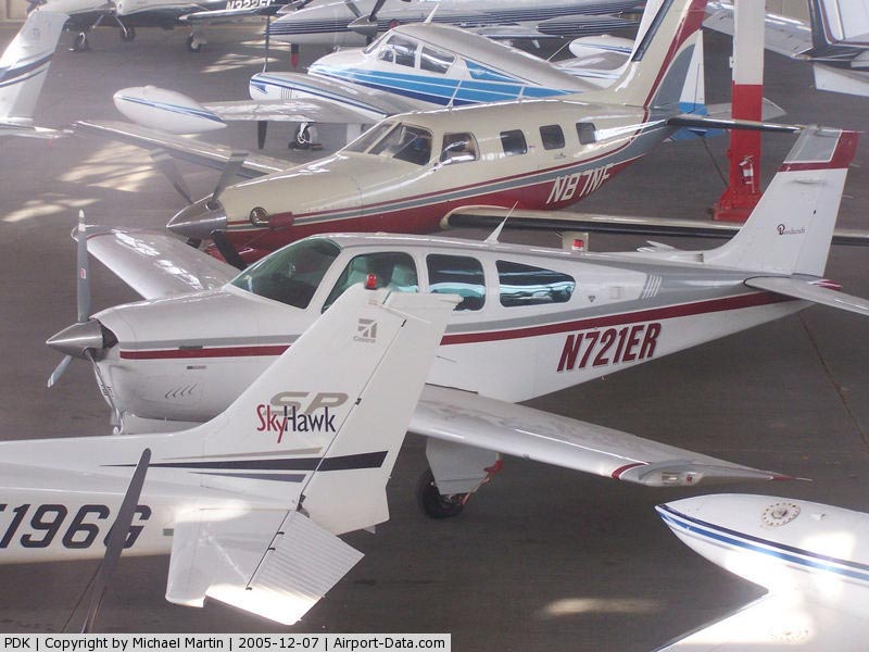
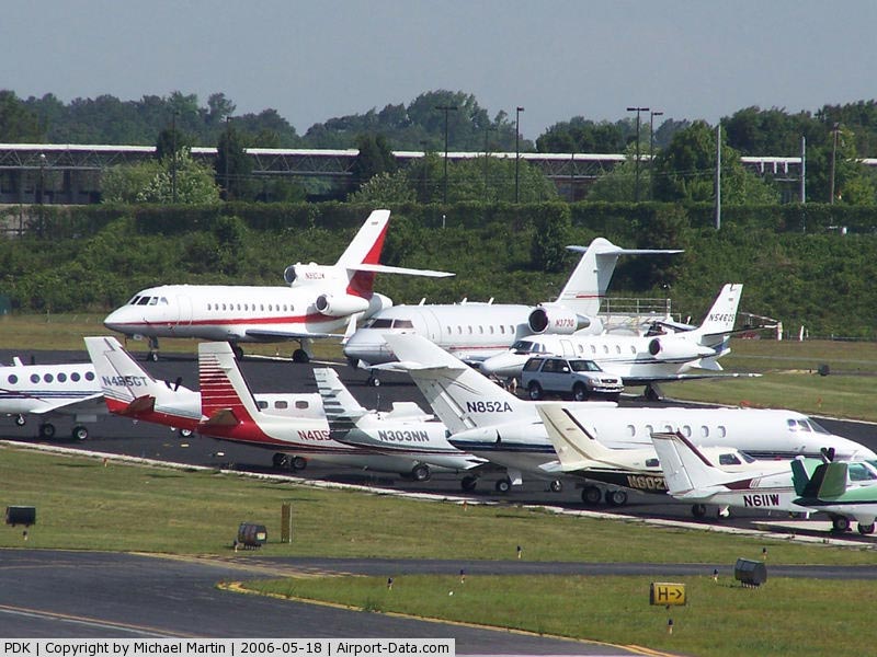
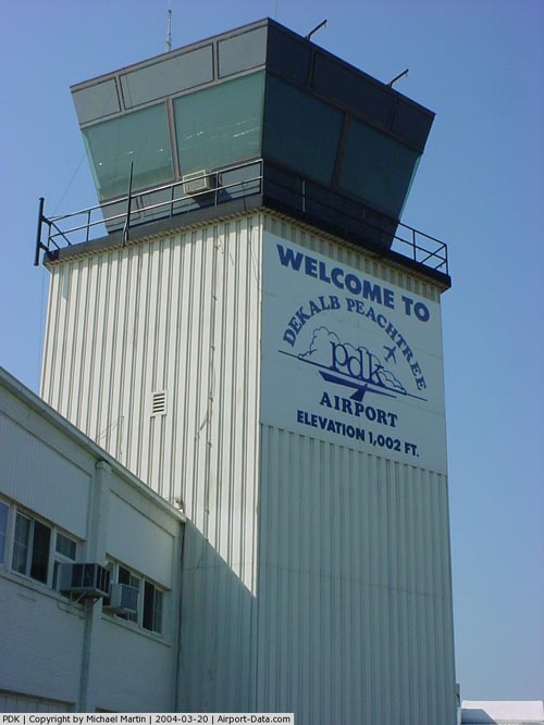
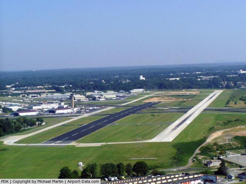
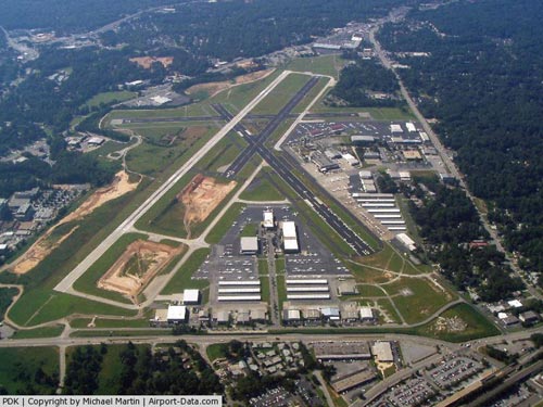
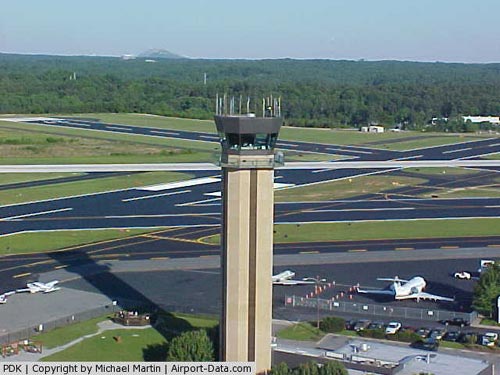
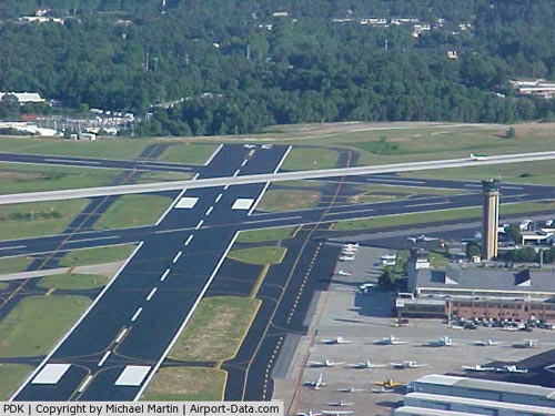
Facilities
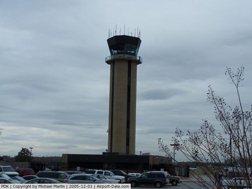
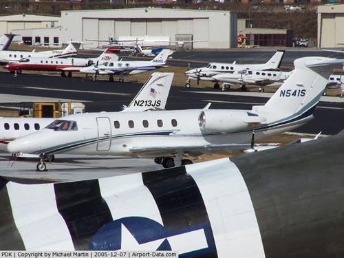
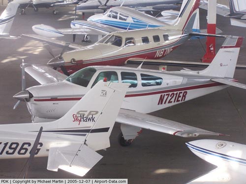
The airport still has 765 acres (3.10 km) of land, with over 100 hangars and several hundred aircraft based there. It is the second-busiest airport in Georgia behind Hartsfield-Jackson Atlanta International Airport in the number of flight operations per year (around 250,000), and helps to relieve ATL of smaller-airplane traffic. It also has a helipad, used by helicopters for metro Atlanta's four major news TV stations (WSB-TV 2, WAGA-TV 5, WXIA-TV 11, WGCL-TV 46) as the base for electronic news gathering from the air. PDK is also home to The AutoPILOT Magazine, an advertorial publication covering all things aviation-related. A control tower was built in 1988, and stands at 130 feet (40 m) tall. The main runway (20L) is 6,000 feet (1,800 m) long.
Economic impact
DeKalb Peachtree Airport occupies a prime location inside the Perimeter, located less than fifteen minutes from Atlanta's major business centers in Buckhead and Midtown. This proximity drives the 600 operations logged daily by the airport which makes it the second busiest in the state of Georgia behind Hartsfield-Jackson International Airport, the world's busiest, located eighteen miles (29 km) away.
In 1997, DeKalb Peachtree Airport was one of the largest tax contributors of DeKalb County, behind The Southern Company and Bellsouth but receives no taxpayer dollars for operations. The 1997 study found that in addition to 762 aviation-related jobs at the airport, there were indirect benefits of $14 million in annual visitor spending as well as 3,600 non-airport jobs driven by airport activities.
While not primarily driven by the airport, a 30-acre (120,000 m) mixed-use project called International Village is under development near the airport with a planned completion date of 2009. The previously residential property was purchased by Dekalb County as part of a noise mitigation buyout and ultimately sold to the developer, PDK Investments, LLC, in 2005. The project name references the cultural and ethnic diversity of the surrounding neighborhoods and the Buford Highway corridor. The development is slated for a mix of low- and mid-rise commercial and retail space and will also host a boutique hotel and conference center as well as an amphitheater and green space for community festivals.
The above content comes from Wikipedia and is published under free licenses – click here to read more.
|
 |
(Click on the photo to enlarge) |
|
 |
(Click on the photo to enlarge) |
|
 |
(Click on the photo to enlarge) |
|
 |
(Click on the photo to enlarge) |
|
 |
(Click on the photo to enlarge) |
|
 |
(Click on the photo to enlarge) |
|
 |
(Click on the photo to enlarge) |
|
 |
(Click on the photo to enlarge) |
|
 |
(Click on the photo to enlarge) |
|
 |
(Click on the photo to enlarge) |
|
 |
(Click on the photo to enlarge) |
|
 |
(Click on the photo to enlarge) |
|
 |
(Click on the photo to enlarge) |
|
 |
(Click on the photo to enlarge) |
|
 |
(Click on the photo to enlarge) |
|
 |
(Click on the photo to enlarge) |
|
 |
(Click on the photo to enlarge) |
|
 |
(Click on the photo to enlarge) |
Location
& QuickFacts
|
FAA Information Effective: |
2007-01-18 |
|
Airport
Identifier: |
PDK |
|
Airport
Status: |
Operational |
|
Longitude/Latitude: |
084-18-07.1000W/33-52-32.2000N
-84.301972/33.875611 (Estimated) |
|
Elevation: |
1003 ft / 305.71 m (Surveyed) |
|
Land: |
745 acres |
|
From
nearest city: |
8 nautical miles NE of Atlanta, GA |
|
Location: |
De Kalb County, GA |
|
Magnetic Variation: |
02W (1985) |
Owner
& Manager
|
Ownership: |
Publicly owned |
|
Owner: |
Dekalb County |
|
Address: |
1300 Commerce Dr / Suite 600
Decatur, GA 30030 |
|
Phone
number: |
770-936-5440 |
|
Manager: |
Lee Remmel |
|
Address: |
2000airport Rd / Rm 212
Atlanta, GA 30341 |
|
Phone number: |
770-936-5440 |
Airport
Operations and Facilities
|
Airport Use: |
Open to public |
|
Wind
indicator: |
Yes |
|
Segmented
Circle: |
No |
|
Control
Tower: |
Yes |
|
Lighting
Schedule: |
DUSK-DAWN
WHEN ATCT CLSD HIRL RY 02R/20L PRESET MED INTST; TO INCR
INTST & ACTVT MALSF RY 20L AND TWY LGTS - 120.0.
PERIMETER
LGTS H1 OPER DUSK-DAWN. |
|
Beacon
Color: |
Clear-Green (lighted land airport) |
|
Landing
fee charge: |
No |
|
Sectional
chart: |
Atlanta |
|
Region: |
ASO - Southern |
|
Boundary
ARTCC: |
ZTL - Atlanta |
|
Tie-in
FSS: |
MCN - Macon |
|
FSS
on Airport: |
No |
|
FSS
Phone: |
478-784-1155 |
|
FSS
Toll Free: |
1-800-WX-BRIEF |
|
NOTAMs
Facility: |
PDK (NOTAM-d service avaliable) |
|
Federal Agreements: |
NGPY3 |
Airport
Communications
|
CTAF: |
120.900 |
|
Unicom: |
122.950 |
Airport
Services
|
Fuel available: |
100 A A1
GSA CONTRACT FUEL AVAILABLE. |
|
Airframe Repair: |
MAJOR |
|
Power Plant Repair: |
MAJOR |
|
Bottled
Oxygen: |
HIGH/LOW |
|
Bulk
Oxygen: |
HIGH/LOW |
|
Runway Information
Runway 02L/20R
|
Dimension: |
3746 x 150 ft / 1141.8 x 45.7 m |
|
Surface: |
ASPH, Good Condition |
|
Weight
Limit: |
Single wheel: 20000 lbs. |
|
Edge
Lights: |
Medium |
|
|
Runway 02L |
Runway 20R |
|
Longitude: |
084-18-20.1394W |
084-18-04.5683W |
|
Latitude: |
33-52-08.1928N |
33-52-42.9007N |
|
Elevation: |
990.00
ft |
977.00
ft |
|
Alignment: |
21 |
127 |
|
Traffic
Pattern: |
Left |
Right |
|
Markings: |
Basic, Good Condition |
Basic, Good Condition |
|
VASI: |
2-light PAPI on left side |
2-light PAPI on left side |
|
Obstruction: |
45 ft trees, 1190.0 ft from runway, 220 ft
left of centerline, 22:1 slope to clear |
60 ft trees, 2600.0 ft from runway, 400 ft
right of centerline, 40:1 slope to clear |
|
Runway 02R/20L
|
Dimension: |
6001 x 100 ft / 1829.1 x 30.5 m |
|
Surface: |
CONC, Good Condition |
|
Surface
Treatment: |
Saw-cut or plastic Grooved |
|
Weight
Limit: |
Single wheel: 46000 lbs.
Dual wheel: 75000 lbs. |
|
Edge
Lights: |
High |
|
|
Runway 02R |
Runway 20L |
|
Longitude: |
084-18-14.3704W |
084-17-49.4438W |
|
Latitude: |
33-52-06.9276N |
33-53-02.5262N |
|
Elevation: |
996.00
ft |
983.00
ft |
|
Alignment: |
21 |
127 |
|
ILS
Type: |
|
ILS |
|
Traffic
Pattern: |
Right |
Left |
|
Markings: |
Non-precision instrument, Fair Condition |
Precision instrument, Good Condition |
|
Crossing
Height: |
35.00
ft |
0.00 ft |
|
Displaced
threshold: |
0.00 ft |
1000.00
ft |
|
VASI: |
4-box on left side |
2-light PAPI on right side |
|
Visual
Glide Angle: |
3.90° |
0.00° |
|
Approach
lights: |
|
MALSF |
|
Runway
End Identifier: |
Yes |
|
|
Obstruction: |
31 ft trees, 975.0 ft from runway, 25:1 slope
to clear
RY 02R HAS +8 FT BRUSH AT THLD & 88 FT RIGHT. |
35 ft pline, 550.0 ft from runway, 500 ft right
of centerline, 10:1 slope to clear
RY 20L APCH RATIO 40:1 TO DSPLCD THLD; 34 FT TREES 1360 FT
FM THLD, 580 FT RIGHT ACROSS THLD.
+20
FT TREES AND BRUSH AT THLD 291 FT LEFT. |
|
Runway 09/27
|
Dimension: |
3383 x 150 ft / 1031.1 x 45.7 m |
|
Surface: |
ASPH, Good Condition |
|
Weight
Limit: |
Single wheel: 20000 lbs. |
|
Edge
Lights: |
High |
|
|
Runway 09 |
Runway 27 |
|
Longitude: |
084-18-26.2368W |
084-17-46.2019W |
|
Latitude: |
33-52-25.2483N |
33-52-27.3671N |
|
Elevation: |
1002.00
ft |
977.00
ft |
|
Alignment: |
86 |
127 |
|
Traffic
Pattern: |
Left |
Left |
|
Markings: |
Non-precision instrument, Good Condition |
Non-precision instrument, Good Condition |
|
Crossing
Height: |
28.00
ft |
49.00
ft |
|
VASI: |
4-box on right side |
4-box on left side |
|
Visual
Glide Angle: |
3.40° |
3.80° |
|
Runway
End Identifier: |
Yes |
Yes |
|
Obstruction: |
26 ft trees, 486.0 ft from runway, 250 ft right
of centerline, 11:1 slope to clear |
40 ft trees, 200.0 ft from runway
RY 27 HAS +40 FT TREES 117 FT FM THLD ACROSS APCH. |
|
Runway 16/34
|
Dimension: |
3967 x 150 ft / 1209.1 x 45.7 m |
|
Surface: |
ASPH, Good Condition |
|
Weight
Limit: |
Single wheel: 20000 lbs. |
|
Edge
Lights: |
Medium |
|
|
Runway 16 |
Runway 34 |
|
Longitude: |
084-18-19.7654W |
084-18-01.6816W |
|
Latitude: |
33-52-57.6346N |
33-52-21.4034N |
|
Elevation: |
998.00
ft |
991.00
ft |
|
Alignment: |
127 |
127 |
|
Traffic
Pattern: |
Left |
Left |
|
Markings: |
Basic, Good Condition |
Basic, Good Condition |
|
Crossing
Height: |
30.00
ft |
39.00
ft |
|
VASI: |
4-box on left side |
4-box on left side |
|
Visual
Glide Angle: |
3.40° |
3.30° |
|
Runway
End Identifier: |
No |
Yes |
|
Obstruction: |
47 ft bldg, 1516.0 ft from runway, 200 ft right
of centerline, 28:1 slope to clear |
33 ft trees, 1025.0 ft from runway, 25:1 slope
to clear |
|
Helipad H1
|
Dimension: |
56 x 56 ft / 17.1 x 17.1 m |
|
Surface: |
CONC, Good Condition |
|
|
Runway H1 |
Runway |
|
Traffic
Pattern: |
Left |
Left |
|
Radio Navigation
Aids
|
ID |
Type |
Name |
Ch |
Freq |
Var |
Dist |
|
BR |
NDB |
Redan |
|
266.00 |
02W |
13.8 nm |
|
FT |
NDB |
Flanc |
|
344.00 |
02W |
18.1 nm |
|
DJD |
NDB |
Canton |
|
415.00 |
04W |
24.5 nm |
|
FKV |
NDB |
Flowery Branch |
|
365.00 |
03W |
27.9 nm |
|
VOF |
NDB |
Alcovy |
|
370.00 |
03W |
29.9 nm |
|
JNM |
NDB |
Monroe |
|
392.00 |
03W |
29.9 nm |
|
EVZ |
NDB |
Cartersville |
|
308.00 |
04W |
33.3 nm |
|
BMW |
NDB |
Barrow County |
|
404.00 |
03W |
35.7 nm |
|
FF |
NDB |
Pecat |
|
316.00 |
02W |
35.8 nm |
|
JZP |
NDB |
Pickens County |
|
285.00 |
04W |
35.8 nm |
|
DDA |
NDB |
Commerce |
|
244.00 |
03W |
40.5 nm |
|
JHH |
NDB |
Griffin |
|
412.00 |
04W |
41.7 nm |
|
EQQ |
NDB |
Coweta County |
|
234.00 |
03W |
42.5 nm |
|
OUK |
NDB |
Calhoun |
|
323.00 |
02W |
44.3 nm |
|
GPQ |
NDB |
Carrollton |
|
278.00 |
02W |
45.4 nm |
|
OYD |
NDB |
Floyd |
|
388.00 |
02W |
49.9 nm |
|
DOB |
TACAN |
Dobbins |
077X |
|
01W |
10.5 nm |
|
PDK |
VOR/DME |
Peachtree |
113X |
116.60 |
02W |
0.2 nm |
|
ATL |
VORTAC |
Atlanta |
116X |
116.90 |
00W |
16.2 nm |
|
RMG |
VORTAC |
Rome |
101X |
115.40 |
01E |
44.2 nm |
|
AHN |
VORTAC |
Athens |
33 |
109.60 |
00E |
48.9 nm |
|
ATL |
VOT |
Atlanta Muni |
|
111.00 |
|
14.5 nm |
Remarks
- VOLUNTARY
NIGHT CURFEW IN EFFECT FROM 2300-0600. NO HIGH POWER ENGINE/MAINTENANCE
RUNUPS FROM 2200-0700.
- NOISE
SENSITIVE AREAS ALL QUADRANTS. PILOTS USE CLOSE-IN DEPARTURE PROCEDURES.
- HVY
HEL OPNS NW CORNER OF ARPT. HELI LCTD NORTH OF RY 16 THLD.
- PPR
FOR ALL TRANSIENT MIL ACFT.
- ALL
TWY 'K' IS NON-MOVEMENT AREA.
- PPR
FOR ACFT WITH MAX GROSS CERTIF WEIGHT MORE THAN 75,000 LBS.
- BE
ALERT DURG ACFT GRND OPS. MULTIPLE RY/TWY CROSSINGS REQUIRED.
- BE
ALERT: PILOTS SHOULD BE ALERT WHEN OPERATING AT PDK DUE TO HIGH NUMBER
OF RY INCURSIONS.
- EXISTED
PRIOR TO 1959.
Based
Aircraft
|
Aircraft
based on field: |
565 |
|
Single
Engine Airplanes: |
385 |
|
Multi
Engine Airplanes: |
112 |
|
Jet Engine
Airplanes: |
56 |
|
Helicopters: |
12 |
Operational Statistics
Time Period: 2005-08-03
- 2006-08-02
|
Aircraft
Operations: |
555/Day |
|
General
Aviation Local: |
23.5% |
|
General
Aviation Itinerant: |
76.3% |
|
Military: |
0.1% |
Dekalb-peachtree Airport
Address:
De Kalb County, GA
Tel:
770-936-5440
Images
and information placed above are from
http://www.airport-data.com/airport/PDK/
We
thank them for the data!
| General
Info |
| Country |
United
States |
| State |
GEORGIA
|
| FAA ID |
PDK
|
| Latitude |
33-52-32.176N
|
| Longitude |
084-18-07.084W
|
| Elevation |
1002 feet
|
| Near City |
ATLANTA
|
We don't guarantee the information is fresh and accurate. The data may
be wrong or outdated.
For more up-to-date information please refer to other sources.
|
|