 |
|
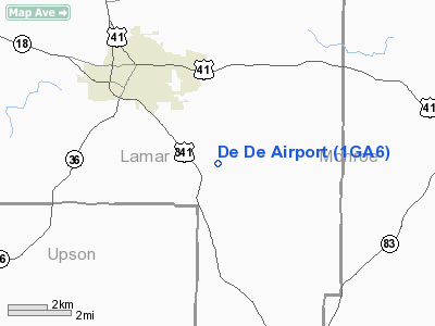
Location
& QuickFacts
|
FAA Information Effective: |
2007-01-18 |
|
Airport
Identifier: |
1GA6 |
|
Airport
Status: |
Operational |
|
Longitude/Latitude: |
084-06-38.6910W/33-00-32.4650N
-84.110748/33.009018 (Estimated) |
|
Elevation: |
800 ft / 243.84 m (Estimated) |
|
Land: |
10
acres |
|
From
nearest city: |
4 nautical miles NW of Barnesville, GA |
|
Location: |
Lamar County, GA |
|
Magnetic Variation: |
02W (1990) |
Owner
& Manager
|
Ownership: |
Privately owned |
|
Owner: |
Samuel N. Sims |
|
Address: |
309 Brent Road
Barnesville, GA 30204 |
|
Phone number: |
404-358-0563 |
|
Manager: |
Samuel N. Sims |
|
Address: |
309 Brent Road
Barnesville, GA 30204 |
|
Phone number: |
404-358-0563 |
Airport
Operations and Facilities
|
Airport Use: |
Private |
|
Wind
indicator: |
Yes |
|
Segmented
Circle: |
No |
|
Control
Tower: |
No |
|
Sectional
chart: |
Atlanta |
|
Region: |
ASO - Southern |
|
Boundary
ARTCC: |
ZTL - Atlanta |
|
Tie-in
FSS: |
MCN - Macon |
|
FSS
on Airport: |
No |
|
FSS
Phone: |
478-784-1155 |
|
FSS
Toll Free: |
1-800-WX-BRIEF |
|
Runway Information
Runway 16/34
|
Dimension: |
1800 x 40 ft / 548.6 x 12.2 m |
|
Surface: |
TURF, |
|
|
Runway 16 |
Runway 34 |
|
Traffic
Pattern: |
Left |
Left |
|
Displaced
threshold: |
300.00 ft
DSPLCD THR 300 FT MKD WITH AUTO TIRES. |
0.00 ft |
|
Radio Navigation
Aids
|
ID |
Type |
Name |
Ch |
Freq |
Var |
Dist |
|
OP |
NDB |
Yates |
|
339.00 |
03W |
6.6 nm |
|
JHH |
NDB |
Griffin |
|
412.00 |
04W |
12.1 nm |
|
FF |
NDB |
Pecat |
|
316.00 |
02W |
25.8 nm |
|
EQQ |
NDB |
Coweta County |
|
234.00 |
03W |
33.8 nm |
|
BEP |
NDB |
Bay Creek |
|
350.00 |
03W |
37.5 nm |
|
IZS |
NDB |
Montezuma |
|
426.00 |
04W |
38.9 nm |
|
BR |
NDB |
Redan |
|
266.00 |
02W |
39.6 nm |
|
PIM |
NDB |
Pine Mountain |
|
272.00 |
03W |
39.7 nm |
|
VOF |
NDB |
Alcovy |
|
370.00 |
03W |
40.8 nm |
|
JNM |
NDB |
Monroe |
|
392.00 |
03W |
47.8 nm |
|
UMB |
NDB |
Culvr |
|
380.00 |
04W |
48.7 nm |
|
MCN |
VORTAC |
Macon |
089X |
114.20 |
01E |
30.2 nm |
|
ATL |
VORTAC |
Atlanta |
116X |
116.90 |
00W |
40.7 nm |
|
ATL |
VOT |
Atlanta Muni |
|
111.00 |
|
42.1 nm |
Remarks
- ROAD
& TREES & PLINES AT N END OF RY 34.
- PRVDD
VFR PRIVATE USE ONLY.
Based
Aircraft
|
Aircraft
based on field: |
1 |
|
Single
Engine Airplanes: |
1 |
De De Airport
Address:
Lamar County, GA
Tel:
404-358-0563
Images
and information placed above are from
http://www.airport-data.com/airport/1GA6/
We
thank them for the data!
| General
Info |
| Country |
United
States |
| State |
GEORGIA
|
| FAA ID |
1GA6
|
| Latitude |
33-00-32.465N
|
| Longitude |
084-06-38.691W
|
| Elevation |
800 feet
|
| Near City |
BARNESVILLE
|
We don't guarantee the information is fresh and accurate. The data may
be wrong or outdated.
For more up-to-date information please refer to other sources.
|
|


