 |
|
Coordinates: 34°43â²23â³N 084°52â²13â³W / 34.72306°N 84.87028°W / 34.72306; -84.87028
| Dalton Municipal Airport |
| IATA: DNN â ICAO: KDNN â FAA LID: DNN |
| Summary |
| Airport type |
Public |
| Owner |
City of Dalton |
| Serves |
Dalton, Georgia |
| Elevation AMSL |
710 ft / 216 m |
| Website |
www.cityofdalton-ga.gov/... |
| Runways |
| Direction |
Length |
Surface |
| ft |
m |
| 14/32 |
5,500 |
1,676 |
Asphalt |
| Statistics (2007) |
| Aircraft operations |
24,000 |
| Source: Federal Aviation Administration |
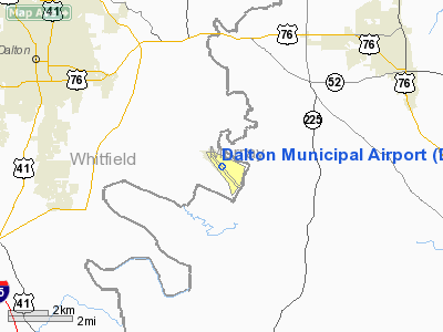
Dalton Municipal Airport (IATA: DNN, ICAO: KDNN, FAA LID: DNN) is a city-owned public-use airport located six miles (10 km) southeast of the central business district of Dalton, a city in Whitfield County, Georgia, United States.
Facilities and aircraft
Dalton Municipal Airport covers an area of 554 acres (224 ha) and contains one asphalt paved runway designated 14/32 which measures 5,500 x 100 ft (1,676 x 30 m). For the 12-month period ending May 24, 2007, the airport had 24,000 aircraft operations, an average of 65 per day: 99% general aviation and 1% military.
The above content comes from Wikipedia and is published under free licenses – click here to read more.
Location
& QuickFacts
|
FAA Information Effective: |
2007-01-18 |
|
Airport
Identifier: |
DNN |
|
Airport
Status: |
Operational |
|
Longitude/Latitude: |
084-52-12.8720W/34-43-22.5720N
-84.870242/34.722937 (Estimated) |
|
Elevation: |
710 ft / 216.41 m (Surveyed) |
|
Land: |
554 acres |
|
From
nearest city: |
6 nautical miles SE of Dalton, GA |
|
Location: |
Whitfield County, GA |
|
Magnetic Variation: |
03W (2000) |
Owner
& Manager
|
Ownership: |
Publicly owned |
|
Owner: |
City Of Dalton |
|
Address: |
Po Box 1205
Dalton, GA 30720 |
|
Phone
number: |
706-278-9500 |
|
Manager: |
Harvey Halman |
|
Address: |
Po Box 831, 4483 Airport Road
Dalton, GA 30720 |
|
Phone
number: |
706-278-4700 |
Airport
Operations and Facilities
|
Airport Use: |
Open to public |
|
Wind
indicator: |
Yes |
|
Segmented
Circle: |
Yes |
|
Control
Tower: |
No |
|
Lighting
Schedule: |
DUSK-DAWN
HIRL RY 14/32 OPER DUSK-DAWN, ACTVT HIRL DAYTIME AND MALSR
RWY 14 - CTAF. |
|
Beacon
Color: |
Clear-Green (lighted land airport) |
|
Landing
fee charge: |
No |
|
Sectional
chart: |
Atlanta |
|
Region: |
ASO - Southern |
|
Traffic
Pattern Alt: |
800 ft |
|
Boundary
ARTCC: |
ZTL - Atlanta |
|
Tie-in
FSS: |
MCN - Macon |
|
FSS
on Airport: |
No |
|
FSS
Phone: |
478-784-1155 |
|
FSS
Toll Free: |
1-800-WX-BRIEF |
|
NOTAMs
Facility: |
DNN (NOTAM-d service avaliable) |
|
Federal
Agreements: |
NGY |
Airport
Communications
|
CTAF: |
122.975 |
|
Unicom: |
122.975 |
Airport
Services
|
Fuel available: |
100LLA1+ |
|
Airframe Repair: |
MAJOR |
|
Power Plant Repair: |
MAJOR |
|
Runway Information
Runway 14/32
|
Dimension: |
5498 x 100 ft / 1675.8 x 30.5 m |
|
Surface: |
ASPH, Good Condition |
|
Weight
Limit: |
Single wheel: 30000 lbs.
Dual wheel: 42000 lbs.
Dual tandem wheel: 80000 lbs. |
|
Edge
Lights: |
High |
|
|
Runway 14 |
Runway 32 |
|
Longitude: |
084-52-35.1425W |
084-51-50.6100W |
|
Latitude: |
34-43-42.6031N |
34-43-02.5400N |
|
Elevation: |
708.00
ft |
691.00
ft |
|
Alignment: |
127 |
127 |
|
ILS
Type: |
ILS |
|
|
Traffic
Pattern: |
Left |
Left |
|
Markings: |
Precision instrument, Good Condition |
Precision instrument, Good Condition |
|
Crossing
Height: |
34.00
ft |
37.00
ft |
|
VASI: |
2-light PAPI on left side |
2-light PAPI on left side |
|
Visual
Glide Angle: |
3.50° |
3.50° |
|
Approach
lights: |
MALSR
MALSR RY 14 OPER DUSK-DAWN WHEN THE VIS IS LESS THAN 3 MILES
AND/OR THE CEILING IS LESS THAN 1000 FT OTR TIMES - CTAF. |
|
|
Obstruction: |
63
ft trees, 1775.0 ft from runway, 475 ft left of centerline,
25:1 slope to clear |
103
ft trees, 2466.0 ft from runway, 550 ft right of centerline,
22:1 slope to clear |
|
Radio Navigation
Aids
|
ID |
Type |
Name |
Ch |
Freq |
Var |
Dist |
|
UWI |
NDB |
Whitfield |
|
400.00 |
03W |
5.5 nm |
|
OUK |
NDB |
Calhoun |
|
323.00 |
02W |
19.5 nm |
|
JZP |
NDB |
Pickens County |
|
285.00 |
04W |
25.9 nm |
|
HDI |
NDB |
Hardwick |
|
369.00 |
01W |
26.0 nm |
|
OYD |
NDB |
Floyd |
|
388.00 |
02W |
29.4 nm |
|
CQN |
NDB |
Daisy |
|
341.00 |
02W |
30.2 nm |
|
EVZ |
NDB |
Cartersville |
|
308.00 |
04W |
31.5 nm |
|
DJD |
NDB |
Canton |
|
415.00 |
04W |
34.0 nm |
|
APT |
NDB |
Jasper |
|
382.00 |
02W |
40.6 nm |
|
FTP |
NDB |
Fort Payne |
|
426.00 |
01W |
41.5 nm |
|
MMI |
NDB |
Mc Minn County |
|
242.00 |
03W |
43.1 nm |
|
DTE |
NDB |
Mark Anton |
|
394.00 |
02W |
45.7 nm |
|
GQO |
VORTAC |
Choo Choo |
105X |
115.80 |
01E |
20.0 nm |
|
RMG |
VORTAC |
Rome |
101X |
115.40 |
01E |
35.9 nm |
|
HRS |
VORTAC |
Harris |
035X |
109.80 |
00E |
48.9 nm |
Based
Aircraft
|
Aircraft
based on field: |
57 |
|
Single
Engine Airplanes: |
42 |
|
Multi
Engine Airplanes: |
12 |
|
Jet Engine
Airplanes: |
2 |
|
Helicopters: |
1 |
Operational Statistics
Time Period: 2004-05-12 - 2005-05-11
|
Aircraft
Operations: |
66/Day |
|
General
Aviation Local: |
53.8% |
|
General
Aviation Itinerant: |
46.2% |
Dalton Municipal Airport
Address:
Whitfield County, GA
Tel:
706-278-9500, 706-278-4700
Images
and information placed above are from
http://www.airport-data.com/airport/DNN/
We
thank them for the data!
| General
Info |
| Country |
United
States |
| State |
GEORGIA
|
| FAA ID |
DNN
|
| Latitude |
34-43-18.294N
|
| Longitude |
084-52-08.789W
|
| Elevation |
710 feet
|
| Near City |
DALTON
|
We don't guarantee the information is fresh and accurate. The data may
be wrong or outdated.
For more up-to-date information please refer to other sources.
|
|


