 |
|
Crisp County - Cordele Airport |
| Crisp County-Cordele Airport |
 |
| IATA: CKF â ICAO: KCKF â FAA LID: CKF |
| Summary |
| Airport type |
Public |
| Owner |
Crisp County |
| Serves |
Cordele, Georgia |
| Location |
Crisp County, near Cordele, Georgia |
| Elevation AMSL |
310 ft / 94 m |
| Coordinates |
31°59â²20â³N 083°46â²26â³W / 31.98889°N 83.77389°W / 31.98889; -83.77389 |
| Runways |
| Direction |
Length |
Surface |
| ft |
m |
| 10/28 |
5,001 |
1,524 |
Asphalt |
| 5/23 |
5,006 |
1,526 |
Asphalt |
| Statistics (2008) |
| Aircraft operations |
26,100 |
| Based aircraft |
17 |
| Source: Federal Aviation Administration |
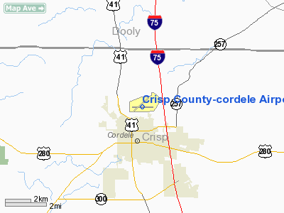
Crisp County-Cordele Airport (IATA: CKF, ICAO: KCKF, FAA LID: CKF) is a county-owned public-use airport located two nautical miles (3.7 km) northeast of the central business district of Cordele, in Crisp County, Georgia, United States. The airport serves the general aviation community, with no scheduled commercial airline service. History
Opened to the public in March 1943, during World War II, the airport was requisitioned by the United States Army Air Force, and was known as Cordele Army Airfield. Also known as Turner AAF Auxiliary Airfield No. 7, the airfield supported the AAF Advanced Pilot School (Twin-Engine) school at Turner Army Airfield.
It was closed in mid-1944 with the drawdown of AAFTC's pilot training program. Declared surplus and turned over to the Army Corps of Engineers on 30 September 1945. Eventually discharged to the War Assets Administration (WAA) and became civil airport.
Facilities and aircraft
Crisp County-Cordele Airport covers an area of 619 acres (251 ha) at an elevation of 310 feet (94 m) above mean sea level. It has two asphalt paved runways: 10/28 is 5,001 by 150 feet (1,524 x 46 m) and 5/23 is 5,006 by 100 feet (1,526 x 30 m).
For the 12-month period ending June 9, 2008, the airport had 26,100 aircraft operations, an average of 71 per day: 99.7% general aviation and 0.3% military. At that time there were 17 aircraft based at this airport: 94% single-engine and 6% multi-engine.
The above content comes from Wikipedia and is published under free licenses – click here to read more.
Location
& QuickFacts
|
FAA Information Effective: |
2007-01-18 |
|
Airport
Identifier: |
CKF |
|
Airport
Status: |
Operational |
|
Longitude/Latitude: |
083-46-26.1000W/31-59-19.8000N
-83.773917/31.988833 (Estimated) |
|
Elevation: |
310 ft / 94.49 m (Surveyed) |
|
Land: |
619 acres |
|
From
nearest city: |
2 nautical miles NE of Cordele, GA |
|
Location: |
Crisp County, GA |
|
Magnetic Variation: |
02W (1985) |
Owner
& Manager
|
Ownership: |
Publicly owned |
|
Owner: |
Crisp County |
|
Address: |
210 7th St, Room303
Cordele, GA 31015 |
|
Phone
number: |
229-276-2672 |
|
Manager: |
Dub Cooper |
|
Address: |
1701 N 2nd St
Cordele, GA 31015 |
|
Phone
number: |
229-273-3124 |
Airport
Operations and Facilities
|
Airport Use: |
Open to public |
|
Wind
indicator: |
Yes |
|
Segmented
Circle: |
Yes |
|
Control
Tower: |
No |
|
Lighting
Schedule: |
DUSK-DAWN
MIRL RY 10/28 & PAPI RYS 10 & 28 PRESET ON LOW INTST
DUSK-2200; TO INCR INTST & ACTVT AFT 2200 - CTAF. ACTVT
ODALS RY 10 & REIL RY 10 - CTAF. |
|
Beacon
Color: |
Clear-Green (lighted land airport) |
|
Landing
fee charge: |
No |
|
Sectional
chart: |
Jacksonville |
|
Region: |
ASO - Southern |
|
Boundary
ARTCC: |
ZJX - Jacksonville |
|
Tie-in
FSS: |
MCN - Macon |
|
FSS
on Airport: |
No |
|
FSS
Phone: |
478-784-1155 |
|
FSS
Toll Free: |
1-800-WX-BRIEF |
|
NOTAMs
Facility: |
MCN (NOTAM-d service avaliable) |
|
Federal
Agreements: |
NGRY3 |
Airport
Communications
|
CTAF: |
123.050 |
|
Unicom: |
123.050 |
Airport
Services
|
Fuel available: |
100LLA |
|
Airframe Repair: |
MAJOR |
|
Power Plant Repair: |
MAJOR |
|
Bottled
Oxygen: |
NONE |
|
Bulk
Oxygen: |
NONE |
|
Runway Information
Runway 05/23
|
Dimension: |
5006 x 100 ft / 1525.8 x 30.5 m |
|
Surface: |
ASPH, Good Condition |
|
Weight
Limit: |
Single wheel: 24000 lbs. |
|
|
Runway 05 |
Runway 23 |
|
Longitude: |
083-46-50.2091W |
083-46-05.8981W |
|
Latitude: |
31-59-09.5788N |
31-59-41.6428N |
|
Elevation: |
310.00
ft |
307.00
ft |
|
Alignment: |
50 |
127 |
|
Traffic
Pattern: |
Left |
Right |
|
Markings: |
Non-precision instrument, Good Condition |
Non-precision instrument, Good Condition |
|
Obstruction: |
46
ft trees, 706.0 ft from runway, 280 ft right of centerline,
11:1 slope to clear |
58
ft trees, 1070.0 ft from runway, 15:1 slope to clear
+10 FT BRUSH AND TREES 100 FT FROM RY END, ACROSS APROACH. |
|
Runway 10/28
|
Dimension: |
5001 x 150 ft / 1524.3 x 45.7 m |
|
Surface: |
ASPH, Good Condition |
|
Weight
Limit: |
Single wheel: 30000 lbs.
Dual wheel: 45000 lbs. |
|
Edge
Lights: |
Medium |
|
|
Runway 10 |
Runway 28 |
|
Longitude: |
083-46-52.8416W |
083-45-55.2747W |
|
Latitude: |
31-59-17.2948N |
31-59-10.8301N |
|
Elevation: |
302.00
ft |
308.00
ft |
|
Alignment: |
98 |
127 |
|
ILS
Type: |
LOCALIZER |
|
|
Traffic
Pattern: |
Left |
Right |
|
Markings: |
Non-precision instrument, Good Condition |
Non-precision instrument, Good Condition |
|
Crossing
Height: |
43.00
ft |
36.00
ft |
|
VASI: |
2-light PAPI on left side |
2-light PAPI on left side |
|
Visual
Glide Angle: |
3.00° |
3.00° |
|
Approach
lights: |
ODALS |
|
|
Runway
End Identifier: |
Yes |
|
|
Obstruction: |
69
ft trees, 2132.0 ft from runway, 28:1 slope to clear
+12 FT TREES AND BRUSH 160 FT FM RY END & 200 FT RIGHT;
+10 FT BRUSH AND TREES 190 FT FM RY END & 160 FT LEFT. |
47
ft trees, 811.0 ft from runway, 250 ft left of centerline,
13:1 slope to clear |
|
Radio Navigation
Aids
|
ID |
Type |
Name |
Ch |
Freq |
Var |
Dist |
|
OHY |
NDB |
Coney |
|
400.00 |
02W |
4.5 nm |
|
LKG |
NDB |
Lindbergh |
|
242.00 |
03W |
20.4 nm |
|
IZS |
NDB |
Montezuma |
|
426.00 |
04W |
25.7 nm |
|
BEP |
NDB |
Bay Creek |
|
350.00 |
03W |
28.2 nm |
|
EZM |
NDB |
Eastman |
|
366.00 |
04W |
32.8 nm |
|
SUR |
NDB |
Fitzgerald |
|
362.00 |
03W |
33.5 nm |
|
AB |
NDB |
Putny |
|
227.00 |
02W |
41.0 nm |
|
TM |
NDB |
Tifto |
|
409.00 |
03W |
41.2 nm |
|
MQW |
NDB |
Mc Rae |
|
280.00 |
03W |
45.8 nm |
|
DB |
NDB |
Creke |
|
251.00 |
04W |
48.9 nm |
|
IFM |
VOR |
Tift Myers |
|
112.50 |
01W |
36.7 nm |
|
VNA |
VORTAC |
Vienna |
112X |
116.50 |
01E |
19.5 nm |
|
PZD |
VORTAC |
Pecan |
108X |
116.10 |
02W |
33.2 nm |
|
MCN |
VORTAC |
Macon |
089X |
114.20 |
01E |
42.7 nm |
Remarks
- GCO
AVBL ON FREQ 121.725 THRU MCN AFSS.
- EXISTED
PRIOR TO 1959.
Based
Aircraft
|
Aircraft
based on field: |
22 |
|
Single
Engine Airplanes: |
22 |
Operational Statistics
Time Period: 2005-06-15 - 2006-06-14
|
Aircraft
Operations: |
72/Day |
|
General
Aviation Local: |
69.0% |
|
General
Aviation Itinerant: |
30.7% |
|
Military: |
0.4% |
Crisp County-cordele Airport
Address:
Crisp County, GA
Tel:
229-276-2672, 229-273-3124
Images
and information placed above are from
http://www.airport-data.com/airport/CKF/
We
thank them for the data!
| General
Info |
| Country |
United
States |
| State |
GEORGIA
|
| FAA ID |
CKF
|
| Latitude |
31-59-19.800N
|
| Longitude |
083-46-26.100W
|
| Elevation |
309 feet
|
| Near City |
CORDELE
|
We don't guarantee the information is fresh and accurate. The data may
be wrong or outdated.
For more up-to-date information please refer to other sources.
|
|


