 |
|
|
|
|
|
Location
& QuickFacts
|
FAA Information Effective: |
2007-01-18 |
|
Airport
Identifier: |
5GA1 |
|
Airport
Status: |
Operational |
|
Longitude/Latitude: |
083-58-25.6590W/33-59-14.3720N
-83.973794/33.987326 (Estimated) |
|
Elevation: |
1070 ft / 326.14 m (Estimated) |
|
Land: |
0
acres |
|
From
nearest city: |
2 nautical miles NE of Lawrenceville, GA |
|
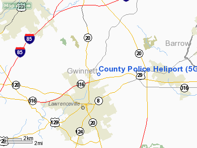
Location: |
Gwinnett County, GA |
|
Magnetic Variation: |
02W (1985) |
Owner
& Manager
|
Ownership: |
Publicly owned |
|
Owner: |
Gwinnett Co Ga Police Dept |
|
Address: |
770 Hi-hope Rd
Lawrenceville, GA 30245 |
|
Phone
number: |
404-339-3293 |
|
Manager: |
Captain T. R. Lowe |
|
Address: |
770 Hi-hope Rd
Lawrenceville, GA 30245 |
|
Phone number: |
404-339-3293
EXT 136 |
Airport
Operations and Facilities
|
Airport Use: |
Private |
|
Wind
indicator: |
Yes |
|
Segmented
Circle: |
No |
|
Control
Tower: |
No |
|
Lighting
Schedule: |
DUSK-DAWN |
|
Beacon
Color: |
Clear-Yellow (lighted seaplan base) |
|
Landing fee charge: |
No |
|
Sectional chart: |
Atlanta |
|
Region: |
ASO - Southern |
|
Boundary ARTCC: |
ZTL - Atlanta |
|
Tie-in FSS: |
MCN - Macon |
|
FSS on Airport: |
No |
|
FSS Phone: |
478-784-1155 |
|
FSS Toll Free: |
1-800-WX-BRIEF |
Airport
Communications
|
Runway Information
Helipad H1
|
Dimension: |
40
x 40 ft / 12.2 x 12.2 m
40 BY 40 MAIN PAD WITHIN 300' HELIPORT AREA; 8 PARKING PADS AVAILABLE. |
|
Surface: |
ASPH-CONC, |
|
|
Runway H1 |
Runway |
|
Traffic
Pattern: |
Left |
Left |
|
Radio Navigation
Aids
|
ID |
Type |
Name |
Ch |
Freq |
Var |
Dist |
|
FKV |
NDB |
Flowery Branch |
|
365.00 |
03W |
13.4 nm |
|
BMW |
NDB |
Barrow County |
|
404.00 |
03W |
19.4 nm |
|
JNM |
NDB |
Monroe |
|
392.00 |
03W |
19.4 nm |
|
DDA |
NDB |
Commerce |
|
244.00 |
03W |
23.0 nm |
|
VOF |
NDB |
Alcovy |
|
370.00 |
03W |
23.5 nm |
|
BR |
NDB |
Redan |
|
266.00 |
02W |
26.6 nm |
|
DJD |
NDB |
Canton |
|
415.00 |
04W |
30.1 nm |
|
FT |
NDB |
Flanc |
|
344.00 |
02W |
35.8 nm |
|
JZP |
NDB |
Pickens County |
|
285.00 |
04W |
37.1 nm |
|
AJR |
NDB |
Habersham |
|
347.00 |
03W |
37.4 nm |
|
BJT |
NDB |
Bulldog |
|
221.00 |
03W |
37.7 nm |
|
EVZ |
NDB |
Cartersville |
|
308.00 |
04W |
45.1 nm |
|
FF |
NDB |
Pecat |
|
316.00 |
02W |
48.6 nm |
|
JHH |
NDB |
Griffin |
|
412.00 |
04W |
49.9 nm |
|
DOB |
TACAN |
Dobbins |
077X |
|
01W |
27.0 nm |
|
PDK |
VOR/DME |
Peachtree |
113X |
116.60 |
02W |
17.5 nm |
|
ATL |
VORTAC |
Atlanta |
116X |
116.90 |
00W |
31.5 nm |
|
AHN |
VORTAC |
Athens |
33 |
109.60 |
00E |
32.4 nm |
|
ATL |
VOT |
Atlanta Muni |
|
111.00 |
|
30.0 nm |
Remarks
- VFR
OPERATIONS/PRIVATE USE. COORDINATE USE OF HELIPORT WITH ATLANTA GADO.
INGRESS/EGRESS CONDUCTED IN AREA 270 DEG CLOCKWISE TO 360 DEG FROM HELIPORT.
COMPATIBLE OPERATIONAL AGREEMENT IS MAINTAINED WITH OPERATOR OF GWINNETT
CO AIRPORT.
Based Aircraft
|
Aircraft
based on field: |
3 |
|
Helicopters: |
3 |
County Police Heliport
Address:
Gwinnett County, GA
Tel:
404-339-3293
Images
and information placed above are from
http://www.airport-data.com/airport/5GA1/
We
thank them for the data!
| General
Info |
| Country |
United
States |
| State |
GEORGIA
|
| FAA ID |
5GA1
|
| Latitude |
33-59-14.372N
|
| Longitude |
083-58-25.659W
|
| Elevation |
1070 feet
|
| Near City |
LAWRENCEVILLE |
We don't guarantee the information is fresh and accurate. The data may
be wrong or outdated.
For more up-to-date information please refer to other sources.
|
|


