 |
|
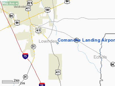
Location
& QuickFacts
|
FAA Information Effective: |
2007-01-18 |
|
Airport
Identifier: |
66GA |
|
Airport
Status: |
Operational |
|
Longitude/Latitude: |
083-13-15.5360W/30-47-15.7360N
-83.220982/30.787704 (Estimated) |
|
Elevation: |
210 ft / 64.01 m (Estimated) |
|
Land: |
15
acres |
|
From
nearest city: |
4 nautical miles SE of Valdosta, GA |
|
Location: |
Lowndes County, GA |
|
Magnetic Variation: |
02W (1985) |
Owner
& Manager
|
Ownership: |
Privately owned |
|
Owner: |
Preston J Daniels |
|
Address: |
3434 Burkhalter Lane
Santa Clara, CA 95054-3734 |
|
Phone number: |
912-244-6589 |
|
Manager: |
Preston J Daniels |
|
Address: |
3434 Burkhalter Lane
Valdosta, GA 31601 |
|
Phone number: |
912-244-6589 |
Airport
Operations and Facilities
|
Airport Use: |
Private
PERSONAL USE. |
|
Segmented
Circle: |
No |
|
Control
Tower: |
No |
|
Sectional
chart: |
Jacksonville |
|
Region: |
ASO - Southern |
|
Boundary
ARTCC: |
ZJX - Jacksonville |
|
Tie-in
FSS: |
MCN - Macon |
|
FSS
on Airport: |
No |
|
FSS
Phone: |
478-784-1155 |
|
FSS
Toll Free: |
1-800-WX-BRIEF |
|
Runway Information
Runway 06/24
|
Dimension: |
2600 x 100 ft / 792.5 x 30.5 m |
|
Surface: |
TURF, |
|
|
Runway 06 |
Runway 24 |
|
Traffic
Pattern: |
Right |
Left |
|
Radio Navigation
Aids
|
ID |
Type |
Name |
Ch |
Freq |
Var |
Dist |
|
HOE |
NDB |
Homerville |
|
209.00 |
03W |
28.2 nm |
|
GTP |
NDB |
Patten |
|
245.00 |
02W |
32.9 nm |
|
TM |
NDB |
Tifto |
|
409.00 |
03W |
36.5 nm |
|
OWC |
NDB |
Coffee County |
|
390.00 |
03W |
40.1 nm |
|
CYR |
NDB |
Caidy |
|
338.00 |
01W |
48.8 nm |
|
LCQ |
NDB |
Lake City |
|
204.00 |
03W |
49.2 nm |
|
SUR |
NDB |
Fitzgerald |
|
362.00 |
03W |
49.7 nm |
|
IFM |
VOR |
Tift Myers |
|
112.50 |
01W |
40.9 nm |
|
OTK |
VOR/DME |
Valdosta |
095X |
114.80 |
02W |
3.1 nm |
|
MGR |
VOR/DME |
Moultrie |
025X |
108.80 |
02W |
34.9 nm |
|
VAD |
VORTAC |
Moody |
080X |
113.30 |
03W |
10.5 nm |
|
GEF |
VORTAC |
Greenville |
027X |
109.00 |
01E |
32.3 nm |
|
TAY |
VORTAC |
Taylor |
076X |
112.90 |
03W |
38.5 nm |
|
AYS |
VORTAC |
Waycross |
039X |
110.20 |
00E |
44.8 nm |
Remarks
- PRVDD
VFR/PVT USE ONLY; TFC PATS ARE S OF RY; LTR OF AGRMT W/VALDOSTA REG
ARPT.
Based
Aircraft
|
Aircraft
based on field: |
2 |
|
Single
Engine Airplanes: |
1 |
|
Multi
Engine Airplanes: |
1 |
Comanche Landing Airport
Address:
Lowndes County, GA
Tel:
912-244-6589
Images
and information placed above are from
http://www.airport-data.com/airport/66GA/
We
thank them for the data!
| General
Info |
| Country |
United
States |
| State |
GEORGIA
|
| FAA ID |
66GA
|
| Latitude |
30-47-15.736N
|
| Longitude |
083-13-15.536W
|
| Elevation |
210 feet
|
| Near City |
VALDOSTA
|
We don't guarantee the information is fresh and accurate. The data may
be wrong or outdated.
For more up-to-date information please refer to other sources.
|
|


