 |
|
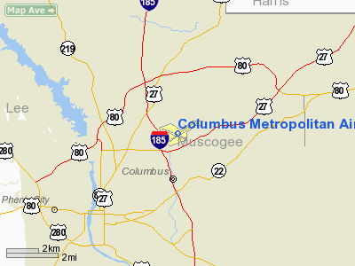
Columbus Metropolitan Airport |
| Columbus Metropolitan Airport |
| IATA: CSG â ICAO: KCSG â FAA LID: CSG |
| Summary |
| Airport type |
Public |
| Owner |
Columbus Airport Commission |
| Serves |
Columbus, Georgia |
| Hub for |
Evergreen International Airlines |
| Elevation AMSL |
397 ft / 121 m |
| Coordinates |
32°30â²59â³N 084°56â²20â³W / 32.51639°N 84.93889°W / 32.51639; -84.93889 |
| Website |
www.FlyColumbusGA.com |
| Runways |
| Direction |
Length |
Surface |
| ft |
m |
| 6/24 |
6,997 |
2,133 |
Asphalt |
| 13/31 |
3,997 |
1,218 |
Asphalt |
| Statistics (2007) |
| Aircraft operations |
53,338 |
| Based aircraft |
236 |
| Source: Federal Aviation Administration |
Columbus Metropolitan Airport (IATA: CSG, ICAO: KCSG, FAA LID: CSG) is a public use airport located three nautical miles (6 km) northeast of the central business district of Columbus, the third largest city in Georgia. It is the 4th busiest airport in the state of Georgia. It is owned by Columbus Airport Commission. The airport is mostly used by commercial airlines, but is also used for general aviation. Facilities and aircraft
Columbus Metropolitan Airport covers an area of 680 acres (275 ha) at an elevation of 397 feet (121 m) above mean sea level. It has two asphalt paved runways: 6/24 measuring 6,997 by 150 feet (2,133 x 46 m) and 13/31 measuring 3,997 by 150 feet (1,218 x 46 m).
For the 12-month period ending January 31, 2007, the airport had 53,338 aircraft operations, an average of 146 per day: 82% general aviation, 11% air taxi, 5% scheduled commercial and 2% military. At that time there were 236 aircraft based at this airport: 38% single-engine, 29% multi-engine, 30% jet and 3% helicopter.
Airlines and destinations
| Airlines |
Destinations |
| American Eagle |
Dallas/Fort Worth |
| Delta Connection operated by Atlantic Southeast Airlines |
Atlanta |
Accidents
- On August 17, 1984, a Mooney M20, flying from Tennessee to Florida, stopped in Columbus to refuel and crashed shortly after takeoff. There were 4 fatalities.
- On July 19, 2009, at around 6:15 PM, a Rutan VariEze, containing 2 men, crashed shortly after take off. There was 1 fatality.
The above content comes from Wikipedia and is published under free licenses – click here to read more.
Location
& QuickFacts
|
FAA Information Effective: |
2007-01-18 |
|
Airport
Identifier: |
CSG |
|
Airport
Status: |
Operational |
|
Longitude/Latitude: |
084-56-19.9000W/32-30-58.8000N
-84.938861/32.516333 (Estimated) |
|
Elevation: |
397 ft / 121.01 m (Surveyed) |
|
Land: |
680 acres |
|
From
nearest city: |
3 nautical miles NE of Columbus, GA |
|
Location: |
Muscogee County, GA |
|
Magnetic Variation: |
02W (1990) |
Owner
& Manager
|
Ownership: |
Publicly owned |
|
Owner: |
Columbus Airport Commission
COLUMBUS AIRPORT COMMISSION. |
|
Address: |
3250 W Britt David Rd
Columbus, GA 31909 |
|
Phone
number: |
706-324-2449 |
|
Manager: |
Mark Oropeza |
|
Address: |
3250 W Britt David Rd
Columbus, GA 31909 |
|
Phone number: |
706-324-2449 |
Airport
Operations and Facilities
|
Airport Use: |
Open to public |
|
Wind
indicator: |
Yes |
|
Segmented
Circle: |
No |
|
Control
Tower: |
Yes |
|
Lighting
Schedule: |
DUSK-DAWN
AFTER 2100, ACTVT HIRL RY 06/24, MALSR RY 06, REIL RY 24,
PAPI RY 06, TWY LGTS & WINDCONE LGTS - CTAF.
MIRL
RY 13/31 & VASI RY 31 UNAVBL WHEN ATCT CLSD. |
|
Beacon
Color: |
Clear-Green (lighted land airport) |
|
Landing
fee charge: |
No |
|
Sectional
chart: |
Atlanta |
|
Region: |
ASO - Southern |
|
Boundary
ARTCC: |
ZTL - Atlanta |
|
Tie-in
FSS: |
MCN - Macon |
|
FSS
on Airport: |
No |
|
FSS
Phone: |
478-784-1155 |
|
FSS
Toll Free: |
1-800-WX-BRIEF |
|
NOTAMs
Facility: |
CSG (NOTAM-d service avaliable) |
|
Certification type/date: |
I B S 05/1973 |
|
Federal Agreements: |
NGY3 |
Airport
Communications
|
CTAF: |
120.100 |
|
Unicom: |
122.950 |
Airport
Services
|
Fuel available: |
100LLA
FUEL AVBL 24 HRS. AFTER 2100 HRS FUEL AVBL WITH FEE CTC
FBO PER WRITTEN INSTRUCTION IN FBO VESTIBULE. |
|
Airframe Repair: |
MAJOR |
|
Power Plant Repair: |
MAJOR |
|
Bottled
Oxygen: |
NONE |
|
Bulk
Oxygen: |
NONE |
|
Runway Information
Runway 06/24
|
Dimension: |
6997 x 150 ft / 2132.7 x 45.7 m |
|
Surface: |
ASPH, Good Condition |
|
Surface
Treatment: |
Saw-cut or plastic Grooved |
|
Weight
Limit: |
Dual wheel: 160000 lbs.
Dual tandem wheel: 250000 lbs. |
|
Edge
Lights: |
High |
|
|
Runway 06 |
Runway 24 |
|
Longitude: |
084-56-43.1430W |
084-55-37.1723W |
|
Latitude: |
32-30-40.1994N |
32-31-21.0430N |
|
Elevation: |
376.00
ft |
391.00
ft |
|
Alignment: |
54 |
127 |
|
ILS
Type: |
ILS |
|
|
Traffic
Pattern: |
Left |
Left |
|
Markings: |
Precision instrument, Fair Condition |
Precision instrument, Fair Condition |
|
Crossing
Height: |
48.00
ft |
50.00
ft |
|
VASI: |
4-light PAPI on left side |
4-light PAPI on left side
RY 24 PAPI OTS INDEFLY. |
|
Visual
Glide Angle: |
2.61° |
3.00° |
|
RVR
Equipment: |
touchdown |
|
|
Approach
lights: |
MALSR |
|
|
Runway
End Identifier: |
|
Yes |
|
Obstruction: |
79 ft trees, 2450.0 ft from runway, 250 ft
left of centerline, 28:1 slope to clear |
29 ft bldg, 690.0 ft from runway, 200 ft right
of centerline, 16:1 slope to clear
+5 FT GND 200 FT FROM RY END 500 FT RIGHT. |
|
Runway 13/31
|
Dimension: |
3997 x 150 ft / 1218.3 x 45.7 m |
|
Surface: |
ASPH, Good Condition |
|
Weight
Limit: |
Single wheel: 12000 lbs. |
|
Edge
Lights: |
Medium |
|
|
Runway 13 |
Runway 31 |
|
Longitude: |
084-56-55.6769W |
084-56-18.4049W |
|
Latitude: |
32-31-07.4508N |
32-30-43.6463N |
|
Elevation: |
397.00
ft |
369.00
ft |
|
Alignment: |
127 |
127 |
|
Traffic
Pattern: |
Left |
Left |
|
Markings: |
Basic, Good Condition |
Basic, Good Condition |
|
Crossing
Height: |
0.00
ft |
41.00
ft |
|
VASI: |
V2L NOT COMMISSIONED. |
2-box on left side |
|
Visual
Glide Angle: |
0.00° |
3.00° |
|
Runway
End Identifier: |
Yes |
Yes |
|
Obstruction: |
72 ft tree, 1300.0 ft from runway, 250 ft left
of centerline, 15:1 slope to clear |
10 ft pole, 300.0 ft from runway, 50 ft left
of centerline, 10:1 slope to clear |
|
Radio Navigation
Aids
|
ID |
Type |
Name |
Ch |
Freq |
Var |
Dist |
|
AWS |
NDB |
Lawson |
|
335.00 |
02W |
14.1 nm |
|
PIM |
NDB |
Pine Mountain |
|
272.00 |
03W |
19.9 nm |
|
OP |
NDB |
Yates |
|
339.00 |
03W |
45.1 nm |
|
EQQ |
NDB |
Coweta County |
|
234.00 |
03W |
45.9 nm |
|
LKG |
NDB |
Lindbergh |
|
242.00 |
03W |
46.9 nm |
|
IZS |
NDB |
Montezuma |
|
426.00 |
04W |
48.1 nm |
|
LSF |
VOR/DME |
Lawson |
051X |
111.40 |
02W |
11.4 nm |
|
TGE |
VOR/DME |
Tuskegee |
120X |
117.30 |
02E |
37.1 nm |
|
CSG |
VORTAC |
Columbus |
118X |
117.10 |
01E |
7.2 nm |
|
LGC |
VORTAC |
Lagrange |
103X |
115.60 |
01E |
34.8 nm |
|
EUF |
VORTAC |
Eufaula |
029X |
109.20 |
02E |
35.4 nm |
Remarks
- BIRDS
ON & IN VICINITY OF ARPT.
Based
Aircraft
|
Aircraft
based on field: |
236 |
|
Single
Engine Airplanes: |
90 |
|
Multi
Engine Airplanes: |
68 |
|
Jet Engine
Airplanes: |
71 |
|
Helicopters: |
7 |
Major Carriers
Serving This Airport
| Atlantic Southeast Airlines |
100.0% |
Most Popular Destinations
|
Hartsfield - Jackson Atlanta Intl (ATL) |
100.0% |
Most Popular Aircraft
|
N637AS |
13.2% |
| N642AS |
8.9% |
|
N640AS |
8.3% |
| N634AS |
7.4% |
|
N630AS |
7.4% |
| N632AS |
7.4% |
|
N633AS |
7.1% |
| N635AS |
7.1% |
|
N643AS |
5.8% |
| N641AS |
5.8% |
Operational Statistics
Time Period: 2005-02-01 - 2006-01-31
|
Aircraft
Operations: |
147/Day |
|
Commerical: |
5.0% |
|
Air Taxi: |
11.4% |
|
General
Aviation Local: |
30.3% |
|
General
Aviation Itinerant: |
51.7% |
|
Military: |
1.6% |
Columbus Metropolitan Airport
Address:
Muscogee County, GA
Tel:
706-324-2449
Images
and information placed above are from
http://www.airport-data.com/airport/CSG/
We
thank them for the data!
| General
Info |
| Country |
United
States |
| State |
GEORGIA
|
| FAA ID |
CSG
|
| Latitude |
32-30-58.800N
|
| Longitude |
084-56-19.900W
|
| Elevation |
397 feet
|
| Near City |
COLUMBUS
|
We don't guarantee the information is fresh and accurate. The data may
be wrong or outdated.
For more up-to-date information please refer to other sources.
|
|


