 |
|
- For other airports with this name, see Cherokee County Airport.
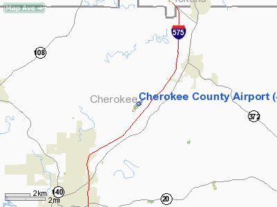
Cherokee County Airport (FAA LID: 47A) is a small municipal airport located in north-central Cherokee County, Georgia, about halfway between the town of Ball Ground and the city of Canton, Georgia (various records list either one as the official address). The airport covers 152 acres (62 ha) and has one runway.
It has a non-directional beacon (callsign WRLB3306) on AM longwave 416 kHz, which identifies itself with DJD in Morse code tones, then announces the name twice, followed by "automated altimeter", and the local sea-level pressure in inches of mercury (such as "two-niner-niner-five" for 29.95).
The above content comes from Wikipedia and is published under free licenses – click here to read more.
Location
& QuickFacts
|
FAA Information Effective: |
2007-01-18 |
|
Airport
Identifier: |
47A |
|
Airport
Status: |
Operational |
|
Longitude/Latitude: |
084-25-26.1000W/34-18-38.1000N
-84.423917/34.310583 (Estimated) |
|
Elevation: |
1219 ft / 371.55 m (Surveyed) |
|
Land: |
152 acres |
|
From
nearest city: |
6 nautical miles NE of Canton, GA |
|
Location: |
Cherokee County, GA |
|
Magnetic Variation: |
04W (2000) |
Owner
& Manager
|
Ownership: |
Publicly owned |
|
Owner: |
Cherokee County Airport Auth. |
|
Address: |
Po Box 5052
Canton, GA 30114 |
|
Phone
number: |
770-479-1808 |
|
Manager: |
Jimmy Garland, Fbo |
|
Address: |
S&s Aviation 1800 Airport Drive
Ballground, GA 30107 |
|
Phone number: |
770-479-6389 |
Airport
Operations and Facilities
|
Airport Use: |
Open to public |
|
Wind
indicator: |
Yes |
|
Segmented
Circle: |
Yes |
|
Control
Tower: |
No |
|
Lighting
Schedule: |
DUSK-DAWN
ACTVT MIRL RY 04/22 AND PAPI RYS 04 & 22 - CTAF. |
|
Beacon
Color: |
Clear-Green (lighted land airport) |
|
Landing
fee charge: |
No |
|
Sectional
chart: |
Atlanta |
|
Region: |
ASO - Southern |
|
Boundary
ARTCC: |
ZTL - Atlanta |
|
Tie-in
FSS: |
MCN - Macon |
|
FSS
on Airport: |
No |
|
FSS
Phone: |
478-784-1155 |
|
FSS
Toll Free: |
1-800-WX-BRIEF |
|
NOTAMs
Facility: |
MCN (NOTAM-d service avaliable) |
|
Federal Agreements: |
NGY |
Airport
Communications
|
CTAF: |
123.000 |
|
Unicom: |
123.000 |
Airport
Services
|
Fuel available: |
100LLA |
|
Airframe Repair: |
MAJOR |
|
Power Plant Repair: |
MAJOR |
|
Bottled
Oxygen: |
NONE |
|
Bulk
Oxygen: |
HIGH |
|
Runway Information
Runway 04/22
|
Dimension: |
3414 x 75 ft / 1040.6 x 22.9 m |
|
Surface: |
ASPH, Fair Condition |
|
Weight
Limit: |
Single wheel: 26000 lbs. |
|
Edge
Lights: |
Medium |
|
|
Runway 04 |
Runway 22 |
|
Longitude: |
084-25-39.6443W |
084-25-12.5137W |
|
Latitude: |
34-18-25.5460N |
34-18-50.7056N |
|
Elevation: |
1205.00
ft |
1215.00
ft |
|
Alignment: |
42 |
127 |
|
Traffic
Pattern: |
Left |
Left |
|
Markings: |
Non-precision instrument, Fair Condition |
Non-precision instrument, Fair Condition |
|
Crossing
Height: |
26.00
ft |
26.00
ft |
|
VASI: |
2-light PAPI on left side |
2-light PAPI on left side |
|
Visual
Glide Angle: |
2.50° |
2.50° |
|
Obstruction: |
, 50:1 slope to clear
+6 FT TREES AND BRUSH 60 FT LEFT AND 85 FT RIGHT AT THRESHOLD
OUT TO 260 FT. |
39
ft trees, 1175.0 ft from runway, 25:1 slope to clear
+8 FT TREES AND BRUSH 62 FT RIGHT AT THRESHOLD AND OUT TO
175 FT. |
|
Radio Navigation
Aids
|
ID |
Type |
Name |
Ch |
Freq |
Var |
Dist |
|
DJD |
NDB |
Canton |
|
415.00 |
04W |
4.7 nm |
|
JZP |
NDB |
Pickens County |
|
285.00 |
04W |
8.9 nm |
|
EVZ |
NDB |
Cartersville |
|
308.00 |
04W |
21.9 nm |
|
OUK |
NDB |
Calhoun |
|
323.00 |
02W |
25.5 nm |
|
FKV |
NDB |
Flowery Branch |
|
365.00 |
03W |
26.5 nm |
|
FT |
NDB |
Flanc |
|
344.00 |
02W |
34.6 nm |
|
OYD |
NDB |
Floyd |
|
388.00 |
02W |
36.8 nm |
|
UWI |
NDB |
Whitfield |
|
400.00 |
03W |
38.7 nm |
|
BR |
NDB |
Redan |
|
266.00 |
02W |
40.4 nm |
|
AJR |
NDB |
Habersham |
|
347.00 |
03W |
44.8 nm |
|
BMW |
NDB |
Barrow County |
|
404.00 |
03W |
47.3 nm |
|
DDA |
NDB |
Commerce |
|
244.00 |
03W |
47.3 nm |
|
JNM |
NDB |
Monroe |
|
392.00 |
03W |
48.9 nm |
|
DOB |
TACAN |
Dobbins |
077X |
|
01W |
24.2 nm |
|
PDK |
VOR/DME |
Peachtree |
113X |
116.60 |
02W |
26.9 nm |
|
RMG |
VORTAC |
Rome |
101X |
115.40 |
01E |
35.7 nm |
|
ATL |
VORTAC |
Atlanta |
116X |
116.90 |
00W |
41.0 nm |
|
HRS |
VORTAC |
Harris |
035X |
109.80 |
00E |
45.6 nm |
|
ATL |
VOT |
Atlanta Muni |
|
111.00 |
|
39.2 nm |
Based
Aircraft
|
Aircraft
based on field: |
106 |
|
Single
Engine Airplanes: |
86 |
|
Multi
Engine Airplanes: |
16 |
|
Helicopters: |
2 |
|
Ultralights: |
2 |
Operational Statistics
Time Period: 2004-05-05 - 2005-05-04
|
Aircraft
Operations: |
57/Day |
|
General
Aviation Local: |
56.7% |
|
General
Aviation Itinerant: |
43.3% |
Cherokee County Airport
Address:
Cherokee County, GA
Tel:
770-479-1808,
770-479-6389
Images
and information placed above are from
http://www.airport-data.com/airport/47A/
We
thank them for the data!
| General
Info |
| Country |
United
States |
| State |
GEORGIA
|
| FAA ID |
47A
|
| Latitude |
34-18-38.100N
|
| Longitude |
084-25-26.100W
|
| Elevation |
1219 feet
|
| Near City |
CANTON
|
We don't guarantee the information is fresh and accurate. The data may
be wrong or outdated.
For more up-to-date information please refer to other sources.
|
|


