 |
|
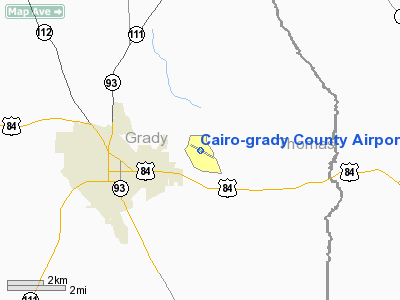
Cairo - Grady County Airport |
|
|
Location
& QuickFacts
|
FAA Information Effective: |
2007-01-18 |
|
Airport
Identifier: |
70J |
|
Airport
Status: |
Operational |
|
Longitude/Latitude: |
084-09-17.0470W/30-53-16.7160N
-84.154735/30.887977 (Estimated) |
|
Elevation: |
265 ft / 80.77 m (Surveyed) |
|
Land: |
251 acres |
|
From
nearest city: |
3 nautical miles E of Cairo, GA |
|
Location: |
Grady County, GA |
|
Magnetic
Variation: |
01W (1985) |
Owner
& Manager
|
Ownership: |
Publicly owned |
|
Owner: |
City Of Cairo |
|
Address: |
Box 29
Cairo, GA 39828 |
|
Phone
number: |
229-377-1722 |
|
Manager: |
Larry Bible Fbo |
|
Address: |
259 Edna Lane
Cairo, GA 39828 |
|
Phone
number: |
229-377-6700 |
Airport
Operations and Facilities
|
Airport Use: |
Open to public |
|
Wind
indicator: |
Yes |
|
Segmented
Circle: |
Yes |
|
Control
Tower: |
No |
|
Lighting
Schedule: |
DUSK-DAWN |
|
Beacon
Color: |
Clear-Green (lighted land airport)
ROTG BCN OBSCURED BY TREES TO THE EAST & WEST. |
|
Landing
fee charge: |
No |
|
Sectional
chart: |
Jacksonville |
|
Region: |
ASO - Southern |
|
Boundary
ARTCC: |
ZJX - Jacksonville |
|
Tie-in
FSS: |
MCN - Macon |
|
FSS
on Airport: |
No |
|
FSS
Phone: |
478-784-1155 |
|
FSS
Toll Free: |
1-800-WX-BRIEF |
|
NOTAMs
Facility: |
MCN (NOTAM-d service avaliable) |
|
Federal
Agreements: |
NGY |
Airport
Communications
|
CTAF: |
122.700 |
|
Unicom: |
122.700 |
Airport
Services
|
Fuel available: |
100LL |
|
Airframe Repair: |
MAJOR |
|
Power Plant Repair: |
MAJOR |
|
Bottled
Oxygen: |
NONE |
|
Bulk
Oxygen: |
NONE |
|
Runway Information
Runway 12/30
|
Dimension: |
4000 x 75 ft / 1219.2 x 22.9 m |
|
Surface: |
ASPH, Fair Condition |
|
Weight
Limit: |
Single wheel: 12000 lbs. |
|
Edge
Lights: |
Medium |
|
|
Runway 12 |
Runway 30 |
|
Longitude: |
084-09-36.8040W |
084-08-57.2890W |
|
Latitude: |
30-53-26.7900N |
30-53-06.6410N |
|
Elevation: |
265.00 ft |
237.00 ft |
|
Alignment: |
121 |
127 |
|
Traffic
Pattern: |
Left |
Left |
|
Markings: |
Non-precision instrument, Fair Condition |
Non-precision instrument, Fair Condition |
|
Crossing
Height: |
30.00 ft |
35.00 ft |
|
VASI: |
2-light PAPI on left side |
2-light PAPI on left side |
|
Visual
Glide Angle: |
3.30° |
3.30° |
|
Obstruction: |
65 ft trees, 1630.0 ft from runway, 22:1 slope
to clear |
23 ft trees, 476.0 ft from runway, 12:1 slope
to clear |
|
Radio Navigation
Aids
|
ID |
Type |
Name |
Ch |
Freq |
Var |
Dist |
|
CYR |
NDB |
Caidy |
|
338.00 |
01W |
0.2 nm |
|
GTP |
NDB |
Patten |
|
245.00 |
02W |
17.4 nm |
|
LYZ |
NDB |
Willis |
|
359.00 |
01W |
19.8 nm |
|
CXU |
NDB |
Camilla |
|
369.00 |
02W |
20.1 nm |
|
AB |
NDB |
Putny |
|
227.00 |
02W |
34.7 nm |
|
TL |
NDB |
Wakul |
|
379.00 |
01W |
35.4 nm |
|
TM |
NDB |
Tifto |
|
409.00 |
03W |
46.4 nm |
|
IWJ |
NDB |
Blaak |
|
344.00 |
03W |
48.3 nm |
|
IFM |
VOR |
Tift Myers |
|
112.50 |
01W |
47.2 nm |
|
MGR |
VOR/DME |
Moultrie |
025X |
108.80 |
02W |
21.5 nm |
|
OTK |
VOR/DME |
Valdosta |
095X |
114.80 |
02W |
45.6 nm |
|
SZW |
VORTAC |
Seminole |
122X |
117.50 |
02E |
22.9 nm |
|
GEF |
VORTAC |
Greenville |
027X |
109.00 |
01E |
27.9 nm |
|
PZD |
VORTAC |
Pecan |
108X |
116.10 |
02W |
46.7 nm |
|
VAD |
VORTAC |
Moody |
080X |
113.30 |
03W |
49.8 nm |
|
TLH |
VOT |
Tallahassee Muni |
|
111.00 |
|
31.1 nm |
Remarks
Based
Aircraft
|
Aircraft
based on field: |
20 |
|
Single
Engine Airplanes: |
20 |
Operational Statistics
Time Period: 2005-06-06 - 2006-06-05
|
Aircraft
Operations: |
154/Week |
|
General
Aviation Local: |
62.5% |
|
General
Aviation Itinerant: |
35.0% |
|
Military: |
2.5% |
Cairo-grady County Airport
Address: Grady County, GA
Tel:
229-377-1722, 229-377-6700
Images
and information placed above are from
http://www.airport-data.com/airport/70J/
We
thank them for the data!
| General
Info |
| Country |
United
States |
| State |
GEORGIA
|
| FAA ID |
70J
|
| Latitude |
30-53-16.716N
|
| Longitude |
084-09-17.047W
|
| Elevation |
265 feet
|
| Near City |
CAIRO
|
We don't guarantee the information is fresh and accurate. The data may
be wrong or outdated.
For more up-to-date information please refer to other sources.
|
|


