|
 |
|
||||
|
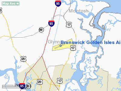
Brunswick Golden Isles Airport (IATA: BQK, ICAO: KBQK, FAA LID: BQK), previously known as Glynco Jetport, is a county-owned public-use airport located five nautical miles (9 km) north of the central business district of Brunswick, a city in Glynn County, Georgia, United States. It is mostly used for general aviation, but is also served by one commercial airline. HistoryPrior to 1975, the airport was Naval Air Station Glynco (IATA: NEA, ICAO: KNEA). In August 1942, the U.S. Navy began building the air station on 2,400 acres (9.7 km) in the northern part of the county. Named NAS Glynco as an abbreviation of Glynn County, it was launched as an operational base for lighter-than-air airships, more commonly known as blimps. In 14 months, workers at the new air station built two enormous wooden hangars, measuring 1,058 feet (322 m) long, 297 feet (91 m) wide and 182 feet (55 m) tall, to house an eight-ship fleet and to provide maintenance for blimps from other bases. Airship Patrol Squadron FIFTEEN (ZP-15), a subordinate unit of Fleet Airship Wing ONE at NAS Lakehurst, New Jersey was subsequently based at NAS Glynco and was the principal based unit during World War II. Capable of sustained flight and state-of-the-art electronic submarine detection, blimps flew thousands of hours on coastal and maritime patrol, as well as convoy escort duty, protecting vulnerable ships delivering essential war materials. This convoy escort program has often been cited as one of the most successful defense operations of the war. NAS Glynco also contributed significant advances in developing new communications and electronics equipment, as well as new search and rescue procedures. NAS Glynco was originally slated for decommissioning in 1949 when tensions in Korea prompted the Navy to reconsider the value of the airship's anti-submarine warfare capabilities. A full complement of blimps returned to NAS Glynco, primarily under Airship Patrol Sqaudron TWO (ZP-2). Airship pilot training for previously designated heavier-than-air Naval Aviators from the fixed-wing and rotary-wing communities was conducted by the Airship Training Unit (ZTG) at NAS Glynco, which had moved from NAS Lakehurst in 1954. Other training functions followed, and when the Navy began to discontinue the airship program and decommissioned ZP-2 and ZTG in 1959, NAS Glynco's mission expanded to offer air traffic control instruction for all armed forces, as well as other highly specialized courses. The air station's runway was expanded to its current length while the mammoth blimp hangars succumbed to the effects of time and climate, with the unique landmarks being demolished in 1971. In the 1960s, as the Navy expanded the role of Naval Aviation Observers, later redesignated as Naval Flight Officers (NFO), for the next generation of carrier-based multi-crew aircraft, NAS Glynco assumed added responsibility for advanced NFO training. The former Naval Air Technical Training Center Glynco was disestablished and Training Air Wing EIGHT (TRAWING 8), reporting to the Chief of Naval Air Training (CNATRA), was established at NAS Glynco in its place. Training Squadron EIGHTY-SIX (VT-86) was subsequently established as a subordinate command to TRAWING 8 in order to provide advanced training for U.S. Navy and U.S. Marine Corps NFOs slated for eventual assignment as Radar Intercept Officers (RIO) in the F-4 Phantom II and F-14 Tomcat, Bombardier Navigators (B/N) in the A-3 Skywarrior, A-5 Vigilante and A-6 Intruder, Reconnaissance Attack Navigators (RAN) in the RA-5C Vigilante, Reconnaissance Systems Officers (RSO) in the RF-4B Phantom II, Electronic Warfare Officers in the EA-3 Skywarrior, Electronic Countermeasures Officers in the EA-6A Intruder and EA-6B Prowler, Combat Information Center Officers (CICO) in the E-2 Hawkeye, and as Tactical Coordinators (TACCO) in the S-3 Viking. While at NAS Glynco, VT-86 operated a combination of twenty-four T-39 Sabreliner, twenty A-4C Skyhawk, two EC-121K Warning Star, and twelve TS-2A Tracker aircraft. The entire community was stunned when plans were announced to close the base at the end of 1974. NAS Glynco had been a strong influence in Glynn County for 31 years, both economically and as a proud element of local identity. As TRAWING 8 was decommissioned and VT-86 transferred to Training Air Wing SIX at NAS Pensacola, Florida, the Glynn County community hastily took control of its destiny when a group of 19 community leaders formed the Glynco Steering Committee to attract new users to the facility. Their hard work paid off in 1975 when the Federal Law Enforcement Training Center (FLETC) selected the former Glynco site for a consolidated training academy for federal law enforcement personnel. FLETC constructed their facility on the former blimp facility, while the community retained the airfield proper and its runway, which was designated the official county municipal airport in 1975. Both developments proved to be invaluable to the future of Brunswick and the Golden Isles. Contributions to the local economy and population of Glynn County by the FLETC have exceeded even the Navy's considerable impact, and the 8,001-foot (2,439 m) jet runway has been an important community asset. The Glynn County Airport Commission was established in 1980 to manage and develop new opportunities for both the Brunswick and St. Simons Island airports. Since that time, the Airport Commission has continued to improve service and facilities through a series of important upgrades and repairs. To more accurately reflect the destination for travelers and pilots, the Glynco Jetport was renamed Brunswick Golden Isles Airport in 2003. The elegant new passenger terminal, completed in 2005, reflects the local tradition of hospitality and welcome for passengers of scheduled carrier service. Other improvements, such as a new control tower in 2005, have encouraged the expansion of general aviation, charter airline and scheduled airline traffic as well. Facilities and aircraftBrunswick Golden Isles Airport covers an area of 2,003 acres (811 ha) at an elevation of 26 feet (8 m) above mean sea level. It has one runway designated 7/25 with an 8,001 x 150 ft (2,439 x 46 m) asphalt and concrete surface. For the 12-month period ending July 31, 2007, the airport had 28,160 aircraft operations, an average of 77 per day: 74% general aviation, 11% air taxi, 9% scheduled commercial and 7% military. At that time there were 63 aircraft based at this airport: 87% single-engine, 11% multi-engine and 2% helicopter. Airlines and destinations
The above content comes from Wikipedia and is published under free licenses – click here to read more.
Runway InformationRunway 07/25
Radio Navigation Aids
Remarks
Based Aircraft
Major Carriers Serving This Airport
Most Popular Destinations
Most Popular Aircraft
Operational StatisticsTime Period: 2005-08-01 - 2006-07-31
Brunswick Golden Isles Airport Address: Glynn County, GA Tel: 912-554-7400, 912-265-2070 Images
and information placed above are from We thank them for the data!
We don't guarantee the information is fresh and accurate. The data may
be wrong or outdated.
|
||||||||||||||||||||||||||||||||||||||||||||||||||||||||||||||||||||||||||||||||||||||||||||||||||||||||||||||||||||||||||||||||||||||||||||||||||||||||||||||||||||||||||||||||||||||||||||||||||||||||||||||||||||||||||||||||||||||||||||||||||||||||||||||||||||||||||||||||||||||||||||||||||||||||||||||||||||||||||||||||||||||||||||||||||||||||||||||||

 |
|
|