 |
|
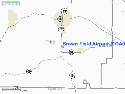
Location
& QuickFacts
|
FAA Information Effective: |
2007-01-18 |
|
Airport
Identifier: |
9GA0 |
|
Airport
Status: |
Operational |
|
Longitude/Latitude: |
084-20-32.7160W/33-03-25.4510N
-84.342421/33.057070 (Estimated) |
|
Elevation: |
864 ft / 263.35 m (Estimated) |
|
Land: |
0 acres |
|
From
nearest city: |
2 nautical miles S of Zebulon, GA |
|
Location: |
Pike County, GA |
|
Magnetic Variation: |
02W (1985) |
Owner
& Manager
|
Ownership: |
Privately owned |
|
Owner: |
Richard Brown |
|
Address: |
Highway 19 South
Zebulon, GA 30295 |
|
Phone number: |
707-567-8668 |
|
Address: |
|
Airport
Operations and Facilities
|
Airport Use: |
Private |
|
Wind
indicator: |
Yes |
|
Segmented
Circle: |
No |
|
Control
Tower: |
No |
|
Landing
fee charge: |
No |
|
Sectional
chart: |
Atlanta |
|
Region: |
ASO - Southern |
|
Boundary
ARTCC: |
ZTL - Atlanta |
|
Tie-in
FSS: |
MCN - Macon |
|
FSS
on Airport: |
No |
|
FSS
Phone: |
478-784-1155 |
|
FSS
Toll Free: |
1-800-WX-BRIEF |
|
Runway Information
Runway 09/27
|
Dimension: |
1700 x 90 ft / 518.2 x 27.4 m |
|
Surface: |
TURF-DIRT, |
|
|
Runway 09 |
Runway 27 |
|
Traffic
Pattern: |
Right |
Left |
|
Displaced
threshold: |
250.00 ft |
0.00 ft |
|
Radio Navigation
Aids
|
ID |
Type |
Name |
Ch |
Freq |
Var |
Dist |
|
JHH |
NDB |
Griffin |
|
412.00 |
04W |
9.6 nm |
|
OP |
NDB |
Yates |
|
339.00 |
03W |
11.4 nm |
|
FF |
NDB |
Pecat |
|
316.00 |
02W |
16.3 nm |
|
EQQ |
NDB |
Coweta County |
|
234.00 |
03W |
22.2 nm |
|
PIM |
NDB |
Pine Mountain |
|
272.00 |
03W |
29.7 nm |
|
BR |
NDB |
Redan |
|
266.00 |
02W |
35.4 nm |
|
VOF |
NDB |
Alcovy |
|
370.00 |
03W |
44.5 nm |
|
IZS |
NDB |
Montezuma |
|
426.00 |
04W |
44.8 nm |
|
FT |
NDB |
Flanc |
|
344.00 |
02W |
44.9 nm |
|
BEP |
NDB |
Bay Creek |
|
350.00 |
03W |
46.4 nm |
|
PDK |
VOR/DME |
Peachtree |
113X |
116.60 |
02W |
49.3 nm |
|
ATL |
VORTAC |
Atlanta |
116X |
116.90 |
00W |
34.7 nm |
|
MCN |
VORTAC |
Macon |
089X |
114.20 |
01E |
41.4 nm |
|
CSG |
VORTAC |
Columbus |
118X |
117.10 |
01E |
43.2 nm |
|
LGC |
VORTAC |
Lagrange |
103X |
115.60 |
01E |
43.5 nm |
|
ATL |
VOT |
Atlanta Muni |
|
111.00 |
|
36.4 nm |
Remarks
- VFR
ONLY; ALL TRAFFIC PATTERNS ESTABLISHED SOUTH OF RWY; PRIVATE USE; COMPATIBLE
OPERATIONAL AGREEMENT MAINTAINED WITH RIDGEVIEW FARM AIRPORT; ALL PERSONS
USING BROWN FIELD ARE BRIEFED ON OPERATIONAL AGREEMENT AND GIVE WAY
TO AIRCRAFT OPERATING IN THE RIDGEVIEV FARM AIRPORT TRAFFIC PATTERNS.
Based
Aircraft
|
Aircraft
based on field: |
2 |
|
Single
Engine Airplanes: |
2 |
Brown Field Airport
Address:
Pike County, GA
Tel:
707-567-8668
Images
and information placed above are from
http://www.airport-data.com/airport/9GA0/
We
thank them for the data!
| General
Info |
| Country |
United
States |
| State |
GEORGIA
|
| FAA ID |
9GA0
|
| Latitude |
33-03-25.451N
|
| Longitude |
084-20-32.716W
|
| Elevation |
864 feet
|
| Near City |
ZEBULON
|
We don't guarantee the information is fresh and accurate. The data may
be wrong or outdated.
For more up-to-date information please refer to other sources.
|
|


