 |
|
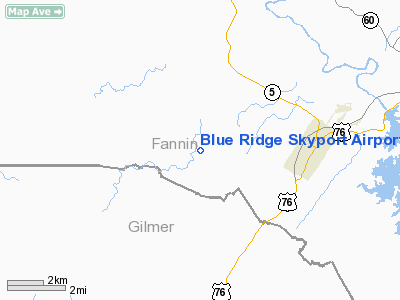
Blue Ridge Skyport Airport |
Location
& QuickFacts
|
FAA Information Effective: |
2007-01-18 |
|
Airport
Identifier: |
57GA |
|
Airport
Status: |
Operational |
|
Longitude/Latitude: |
084-23-37.7200W/34-51-47.2900N
-84.393811/34.863136 (Estimated) |
|
Elevation: |
1946 ft / 593.14 m (Estimated) |
|
Land: |
62 acres |
|
From
nearest city: |
3 nautical miles W of Blue Ridge, GA |
|
Location: |
Fannin County, GA |
|
Magnetic Variation: |
04W (2000) |
Owner
& Manager
|
Ownership: |
Privately owned |
|
Owner: |
James F Clack |
|
Address: |
345 Horse Pointe
Blue Ridge, GA 30228 |
|
Phone
number: |
706-258-2060 |
|
Manager: |
James F Clack |
|
Address: |
526 Red Bush School Road
Blue Ridge, GA 30228 |
|
Phone number: |
706-258-2060 |
Airport
Operations and Facilities
|
Airport Use: |
Private |
|
Wind
indicator: |
Yes |
|
Segmented
Circle: |
No |
|
Control
Tower: |
No |
|
Sectional
chart: |
Atlanta |
|
Region: |
ASO - Southern |
|
Boundary
ARTCC: |
ZTL - Atlanta |
|
Tie-in
FSS: |
MCN - Macon |
|
FSS
Phone: |
478-784-1155 |
|
FSS
Toll Free: |
1-800-WX-BRIEF |
|
Runway Information
Runway 18/36
|
Dimension: |
3100 x 30 ft / 944.9 x 9.1 m |
|
Surface: |
ASPH, |
|
|
Runway 18 |
Runway 36 |
|
Traffic
Pattern: |
Left |
Left |
|
Obstruction: |
30 ft trees, 100.0 ft from runway |
|
|
Radio Navigation
Aids
|
ID |
Type |
Name |
Ch |
Freq |
Var |
Dist |
|
JZP |
NDB |
Pickens County |
|
285.00 |
04W |
24.7 nm |
|
TTQ |
NDB |
Tomotla |
|
335.00 |
01W |
26.4 nm |
|
UWI |
NDB |
Whitfield |
|
400.00 |
03W |
27.6 nm |
|
HDI |
NDB |
Hardwick |
|
369.00 |
01W |
30.7 nm |
|
MMI |
NDB |
Mc Minn County |
|
242.00 |
03W |
33.0 nm |
|
DJD |
NDB |
Canton |
|
415.00 |
04W |
37.0 nm |
|
OUK |
NDB |
Calhoun |
|
323.00 |
02W |
38.3 nm |
|
MNV |
NDB |
Madisonville |
|
361.00 |
04W |
41.0 nm |
|
CQN |
NDB |
Daisy |
|
341.00 |
02W |
41.8 nm |
|
DTE |
NDB |
Mark Anton |
|
394.00 |
02W |
45.6 nm |
|
EVZ |
NDB |
Cartersville |
|
308.00 |
04W |
45.7 nm |
|
FKV |
NDB |
Flowery Branch |
|
365.00 |
03W |
46.4 nm |
|
AJR |
NDB |
Habersham |
|
347.00 |
03W |
47.0 nm |
|
HRS |
VORTAC |
Harris |
035X |
109.80 |
00E |
24.1 nm |
|
GQO |
VORTAC |
Choo Choo |
105X |
115.80 |
01E |
37.9 nm |
Remarks
Blue Ridge Skyport Airport
Address:
Fannin County, GA
Tel:
706-258-2060
Images
and information placed above are from
http://www.airport-data.com/airport/57GA/
We
thank them for the data!
| General
Info |
| Country |
United
States |
| State |
GEORGIA
|
| FAA ID |
57GA
|
| Latitude |
34.863136
34° 51' 47.29" N |
| Longitude |
-84.393811
084° 23' 37.72" W |
| Elevation |
1946 feet
593 meters |
| Magnetic
Variation |
004° W
(07/06) |
| Operating
Agency |
PRIVATE
|
We don't guarantee the information is fresh and accurate. The data may
be wrong or outdated.
For more up-to-date information please refer to other sources.
|
|


