 |
|
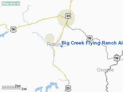
Big Creek Flying Ranch Airport |
Location
& QuickFacts
|
FAA Information Effective: |
2007-01-18 |
|
Airport
Identifier: |
GA18 |
|
Airport
Status: |
Operational |
|
Longitude/Latitude: |
083-24-34.5830W/34-49-58.3340N
-83.409606/34.832871 (Estimated) |
|
Elevation: |
1650 ft / 502.92 m (Estimated) |
|
Land: |
80 acres |
|
From
nearest city: |
4 nautical miles SE of Clayton, GA |
|
Location: |
Rabun County, GA |
|
Magnetic Variation: |
03W (1985) |
Owner
& Manager
|
Ownership: |
Privately owned |
|
Owner: |
Delta Brano Enterprises Inc |
|
Address: |
3000 Stilesboro Rd
Kennesaw, GA 30144 |
|
Phone number: |
706-782-6647 |
|
Manager: |
Earl B. Benson |
|
Address: |
Rt 3 3109
Clayton, GA 30525 |
|
Phone number: |
404-782-2534 |
Airport
Operations and Facilities
|
Airport Use: |
Private |
|
Wind
indicator: |
Yes |
|
Segmented
Circle: |
No |
|
Control
Tower: |
No |
|
Sectional
chart: |
Atlanta |
|
Region: |
ASO - Southern |
|
Boundary
ARTCC: |
ZTL - Atlanta |
|
Tie-in
FSS: |
MCN - Macon |
|
FSS
Phone: |
478-784-1155 |
|
FSS
Toll Free: |
1-800-WX-BRIEF
1-WX-BRIEF |
|
Runway Information
Runway 09/27
|
Dimension: |
2800 x 60 ft / 853.4 x 18.3 m |
|
Surface: |
TURF, |
|
|
Runway 09 |
Runway 27 |
|
Traffic
Pattern: |
Left |
Left |
|
Displaced
threshold: |
100.00 ft |
0.00 ft |
|
Obstruction: |
5 ft fence |
40 ft plines, 600.0 ft from runway |
|
Radio Navigation
Aids
|
ID |
Type |
Name |
Ch |
Freq |
Var |
Dist |
|
AJR |
NDB |
Habersham |
|
347.00 |
03W |
21.1 nm |
|
CEU |
NDB |
Clemson |
|
257.00 |
05W |
27.5 nm |
|
TTQ |
NDB |
Tomotla |
|
335.00 |
01W |
31.9 nm |
|
LQK |
NDB |
Lake Keowee |
|
408.00 |
04W |
34.9 nm |
|
AND |
NDB |
Anderson County |
|
230.00 |
04W |
40.1 nm |
|
FKV |
NDB |
Flowery Branch |
|
365.00 |
03W |
45.1 nm |
|
DDA |
NDB |
Commerce |
|
244.00 |
03W |
46.6 nm |
|
GY |
NDB |
Dyana |
|
338.00 |
03W |
48.5 nm |
|
ODF |
VORTAC |
Foothills |
081X |
113.40 |
00E |
9.9 nm |
|
HRS |
VORTAC |
Harris |
035X |
109.80 |
00E |
25.8 nm |
|
ELW |
VORTAC |
Electric City |
023X |
108.60 |
00E |
39.7 nm |
Remarks
- RWY
27 FOR LDG ONLY;RWY 09 FOR DEP ONLY-STRAIGHT OUT AND DOWN THE VALLEY
- PRVDD
VFR/PVT USE.
Based
Aircraft
|
Aircraft
based on field: |
1 |
|
Single
Engine Airplanes: |
1 |
Big Creek Flying Ranch Airport
Address:
Rabun County, GA
Tel:
706-782-6647, 404-782-2534
Images
and information placed above are from
http://www.airport-data.com/airport/GA18/
We
thank them for the data!
| General
Info |
| Country |
United
States |
| State |
GEORGIA
|
| FAA ID |
GA18
|
| Latitude |
34-49-58.334N
|
| Longitude |
083-24-34.583W
|
| Elevation |
1650 feet
|
| Near City |
CLAYTON
|
We don't guarantee the information is fresh and accurate. The data may
be wrong or outdated.
For more up-to-date information please refer to other sources.
|
|


