 |
|
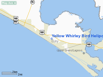
Yellow Whirley Bird Heliport |
Location
& QuickFacts
|
FAA Information Effective: |
2007-01-18 |
|
Airport
Identifier: |
65FD |
|
Airport
Status: |
Operational |
|
Longitude/Latitude: |
085-49-42.0000W/30-11-56.0000N
-85.828333/30.198889 (Estimated) |
|
Elevation: |
10
ft / 3.05 m (Estimated) |
|
Land: |
2
acres |
|
From
nearest city: |
1 nautical miles N of Panama City Beach,
FL |
|
Location: |
Bay County, FL |
|
Magnetic Variation: |
00W (1990) |
Owner
& Manager
|
Ownership: |
Privately owned |
|
Owner: |
Jeffrey J. Short |
|
Address: |
3064 Eutaw Forest Dr
Waldorf, MD 20603 |
|
Phone number: |
301-932-4612 |
|
Address: |
|
Airport
Operations and Facilities
|
Airport Use: |
Private |
|
Wind
indicator: |
Yes |
|
Segmented
Circle: |
No |
|
Control
Tower: |
No |
|
Sectional
chart: |
New Orleans |
|
Region: |
ASO - Southern |
|
Boundary
ARTCC: |
ZJX - Jacksonville |
|
Tie-in
FSS: |
GNV - Gainesville |
|
FSS
on Airport: |
No |
|
FSS
Phone: |
850-377-3291 |
|
FSS
Toll Free: |
1-800-WX-BRIEF |
|
Runway Information
Helipad H1
|
Dimension: |
20
x 20 ft / 6.1 x 6.1 m |
|
Surface: |
CONC, Good Condition |
|
|
Runway H1 |
Runway |
|
Traffic
Pattern: |
Left |
Left |
|
Radio Navigation
Aids
|
ID |
Type |
Name |
Ch |
Freq |
Var |
Dist |
|
DTS |
NDB |
Destin |
|
254.00 |
01W |
35.7 nm |
|
BKK |
NDB |
Tri County |
|
275.00 |
02W |
41.0 nm |
|
PAM |
TACAN |
Tyndall |
124X |
|
00W |
15.3 nm |
|
DWG |
TACAN |
Warrington |
002X |
|
00E |
39.7 nm |
|
HRT |
TACAN |
Hurlburt |
045X |
|
00E |
46.8 nm |
|
FYL |
VOR |
Tri County |
|
108.40 |
08W |
40.3 nm |
|
PFN |
VORTAC |
Panama City |
090X |
114.30 |
00W |
7.7 nm |
Remarks
- PROVIDED
VFR/PR USE; AREA IS MKD; WIND INDICATOR MAINTAINED; APCH/DEP LMTD TO
40 DEG TO 120 DEG AND 220 DEG TO 300 DEG.
Based
Aircraft
|
Aircraft
based on field: |
1 |
|
Helicopters: |
1 |
Yellow Whirley Bird Heliport
Address:
Bay County, FL
Tel:
301-932-4612
Images
and information placed above are from
http://www.airport-data.com/airport/65FD/
We
thank them for the data!
| General
Info |
| Country |
United
States |
| State |
FLORIDA
|
| FAA ID |
65FD
|
| Latitude |
30-11-56.000N
|
| Longitude |
085-49-42.000W
|
| Elevation |
10 feet
|
| Near City |
PANAMA
CITY BEACH |
We don't guarantee the information is fresh and accurate. The data may
be wrong or outdated.
For more up-to-date information please refer to other sources.
|
|


